


Refine your search for walks in Magstatt-le-Haut
Magstatt-le-Haut walks


 The two Magstatts
 Visorando Member

 4.81 mi
 +295 ft
 -269 ft
 2h 30
 Easy
 Departure from Magstatt-le-Haut (Haut-Rhin)
The Sundgau is an inexhaustible source of walking trails that exude peace and tranquillity. Magstatt-le-haut and Magstatt-le-bas are no exception; the walk alternates between forest and village paths to offer you the very best the region has to offer: a moment out of time.
Between Le Homberg and the Bruchberg, in the heart of the Bas-Sundgau hills
 8.71 mi
+505 ft
-502 ft
4h 25
 Moderate
Departure from Kœtzingue (Haut-Rhin)
A varied family walk that climbs towards the Forêt des Deux Chênes, dotted with wooden sculptures and educational panels. The Schlierbach discovery trails, the return route via the Homberg and the Kœtzingue ecological pond, as well as the beautiful views of the surrounding mountains, will make you forget a few short but sometimes steep climbs.
Stetten from every angle
 4.70 mi
+354 ft
-331 ft
2h 30
Easy
Departure from Haut-Rhin
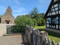
Stetten is one of those villages in the Sundgau that seems to welcome anyone wishing to spend peaceful days there in a rural and traditional setting. As you wander through the village and its surroundings, you can admire the many pretty houses nestled in their beautifully maintained gardens. The Tafelbaum Oak, several hundred years old, overlooks the Three Borders area and points the way to a forest where the presence of a stream lends an almost magical atmosphere.
Around Rantzwiller
 5.35 mi
+459 ft
-463 ft
2h 50
Easy
Departure from Rantzwiller (Haut-Rhin)
Rantzwiller, a small village in the Sundgau region, is a lovely place to live. The area around the village, particularly the hamlet of Heilhof, is well worth exploring and offers some lovely views.
Around the Oberholz
 6.03 mi
+377 ft
-400 ft
3h 05
Moderate
Departure from Kappelen (Haut-Rhin)
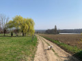
A lovely circular walk starting from Kappelen, passing through Ranspach-le-Bas and the hills of Helfranzkirch, combining woodland, fields and village outskirts.
Circular route via Uffheim, Geispitzen and Waltenheim
 4.67 mi
+177 ft
-200 ft
2h 20
Easy
Departure from Sierentz (Haut-Rhin)
A short, varied circular route between the villages of Uffheim, Geispitzen and Waltenheim.
Circular walk starting from Brinckheim via Stetten and Kappelen
 5.01 mi
+253 ft
-233 ft
2h 30
Easy
Departure from Brinckheim (Haut-Rhin)
The Sundgau is a region that could well have been invented by walkers. This circular walk invites you to discover it for yourselves. Authentic villages and peaceful countryside all around – what more could you ask for?
The Hardt Forest
6.31 mi
+20 ft
-20 ft
2h 55
Easy
Departure from Sierentz (Haut-Rhin)
A pleasant, uneventful walk that starts in Sierentz and passes through fields and the Hardt Forest. The route is mostly on flat ground, part of which consists of tarmac paths for pedestrians and cyclists.
Sierentz to Uffheim circular loop
 3.01 mi
+125 ft
-135 ft
1h 30
Easy
Departure from Sierentz (Haut-Rhin)
Half urban, half countryside, this short walk takes you through the pretty villages of Sierentz and Uffheim. The route is straightforward and well-lit, with a pleasant picnic stop halfway along the way.
The Kenzo Trail
11.40 mi
+607 ft
-594 ft
5h 45
Moderate
Departure from Sierentz (Haut-Rhin)
A walk along easily accessible paths, ideal for families or those with pets.
A route through fields and along forest edges, starting from Sierentz, passing through Uffheim and Stetten to reach Helfrantzkirch, then returning via Kappelen towards Uffheim and back to Sierentz.
The hills of Schlierbach via the Croix and Deux Chênes trails.
 5.60 mi
+289 ft
-305 ft
2h 50
Easy
Departure from Haut-Rhin
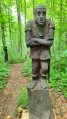
A family hike that follows the Sentier des Croix to the Chapelle des Malgré-nous, then climbs the hills to follow the Sentier des Deux Chênes, decorated with wooden sculptures and dotted with educational panels.
Bartenheim and Brinckheim Vines Trail
 3.93 mi
+246 ft
-256 ft
2h 00
Easy
Departure from Bartenheim (Haut-Rhin)
A trail giving you the possibility to explore a large number of running vineyards throughout the Bartenheim and Brinckheim hillsides.
Bartenheim - Kappelen circular loop
 4.67 mi
+174 ft
-174 ft
2h 20
Easy
Departure from Bartenheim (Haut-Rhin)
The hike alternates between fields, forest edges and villages. Go through the fields of Bartenheim and Brinckheim, passing the small village of Kappelen. The return journey is through the fields of Kappelen and Brinckheim, then HochaLoch along the Muehlgraben.
Circular Bartenheim route via the big oak tree in Stetten
 9.57 mi
+509 ft
-509 ft
4h 50
Moderate
Departure from Bartenheim (Haut-Rhin)
The hike alternates between fields, forest edges and villages. Go through the fields of Bartenheim and Brinckheim, pass the small village of Stetten to reach the Gros Chêne. The return route is via the village of Helfrantzkirch, the fields of Kappelen and Brinckheim, and the HochaLoch along the Muehlgraben.
Sundgau route: Hundsbach-Franken
 3.75 mi
+184 ft
-194 ft
1h 55
Moderate
Departure from Haut-Rhin
Below the Hochistross, the high road from Altkirch to Basel, villages dot the Thalbach valley. The old grain mill in Hundsbach has recently been restored, much to the delight of artists and history lovers.
Bartenheim - Brinckheim circular along the Muehlgraben.
 2.66 mi
+174 ft
-144 ft
1h 20
Easy
Departure from Bartenheim (Haut-Rhin)
A short, unpretentious hike.
Starting at the ACL foyer in Bartenheim, the outward journey takes you through the fields of Bartenheim and Brinckheim, and the return journey takes you through Hochaloch along the Muehlgraben.
From Ranspach-le-Bas to Ranspach-le-Haut
7.04 mi
+528 ft
-515 ft
3h 40
Moderate
Departure from Ranspach-le-Bas (Haut-Rhin)
A lovely walk along the Sundgau trails through meadows, fields and woods. Near the D419, there’s a stunning view of the border region.
Of interest: a memorial to a plane crash in 1915… there weren’t many of those back then!
The Schneckenberg Forest
 4.72 mi
+371 ft
-374 ft
2h 30
Easy
Departure from Bartenheim (Haut-Rhin)
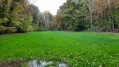
Overlooking the Rhine’s alluvial plain—a barren landscape where the Hardt Forest struggles to survive—the hills of the Bartenheim heights enjoy very rich soil. Set upon this fertile silt, on either side of the ridge between Helfrantzkirch and Bartenheim, lies the most beautiful forest in the Sundgau: the Schneckenberg Forest (see Practical Information).
A short walk through the forest or along the forest edge for tree lovers.
The heights of Blotzheim via the snail hills
 8.25 mi
+623 ft
-604 ft
4h 20
Moderate
Departure from Bartenheim (Haut-Rhin)
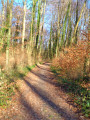
On the heights of Blotzheim, the Grand and Petit Schneckenberg (snail hills) form a wooded area close to its natural state, criss-crossed by streams and surrounded by fields, copses and a few vineyards.A multitude of trails and paths offer beautiful walks in the hills, where you can enjoy the peace and quiet and a few views of the neighbouring mountain ranges, the Vosges, the Black Forest and the Jura.Two versions are available, 10 or 13 km.
A short tour of Brestenberg through fields and forests
 2.51 mi
+174 ft
-174 ft
1h 20
Easy
Departure from Bartenheim (Haut-Rhin)
Family walk around Brestenberg hill between Bartenheim and Brinckheim, passing through sunken lanes typical of the Sundgau hills. Enjoy the forest and the view of the Vosges mountains and the Black Forest.
The Nieder Weiher pond in Obermorschwiller
 4.36 mi
+171 ft
-157 ft
2h 10
Easy
Departure from Obermorschwiller (Haut-Rhin)
On this route through the fields, you will take a small section of the Circuit de la Mémoire (Memorial Trail) with signs recounting the military exploits of the First World War. You will also have the opportunity to walk around the lake, which is impressive in size and pleasant in all seasons, with numerous benches dotted along the route.
The Way of the Cross on the hillsides of Bruebach
 3.97 mi
+305 ft
-302 ft
2h 05
Easy
Departure from Bruebach (Haut-Rhin)
A peaceful route offering beautiful views of the villages south of Bruebach, with the city of Basel on the horizon and the entire Alpine range as a backdrop. You’ll frequently be able to admire the German-speaking Swiss Alps straight ahead, with the Eiger and the Jungfrau and their magnificent pyramidal peaks, and at the other end, on the right-hand side, when the weather permits, Mont Blanc.
Roman Road and the Ill Valley starting from Willer
8.06 mi
+531 ft
-558 ft
4h 10
Moderate
Departure from Haut-Rhin
A lovely walk in the Sundgau starting from Willer.
In the woods at Bruebach
 5.91 mi
+295 ft
-315 ft
3h 00
Easy
Departure from Bruebach (Haut-Rhin)
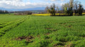
The route runs almost entirely through the forest, in the shade of the trees or exposed to the icy wind in winter. You may spot a few roe deer startled by your presence if you keep quiet. The route is straightforward but features numerous fallen trees that you’ll need to go round.
Bruebach Circular Route
4.04 mi
+299 ft
-299 ft
2h 05
Easy
Departure from Bruebach (Haut-Rhin)
A short, leisurely walk, half of which is in the shade.
The Talrain Forest via Emlingen and Wittersdorf
 4.55 mi
+295 ft
-312 ft
2h 20
Easy
Departure from Emlingen (Haut-Rhin)
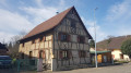
The scene of the terrible battle of 19 August 1914, the Talrain Forest, situated "Auf dem Berg" (literally: On the Hill), which overlooks the villages of Emlingen and Wittersdorf, offers views of Altkirch and the Black Forest and will teach you more about the key figures in this battle via the Path of Remembrance, part of which this route follows.
The tour of the large cannon in Zillisheim
 6.88 mi
+794 ft
-771 ft
3h 50
Moderate
Departure from Zillisheim (Haut-Rhin)
A short hike in the foothills of the Jura to discover the renovated Grand Canyon in Zillisheim, passing by the German cemetery from World War I and the Saint-Brice Chapel in Illfurth.
Circular route in the southern Hardt Forest
 3.83 mi
+30 ft
-30 ft
1h 45
Easy
Departure from Kembs (Haut-Rhin)
A short family walk through a pleasant woodland setting, in stark contrast to the neighbouring urban development. In fine weather, a playground and a picnic area will make for an enjoyable day out.
In wet seasons, the paths are often muddy or overgrown with vegetation, whilst others are rutted due to forestry work.
Around Luemschwiller - Illfurth
 6.19 mi
+666 ft
-656 ft
3h 25
Easy
Departure from Luemschwiller (Haut-Rhin)
Here, you can easily travel through the centuries, from the Britzgyberg oppidum to the German military cemetery in Illfurth. However, as you cross the vast Altenberg massif and the unspoilt village of Luemschwiller, you might think for a moment that you have managed to suspend time.
Cambete route
 Tourist office
 5.48 mi
+49 ft
-46 ft
2h 35
Easy
Departure from Kembs (Haut-Rhin)
A circular route that mainly follows cycle paths. The route, running alongside the water, allows you to discover the local flora, fauna, history and industry between Kembs-Loechlé and Kembs
Sundgau circuit: Wittersdorf-Emlingen-Walheim
 4.19 mi
+495 ft
-502 ft
2h 20
Moderate
Departure from Wittersdorf (Haut-Rhin)
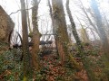
A wooded hill separates the Ill and Thalbach valleys. As you walk along it, you will discover an old vineyard, a quarry marked by tragedy, a botanical trail and the story of an unfortunate general. When you reach the Emlingen lime kilns, the 19th century suddenly springs to life, frozen in stone and iron.
In the heart of the Au plain, Rosenau, daughter of the Rhine
 8.42 mi
+98 ft
-98 ft
3h 55
Moderate
Departure from Kembs (Haut-Rhin)
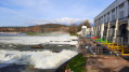
The Plaine de l’Au is this wetland region on the Rhine’s floodplain in the Land of the Three Borders, where the river, before its course was straightened by dykes (19th century) and then channelled (early 20th century), spread out into multiple branches.Between the Kembs hydroelectric power station to the north and the Grand Marais trail to the south, water accompanies us throughout this route, where biodiversity and human activities strive to coexist harmoniously.The time given does not include stops at the five observation points and other points of interest along the route.
Along the canals south of Kembs
 5.48 mi
+13 ft
-13 ft
2h 30
Easy
Departure from Kembs (Haut-Rhin)
Walk from the car park near the turbine roundabout in Kembs, towards Rosenau Sud along the Rosenau Stream, through Rosenau to the Huningue Canal, then back to the starting point along the towpath.
Walk along the old bed of the Rhine: from the Huningue Canal to the Old Rhine
 6.31 mi
+253 ft
-256 ft
3h 05
Easy
Departure from Kembs (Haut-Rhin)
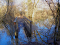
Two centuries ago, the Rhine flowed in a network of meandering channels. From 1842, with the construction of dykes by Tulla, and then around 1930 with the construction of the Grand Canal, the river was channelled into a single course and the Rhine’s ecosystem was profoundly altered.Today, there is a stark contrast between nature, which is becoming overgrown again as it adapts to the drying conditions with diverse and unique flora and fauna, and the intense industrial activity centred on shipping and hydroelectric power.
Through the woods of Bruebach
 5.52 mi
+427 ft
-433 ft
2h 55
Easy
Departure from Brunstatt (Haut-Rhin)
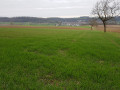
This route takes you on a walk through Bruebach and its surroundings, mainly through the surrounding woods.
Reservoir, view of the Alps and the old tile works from Zimmersheim
4.20 mi
+377 ft
-354 ft
2h 15
Easy
Departure from Zimmersheim (Haut-Rhin)
A walk from the centre of Zimmersheim, climbing steeply towards the Schoofberg where the reservoir is situated. The route passes by the Belle Vue de Zimmersheim and the Vue des Alpes, offering views of the Alps in suitable weather, whilst skirting the Buchwald and Zuhrenwald forests. Return via the south of Zimmersheim and the old tile works, across open countryside.
From the Flaxlanden Cave to the Zillisheim Cannon
 4.79 mi
+404 ft
-384 ft
2h 35
Easy
Departure from Zillisheim (Haut-Rhin)
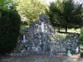
Passing through the pretty village of Flaxlanden and its Lourdes Grotto, discover a First World War military site in the hills above Zillisheim. Learn a little about nature with the discovery trails along the route and enjoy the many views that await you along the way!
Along the former bed of the Rhine: from the drawbridge to the Ecluse
 4.18 mi
+36 ft
-36 ft
1h 55
Easy
Departure from Kembs (Haut-Rhin)
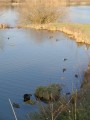
Before the construction of the Canal of Alsace (1928), the Rhine extended its arms east of the Huningue Canal (1806) over a wide area of 1km to 2km. From the Rhone Canal on the North Rhine to the Barre d'Istein on the Old Rhine, along paths and trails often in the protected areas of the "Little Alsatian Camargue.", you'll discover numerous natural and industrial sites related to the history of the Rhine.
Begin with a stroll between the drawbridge of Kembs (1831) and l'Ecluse Le Corbusier (1961).
The beautiful view of Habsheim
 3.70 mi
+253 ft
-253 ft
1h 55
Easy
Departure from Habsheim (Haut-Rhin)
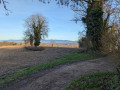
Leaving Habsheim, discover a panoramic view of the surrounding towns and villages as you climb higher! Finish with a short tour of the centre of Habsheim, then through charming residential areas.
Walk along the old bed of the Rhine: from Pont-levis to Ferme du Moulin
 2.77 mi
+16 ft
-16 ft
1h 15
Easy
Departure from Kembs (Haut-Rhin)
Between the marina and the Ferme du Moulin, this unpretentious little walk allows you to enjoy the tranquillity of the banks of the Canal de Huningue, the Grand Canal d'Alsace and the Augraben, which still feature a few oxbow lakes and ponds, natural remnants of the old bed of the Rhine.
On the heights of Habsheim and Rixheim
 2.87 mi
+259 ft
-246 ft
1h 35
Easy
Departure from Habsheim (Haut-Rhin)
La Bellevue de Habsheim, an apiary, donkeys, sheep, goats and cows, a remarkable garden, calvaries, a shelter, the Rixheim school orchard, the reservoirs and relay antenna in Habsheim, numerous viewpoints over the Rhine plain, the Black Forest, the Vosges, the Tour de l'Europe, Habsheim, Rixheim, the Stellantis site, Entremont Park... so much to see on such a short route!
Circular route around the Eichelberg via the Igetalweg
 2.29 mi
+187 ft
-187 ft
1h 15
Easy
Departure from Brunstatt (Haut-Rhin)
The circular route offers a partially shaded section covering around 60 to 70 per cent of the trail, with gentle slopes. It follows the route of the historic Igetalweg (partly paved), which farmers once used to reach their fields with ox-drawn carts thanks to its gentle, even gradient.
Do not use this circular route in strong winds.
Via the Oratory of the Three Virgins from Wentzwiller
6.40 mi
+502 ft
-502 ft
3h 25
Moderate
Departure from Wentzwiller (Haut-Rhin)
The route starts at the car park by the church in Wentzwiller, a pretty little village typical of the Sundgau, a region in southern Alsace. A lovely walk with beautiful views over the Rhine Valley and Basel.
From Haut-Rebberg to Tannenwald, starting from the Belvédère in Mulhouse
 6.35 mi
+495 ft
-502 ft
3h 20
Moderate
Departure from Mulhouse (Haut-Rhin)
Enjoy the omnipresent greenery along this route, the forest and views of four mountain ranges.
Route around Brunstatt
 4.51 mi
+394 ft
-384 ft
2h 25
Easy
Departure from Brunstatt (Haut-Rhin)
A walk to discover Brunstatt and its hills, mostly through fields, with beautiful views of the Vosges mountains.
The villages of Didenheim and Hochstatt via the Saint-Gall Chapel
 5.14 mi
+279 ft
-279 ft
2h 35
Easy
Departure from Brunstatt (Haut-Rhin)
Perched on a hill overlooking the two villages of Didenheim and Hochstatt, the Saint-Gall Chapel has been destroyed and rebuilt many times. Set off to explore it as you stroll through the pretty neighbourhoods of Didenheim and Hochstatt, not forgetting the soothing presence of the River Ill, which you’ll cross on numerous occasions!
The Rebberg district of Mulhouse
 6.74 mi
+436 ft
-440 ft
3h 30
Moderate
Departure from Mulhouse (Haut-Rhin)
The Rebberg district of Mulhouse is undoubtedly one of the most beautiful neighbourhoods in Alsace. For the duration of your walk, forget that you’re right in the city centre as you wander through the various streets and alleyways of this impressive neighbourhood, which is striking both for its ever-present greenery and its many breathtaking mansions.
Between Niffer and Petit Landau, towards the Grand Canal d’Alsace
 6.50 mi
+33 ft
-33 ft
3h 00
Easy
Departure from Niffer (Haut-Rhin)
A walk in the Haut-Rhin starting from Niffer and its lock. Along the Rhône-Rhine Canal, then across the plain facing the Black Forest, and back via the Grand Canal d’Alsace (the canalised Rhine).