Country:
 City:
City:


This route is best undertaken in dry weather (as there are muddy or slippery sections).
The route starts from Kœtzingue Town Hall, Rue Principale (D21).
Parking is available in the town hall car park opposite No. 26 Rue Principale.
(S/E) With your back to the town hall, cross Rue Principale with care and turn right. Atthe first junction, turn left into Rue de la Liberté. After a few dozen metres, turn right onto the Sentier du Tiefend, which runs between pastures and joins Rue Principale.
Head up the street to the left. After the right-hand bend, carry on to thefirst junction opposite a cross. Turn left onto Rue du Ried, heading due north, until you reach the junction with Rue des Pâturages.
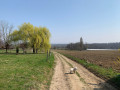
(1) Keep to the right heading north-east and follow the Blue Triangle signposts. At the wayside cross, after the last houses, continue along a track between the fields. At the bend, keep to the right towards a crossroads marked by a cross, opposite which stands a remarkable willow tree.
(2) Leave the signposted route and continue uphill to the left towards the forest, where the path joins the Discovery Trail (a variant of theGR®®532).
(3) There are two options:
1) The easiest option is via theGR®®532to the right; about 500 metres further on, on the left, you’ll find the access to the Sentier des deux Chênes. It joins the junction near a bench at point (4).
2) The shortest option, as shown on the map, is via the path opposite which climbs the embankment and, after about a hundred metres, joins a wide forest track. Like the other option, this leads to the junction near a bench on the right.
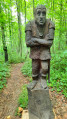
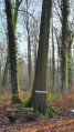
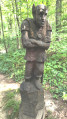
(4) With your back to the bench, take the path. After a few metres, thefirst sign introduces ‘the hornbeam’. Then head down towards a right-hand bend where the ‘goblin’ welcomes you.
(5) Keep to the left. You’ll then come across some beautiful sculptures of forest animals, and information boards such as the one for the pedunculate oak (near the wild boar) and, further on, the magnificent American red oak (near a bench).
When you reach the sign for “Le robinier”, leave the forest and continue along a grassy path. After a left-hand bend, carry on along the edge of the woodland for a few dozen metres.
(6) Enter the forest again. The path, which is sometimes damp, passes close to a spring on your left, then turns eastwards and joins the Discovery Trail (GR®®532, marked with a Yellow Rectangle and a White Rectangle).
(7) Take theGR®® to the left for a gentle descent towards the entrance to Schlierbach. At the junction with Rue de Geispitzen (GR®®531, marked with a Blue Rectangle and a White Rectangle), note the gardens on the right, then turn left into the village. Continue to the bottom of the street, to the junction with Rue du Ruisseau.
(8) Turn right. At the next junction, look to your left at the beautiful fountain (1894) and carry on straight ahead (you are on the Sentier des Croix). At the junction (cross), turn right towards a playground near a junction opposite a large cross.
(9) Turn left onto the path that starts just next to the playground. It runs alongside a ditch and fields until it reaches the cycle path and a picnic area. Turn right towards the next junction and another cross.
(10) Continue to the right onto “Baseler Weg”; keep to the right at the edge of the path to find the Chapel of Our Lady of the Valley of Tears. Carry on straight ahead, pass a path on the left and, at the next one, head up to the left. Just after thefirst junction, you’ll reach the entrance to a sunken path. A flight of steps on the right leads to an open shelter with a table and benches, hidden by the trees, where you can have a picnic if you wish.
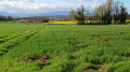
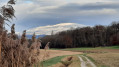
(11) Return to the entrance of the sunken path and head uphill to join the ridge path. Cross it and head downhill opposite; at the bottom, turn right onto a wide path. After about 200 m, walk alongside a few trees on the left and immediately head up to the left, along the edge of the woodland. Continue between two fields; there’s a lovely view to the left of the summit of the Blauen (1,165 m) in the Black Forest. Once at the bottom, head right along the ditch until you reach the wide path (GR®531) near two ponds.
(12) Pass to the right between the ponds and, at the next junction in a clump of trees, turn left. Climb to the top of this path (view of the Jura to the left) and, at thefirst junction, turn right towards a water collection point and a shelter with benches and a viewpoint over the Black Forest.
(13) Retrace your steps to rejoin the path on the right and, passing under high-voltage power lines, reach the nature trail (GR®®532, with a information board and benches on the right-hand side).
(14) Turn left and, after 500 m, you’ll come to the access point (listed as optional) for the Sentier des deux chênes. Continue straight on and rejoin the other access path you used on the way there.
(3) Carry on straight towards the Homberg through a beautiful forest. Further on, at the junction of four paths (metal barrier on your left), carry on straight ahead. Shortly afterwards, at the edge of the forest, enjoy the view of the Jura mountains to your left. Just before a vineyard, look out for a sandstone marker with an engraved coat of arms. At the end of the path, head down to the left, leaving theGR®® trail, and continue straight south until you find the entrance to the Mare Pédagogique trail on your right (see Practical Information)
(15) This is a lovely circular route taking the Sentier du Sanglier followed by the Sentier de la Mare des Têtards. Then head back due south along a long sunken path, continuing via Rue du Homberg and then Rue de la Liberté, until you reach the village town hall (S/E).



 Visorando Member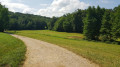
 Easy
Easy