Country:
 City:


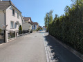
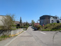
The starting point is at Place de la Gare in Sierentz. There is a large car park available for parking your vehicle.
(S/E) Opposite the station and its car park, turn right onto Rue du Maréchal de Lattre de Tassigny. Ignore Rue de la République, then turn right onto Rue du Maréchal Joffre and follow the Yellow Triangle signposts from here on. Walk alongside a small stream. Ignore the two bridges crossing the stream as well as Rue de la Lorraine, and continue until you reach a ‘Give Way’ sign. Turn left onto the Route Départementale. Cross the bridge, then, immediately afterwards, at the France Services building in Sierentz, carefully cross the zebra crossing, then carry on straight ahead along Rue de la Marne, with the stream on your right. 100 metres further on, cross a small bridge to reach the other side of the stream, and continue left along Rue de la Marne.
(1) At the end of this street, head diagonally left into Rue Werben. The tarmac gives way to a dirt track. You’ll reach a football pitch, which you should walk alongside until you reach the end.
(2) At the T-junction, turn right to continue skirting the pitch. The road becomes tarmac again. Carry on straight ahead until you reach the church. Just before the street bends to the right, go up a small flight of steps on the left, towards Brinckheim. Walk between the church and its cemetery.
(3) Just past the church, turn right into Rue de l’Église, then turn left into a narrow lane that runs between the houses. Continue along a narrow gravel path that curves slightly to the left, then rejoin a tarmac road. Turn into the first street on the right, Rue Gutzwiller. At number 25, turn diagonally to the left, then immediately to the right. 50 metres further on, at the T-junction, turn right into Rue de la Liberté. Ignore the Yellow Triangle signpost heading off to the left. Ignore a path that turns left towards the Maginot Line Memorial. Cross over a stream and then, at the end of the street, at the T-junction, turn right onto Rue du 20 Novembre. Cross the road carefully at the pedestrian crossing to continue along the opposite pavement.
(4) Carry on along the main road, which bends to the left, passing the town hall and its fountain. Ignore Rue de la Fontaine, then Impasse des Chasseurs. Carry straight on at the traffic lights.
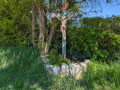
(5) Walk past the Uffheim First Response Centre, then the Place du Sabotier; cross a stream, then carry on until you reach a roundabout. Go straight up Chemin Werbenweg. At the top of the path, where there is a wayside cross, carry on straight ahead.
(6) A little further on, turn right towards Sierentz-Gare, and from here, follow the Blue Triangle signposts. When the path becomes tarmac again, carry on straight ahead until you reach the roundabout.
(7) At the roundabout, carry on straight ahead towards the secondary school along Rue Albert Schweitzer. Ignore Rue de l’Été and carry on straight ahead, skirting the secondary school until you reach the end of the street. At the T-junction, turn right into Rue du Chemin de Fer. Carry on for several hundred metres, ignoring the streets turning to the right. At the end of the street, carefully cross the county road and carry on straight ahead, passing the Bar Aux Deux Clés. You’ll return to your starting point after about a hundred metres. (S/E)

 Visorando Member
 Moderate