Country:
 City:
City:



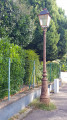
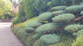
The route starts on Rue de Champagne in Mulhouse. There are plenty of parking spaces available along the street.
(S/E) Start the walk from any point on Rue de Champagne. Head north-east to reach the entrance to the street. At the end, at the STOP sign and the T-junction, turn right. Then take the first street on the right, Rue de Bourgogne, towards the Jardin d’Hygiène Naturelle. At the end of the street, at the four-way junction, carry on straight ahead along Rue du Markstein. At the bottom of the street, at the T-junction, turn left onto Chemin du Klettenberg, then head uphill, immediately turning left onto Rue des Vendanges, past a ‘No Entry’ sign. At the top, the street turns sharply left at a right angle.
(1) There are two options:
- If the gate is open, enter the Parc du Jardin d’Hygiène Naturelle on your left. Walk past a building housing toilets and a car park. Turn right and walk past the bar run by the Société d’Hygiène Naturelle. Carry on straight ahead, passing a playground and a sports area. The path narrows and runs alongside some gazebos available for hire. At the end, the path turns sharply left and goes downhill. At the bottom of the path, turn right and leave the park through a rusty gate. Head up to the right until you reach a four-way junction.
- If the park’s exit gate is closed (mainly out of season), turn back towards the park entrance and turn left to reach the four-way junction.
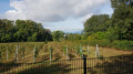
(2) Head up to the right along Rue des Carrières. Pass an extension of Rue des Carrières on your right. At the top of the path, pass Rue de Gascogne on your left and take a cobbled path that runs alongside Rue des Carrières on the right, signposted ‘Green Ring’. The path runs alongside a fenced-off heritage orchard, then the Tony Troxler vineyard. At the end of the path, cross the pedestrian crossing opposite you and turn left onto Rue Robert Breitwieser, following the ‘Yellow Disc’ signposting. Pass the first entrance to Rue Auguste Boehringer on your left.
(3) Follow the ‘Yellow Disc’ signs by turning left into the second entrance to Rue Auguste Boehringer on your left. Immediately afterwards, turn left onto a narrow path. Ignore a road leading uphill to the left and continue straight ahead along this same narrow path marked with ‘Yellow Disc’ signs. At the end of the path, at the T-junction, turn left. Ignore a small path with steps on your right and carry on straight ahead. Turn into the first street on the right, Rue du Belvédère. Cross the road carefully and walk along the street on the left-hand pavement. About 200 metres further on, go down a few steps on your left and, at the Tambov Memorial, turn right.
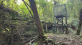
(4) At the end of the path, head up to the right towards the belvedere tower. Walk past it on the right and enter the park through a gate. Take the first path on the left. Then ignore the first path that turns left and, just before reaching the steps leading back to the road, turn left, following the ‘Green Ring’ signposts. When the path becomes tarmac again, leave Rue Joseph Heyberger on your left and head straight down Rue Henri Zislin. At the bottom of the street, at the T-junction, leave the roundabout on your right and turn left uphill. Ignore Rue Lazare Lantz on the left.
- If the park gate is closed, turn back, walk straight down Rue Alfred de Musset and, at the bottom of the street, at the T-junction, turn left. Continue to the next four-way junction.
(5) Pass Rue du Belvédère on your left, cross the road carefully using the pedestrian crossing, and turn right into Rue du Hohneck. Pass the Sentier des Églantines on your left. When the Chemin des Philosophes is on your right, just after house number 5, turn left onto a small path. Further on, the path turns sharply left. At the end of the path, at the T-junction, head down to the left along Rue Pascal, going against the one-way traffic. At the bottom of the street, cross carefully at the pedestrian crossing directly in front of you. Then turn right and, again, cross carefully at a pedestrian crossing that spans Rue de la Montagne from one side to the other, then turn right.
(6) Turn left onto Chemin des Cadets, a narrow tarmac road. Ignore a narrow path that turns right. Immediately after the path turns left, turn right onto a path marked with a Yellow Rectangle. The path turns immediately to the right. At the four-way junction where the Chorale Alliance is located, turn left into a cul-de-sac. The path curves slightly to the left. At the end of the path, at the T-junction, turn right, following the ‘Green Ring’ sign, then take Rue des Étourneaux, immediately on the left. At the bottom of the path, at a Stop sign at a T-junction, turn left.
(7) If it is not closed, enter the Parc du Réservoir through the gate on your left. Take a stroll around the small park along its single path to enjoy the lovely view it offers and the few benches there. Leave the park through the same gate you used to enter and turn left. Ignore Rue des Gardes-Vignes, which leads downhill to the left, and a private lane on the right. At the end of the street, at the T-junction where there is a bench on the corner, head downhill to the left, following the ‘Green Ring’ signposting. At the stop sign, ignore Rue du Frêne and the ‘Green Ring’ signposting on the right and carry on straight ahead. Here, the pavement is protected in turn by two long wooden barriers. Just before the end of the second barrier, take a small flight of steps leading uphill on your right.
(8) Ignore a street leading down to the left, opposite the entrance gate to a private property. At the end of the path, go down a few steps. Join the road at the Ermitage bus stop. Carefully cross the road at the pedestrian crossing and head straight on along Rue Stoeber, following the ‘Green Ring’ signposts. This street bends left, then right. At the end of this street, at the T-junction, turn right. At the top of this street, turn left onto Chemin de la Couronne. Then take Rue de la Fauvette on your left. At the bottom of this street, go down a few steps and, at the T-junction, leave the sign for the entrance to the village of Riedisheim on your right and turn left.
(9) Turn immediately right onto Rue Bellevue. Then turn immediately right again onto Rue de la Colline. At a junction, ignore a flight of steps coming from your right and turn left onto Rue de la Lisière. Ignore Rue Jeanne d’Arc, which turns right. At the end of the street, leave the car park for the Le Manoir residential complex on your right and turn left onto Rue de Sierentz. At a four-way junction, leave Rue Bellevue on your left – it’s a dead end straight ahead – and continue diagonally to the right, staying on the same street. At the end of this street, at the T-junction where there is a bench, use the pedestrian crossing directly in front of you, cross Rue de la Wanne from one side to the other, and continue straight ahead along Allée Gabrielle Koechlin.
(10) At the end of this street, opposite a school, leave Rue Mathias Graf on your left and turn right onto the Sentier des Belles Feuilles – going against the one-way flow – which runs between the blocks of flats. Ignore the path that turns right alongside the block of flats you have just passed. The path turns left and heads downhill. Ignore a path that turns right halfway down. At the bottom of the path, go down a few steps, pass between a block of flats and some garages to reach the departmental road running alongside the railway line. Turn left. Ignore the Chemin des Ardennes, which climbs to the left, and pass the Ardennes bus stop. At the roundabout, stay on the left-hand pavement and turn left onto Boulevard Léon Gambetta.
(11) At the second roundabout, known as Carrefour du Tivoli, stay on the left-hand pavement and turn left onto Rue du Tivoli. As soon as you reach the start of this street, use the pedestrian crossing to cross the road and head to the foot of the Schweissdissi statue. Then turn left to enter Parc du Tivoli. Continue straight ahead at the first junction. After a slight uphill slope, pass a children’s playground and some benches on your left and turn right – still within the park – then immediately left. When you reach Rue de l’Horticulture at the Tivoli bus stop, cross it carefully using the pedestrian crossing directly in front of you, at the traffic lights. Then cross Boulevard Léon Gambetta carefully at the zebra crossing, from one side to the other, and continue straight ahead.
(12) Turn left into the Passage du Triangle. At the end of the street, leave Rue du Moulin à vent, which continues straight ahead, and turn left into Rue de Bruebach, going against the one-way flow. Pass a street on your right leading to the entrance of Célestin Freinet Primary School. At the next roundabout, cross the road carefully using the zebra crossing. Pass Rue de Reims on your left and turn right onto Rue de Verdun. Walk past the Lycée du Rebberg. Cross the road carefully at a pedestrian crossing to join the pavement on the left. Just after passing Rue du Réservoir on your right, head up Rue des Gardes-Vignes, signposted ‘Green Ring’, opposite the Écureuils care home.
(13) Take Rue du Sundgau on your right. Then ignore Rue du Jura on your right, followed by Chemin des Cadets on your left, and continue down the cul-de-sac. Pass the entrance to a car park that slopes down towards the building at number 29 on your right and continue diagonally to the left along a small tarmac path that runs alongside buildings number 34 and 34bis. Further on, the path turns at a right angle to the right. At the end of the path, at the T-junction, turn left towards the junction with traffic lights. Cross the road carefully at the pedestrian crossing and turn right onto Rue de la Montagne. Cross again, carefully, at the pedestrian crossing and take the pavement on the left. Ignore Rue Mirabeau, which turns left.
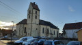
(14) Take the next street on the left, Rue Lafayette. Ignore Rue de Drumont on your right. At the end of the street, at the T-junction, turn left up Rue du Molkenrain. Walk past the entrance to the Church of the Sacred Heart. At the Stop sign, at the four-way junction, continue straight up a small road signposted ‘Residents and Delivery Vehicles Only’ and marked with the ‘Green Ring’ sign. At the top of this street, follow the ‘Green Ring’ signs and turn right onto Rue du Ventron. Walk past the Les Charmilles residential complex. Ignore the Sentier du Donon, which turns left. At the four-way junction, where there is a superb neo-Moorish-style house, cross Rue du Moenschberg from one side to the other and continue straight on, still on the same road, against the flow of traffic.
(15) At the end of the street, at the T-junction, head up to the left onto Rue Reichenstein. Walk alongside a boundary wall on your right. Turn into the first street on the right, the Sentier de la Crête. At number 4, the street turns sharply left and heads uphill (Sentier du Chanteclair). At the four-way junction, turn right onto the Sentier au Bois, where you’ll see a sign reading ‘Residents and Delivery Drivers Only’. At number 6, the road bends and descends to the right. Ignore a private road on the right and continue to the bottom of the street. At the T-junction, marked by a Stop sign, head up to the left, then turn immediately right onto Rue de la Terrasse, a cul-de-sac. Walk past some garages. The road narrows, then turns sharply left.
(16) At the T-junction, pass the gate of house number 10 on your left and head down to the right onto Rue de la Brigade d’Alsace-Lorraine. At the bottom of the street, at the T-junction, turn left uphill. Then, a little further up, turn right onto Rue Paul Winter. Immediately on your right is a war memorial and the entrance to the Mulhouse Les Vallons National Cemetery. If it is not closed, you can take a look around. Back at the start of Rue Paul Winter, at the T-junction, head up to the right onto Rue du Poitou. At the top of the street, turn left onto Chemin du Klettenberg, then, immediately afterwards, at a four-way junction, cross Rue des Carrières from one side to the other and continue straight on, following the Green Ring signposts. About 150 metres further on, when the path turns left, just before house number 13, take a small flight of steps leading to a path that cuts through the woods, running alongside a fence on the right. At the end of this path, you’ll come out onto Rue de Champagne, where you’ll find the (S/E).

 Visorando Member


 Easy
Easy 
 Tourist office