Country:
 City:


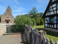
The starting point is at Saint-Laurent Church in Magstatt-le-Haut, at the junction of four streets: Rue de France, Rue du Maréchal Foch, Rue d’Alsace and Rue Clémenceau. Opposite the church is an open space, with a bench and a fountain, where you can park your car.
(S/E) With your back to the church, head straight ahead into Rue d’Alsace. Initially, ignore Rue du Ruisseau and take the second street on the left, Rue de la Forge. Cross the Mossbach; the path leads uphill. At the top, at the end of the street, ignore a dead-end on the right and turn left. At the end, turn right onto Rue Clémenceau (D21) and leave the village. A few metres further on, at the end of the pavement, head diagonally uphill to the right. Walk past an open space with benches and a Marian grotto.
(1) At the top of the path (after entering the forest), turn right at the junction. Ignore the first path on the left, leave the forest, then pass a path on the right and walk alongside a wooded section.
(2) At the junction, when you re-enter the woodland, turn diagonally left and then immediately right. From here, follow the Blue Ring markings. Take a right-angled bend to the left and then head downhill. A little further on, the path forms a chicane (a bend to the left followed by one to the right). Ignore the path coming from your left.
(3) At the four-way junction, where there is a small water tower, ignore the Red Ring signposting which turns left and a path leading to a viewpoint on the right, and carry on straight ahead. Continue until you reach the road. Turn left onto it and walk for about a hundred metres.
(4) At the wayside cross, turn right onto the path facing the Black Forest. After the first field, turn left, following the same signposting. After ignoring the various unmarked paths on either side of the main path, you’ll come to a road again.
(5) Cross it carefully and carry on straight ahead. At the crossroads, cross the Weidemattgraben stream and turn left. Carry on until you reach the tarmac road and the entrance to the village of Magstatt-le-bas. Head diagonally to the left, ignoring Rue des Maraîchers and Rue des Mirabelles, and continue to the junction where the war memorial stands, opposite No. 16.
(6) Turn right (Rue d’Uffheim), walk past the village primary school and, once past it, use the pedestrian crossing to cross the road carefully at the building marked No. 2. Then leave Rue d’Uffheim and turn left to walk alongside this building along a narrow stony path, following the signposts. At the end, carefully cross the road again and continue straight ahead, to the right of No. 4, still along a narrow path. At the end of this path, turn left.
(7) Cross the Place de l’Église, where you’ll find a green space with benches, a shelter and the entrance to the cemetery. At the end of the square, go round the church on its left-hand side and head uphill, passing in front of the Salle Saint-Blaise. At the top of the path, at the T-junction, turn right onto Rue de l’Étang. Walk past the cemetery and continue to the end of the street. At the next junction, carry on straight ahead (Rue du Chanoine Kessler). Ignore two paths that turn left, walk past a large farm and cross the Moosbach.
(8) At the end of the street, at the Stop sign, let the ‘Blue Ring’ signposting continue to the right and turn left. Ignore two paths that branch off successively – one diagonally to the left and the other at a right angle to the right – to reach a cross at the top of the path. Then continue along this path until you reach the village of Magstatt-le-haut.
(9) Once you reach the tarmac road, turn right onto Rue du Fossé. Ignore Impasse de l’Évêque and, after about 150 m, follow the tarmac road as it turns sharply to the right (a dirt track leading to a private property continues straight ahead). Then turn left (Rue des Vergers). At the end of the street, at the junction of five roads, turn left onto the D21 towards Sierentz. Ignore Rue de l’École and pass the village school. A few metres further on, you’ll reach the village church (S/E).

 Visorando Member
 Moderate