Country:
 City:
City:


Parking is available in the car park at Place du Colonel Gauvin, near the fire station.
‘Colonel Gauvin’ bus stop. Distribus.
(S/E) From the car park, cross Rue du6e RIC at the pedestrian crossing and walk along Rue du Rhin until you reach the church.
(1) Turn right towards the church and go round it on the left. Opposite the cemetery, turn left to leave the church grounds and take the path on the right which runs alongside the wall until it enters the woodland.
(2) Head up into the woodland. The path is sometimes overgrown but very quickly reaches a crossroads of four paths, marked by tall pine trees.
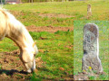
(3) Take the path on the left heading south-east. The path gradually turns to the left before returning to its original direction. After an open stretch beneath high-voltage power lines, you’ll reach a horse paddock. Note the fleur-de-lis boundary marker on the left inside the paddock, directly beneath the high-voltage power line. Carry on, with the fence on your left, until you reach the crossroads surrounded by piles of wood at the far end of the paddock.
(4) Turn right, then immediately left towards the south. At the next crossroads, in a right-hand bend on the wide path, there are two options:
1) Carry on along the wide track, then turn left towards the D66 to rejoin the route and reach the point (6).
2) Let the wide path branch off to the right and continue straight ahead (the option chosen on the map and in the description). Stay on this path, ignoring any side tracks. After a left-hand bend, the path descends towards the edge of the woodland and a housing estate. Stay in the woodland on the right, following the edge. At the next right-hand bend, a few dozen metres further on, don’t miss the small grassy path branching off to the left for a possible round trip.
(5) Follow this narrow path for about a hundred metres until you find, on the left, the small gate leading into the courtyard of the Bartenheim-la-Chaussée Chapel.
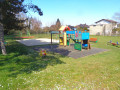
Benches, a playground, a pétanque court and the two stork’s nests on either side of the chapel make this a very pleasant spot. Retrace your steps via the gate and the narrow path.
(5) At the crossroads, turn left and carry on straight ahead, ignoring the side paths. Climb the embankment until you reach a wide path marked with yellow signs. Head left towards signpost 184. Further on, after a right-hand bend, leave the forest and follow the path to the right of an access ramp to the A35 motorway. Turn right at the southern entrance to the forest and follow the cycle path known as the ‘percée centrale’ for about 50 metres.
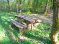
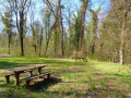
(6) Turn right towards the picnic area (which is in need of some maintenance). Then take the path on the right at the far end of the area. After a left-hand bend and then a crossroads, it leads to a hunting shelter on the right-hand side. Head towards the shelter until you reach the edge of the embankment overlooking a large “wallow” for wild boar; a small downhill path leads down to it.
(7) Retrace your steps to the crossroads you passed earlier, turn right for about 150 metres and rejoin the central track. Continue right along this wide track for about 500 metres, before reaching a bridge spanning a ditch.
(8) Turn 90° to the right. Further on, at the junction near the yellow sign 180, turn left and pass under the high-voltage power lines. Ignore all the side paths until you reach the junction at sign 171.
(9) Go down the embankment on the right and continue straight ahead. At the junction, carry on straight across. The path approaches a housing estate and passes by a curious armchair on the right-hand side. A few metres further on, the path enters the housing estate, passing between two properties. When you reach the road, turn right and then left to reach the car park (S/E).

 Visorando Member

 Moderate
 Tourist office