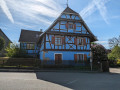
Circular route via Uffheim, Geispitzen and Waltenheim

A short, varied circular route between the villages of Uffheim, Geispitzen and Waltenheim.

Details

n°38305143
Creation:
Last update:
Last review:
  • Walking
    Activity: Walking
  • ↔
    Distance: 4.67 mi
  • ◔
    Average duration: 2h 20 
  • ▲
    Difficulty: Easy

  • ⚐
    Back to start: Yes
  • ↗
    Ascent: + 177 ft
  • ↘
    Descent: - 200 ft

  • ▲
    Highest point: 1,001 ft
  • ▼
    Lowest point: 873 ft
  • ⚐ Country: France
  • ⚐ City: Sierentz (68510)
  • ⚑
    Start/End: N 47.654781° / E 7.444928°
  • ❏
    IGN map(s): Ref. 3721ET
  • Hour-by-hour weather

Photos

Description of the walk

The start is in the hills of the “Werben Est” district of Uffheim, more precisely at the very top of Rue du Muehlweg, where you can park at the edge of the woods.

(S/E) Take the farm track turning to the left. Once you’ve left the track, you’ll come to a crucifix.

(1) Turn right and follow another path which winds its way towards Geispitzen. To do this, ignore the first junction. Then turn left and then right. Take the second track on the left to reach a cross.

(2) Carry on straight ahead. Turn right at the end of the track, then take two left-hand bends to reach Rue de la Chapelle.

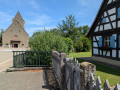
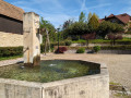
(3) Carry on along this street until you reach the junction with the main road (Rue du Général De Gaulle). Turn left and head downhill to the village fountain. Continue straight on along the street that climbs up to the church.

(4) Keep going straight on until you reach the school. Turn left and follow the street leading towards the main road in Waltenheim.

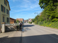
(5) Turn left towards the church, cross at the pedestrian crossing and carry on until you reach the town hall. Immediately after, take the path on the right which, through fields and copses, leads back towards Uffheim – first straight on, then turning left then right. Continue along the small street, pass under a power line and arrive at a junction. Head down to the right until you reach the main road opposite the fire station.

(6) Turn left and go straight ahead at the roundabout. Then take Rue des Vignes on the right, following its S-bend to rejoin Rue du Muehlweg; turn left to reach the car park (S/E).

Waypoints

  1. S/E : mi 0 - alt. 958 ft - Edge of the Werben East woodland
  2. 1 : mi 0.13 - alt. 968 ft - Crucifix
  3. 2 : mi 0.85 - alt. 968 ft - Cross
  4. 3 : mi 1.52 - alt. 984 ft - Rue de la Chapelle
  5. 4 : mi 2.04 - alt. 951 ft - Geispitzen Church
  6. 5 : mi 2.82 - alt. 965 ft - Main road, Waltenheim
  7. 6 : mi 4.28 - alt. 883 ft - Main road Uffheim – Fire station
  8. S/E : mi 4.67 - alt. 955 ft - Rue du Muehlweg

Notes

No special equipment required. Hiking boots or even trainers are sufficient.

Worth a visit

-Fountain in the village of Geispitzen.

Reviews and comments

4.7 / 5
Based on 1 review

Reliability of the description
4 / 5
Ease of following the route
5 / 5
Route interest
5 / 5
Yukulovicz
Yukulovicz

Overall rating : 4.7 / 5

Date of your route : Apr 14, 2024
Reliability of the description : ★★★★☆ Good
Ease of following the route : ★★★★★ Very good
Route interest : ★★★★★ Very good
Very busy route : No

A lovely walk with some lovely views, taking you through neighbourhoods with beautiful flower-filled gardens that are well worth a look! The description is a bit brief, but the route is easy to follow. A little bonus tip: at point number 6 on the route, there’s a covered picnic table behind a playground.

Machine-translated

Other walks in the area

For more walks, use our search engine .

The GPS track and description are the property of this route's author. Please do not copy them without permission.