Country:
 City:


The starting point is situated at the junction of Rue du 19 Novembre and Rue de l’Église. Here you’ll find the school, the town hall, the village church and an area with a fountain and benches. A few parking spaces are available in front of the town hall. Alternatively, further spaces are available alongside the football pitch, about 200 metres further west.
(S/E) Take Rue de l’Église, which runs past the town hall on the right. Walk past the First Response Centre and cross the Muehlgraben. At the T-junction, turn left. A few metres further on, turn right up Rue des Prés. At the county road, cross carefully and continue straight ahead. Then take the first path that turns right and follow the Green Disc signposting from here on. A little further on, ignore a path branching off to the right; you’ll reach the top of the path at a T-junction.
(1) Turn left. Pass through a small wooded section. Ignore the first path coming diagonally from the right, pass under the high-voltage power lines and continue to the next T-junction. There, ignore the Yellow Triangle signposting leading to the right and head down to the left towards Kappelen until you reach the bottom of the path under the high-voltage power lines.
(2) Turn right at a right angle, then ignore the Green Disc signpost turning left and carry on straight ahead, alongside a small stream. At the next T-junction, turn left, ignore a path branching off immediately to the right, and you’ll reach the county road.
(3) Cross it carefully at the pedestrian crossing and carry on straight ahead along Rue du Grengelberg. At the end of this street, turn right into Rue de la Première Armée Française. Then ignore Rue de Magstatt-le-Haut, which turns right, and carry on straight ahead. At the four-way junction, ignore Rue des Alliés and carry on straight ahead. Do the same at the next junction, where there is a wayside cross. Continue to the top of the path, at the edge of the village, to the T-junction in a wooded area.
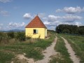
(4) Turn left and carry on until you reach the departmental road, once again passing under the high-voltage power line. Pass the entrance to the village of Stetten on your left and turn right, following the road until you reach the Saint-Wolfgang chapel (with a table and benches nearby).
(5) After the chapel, take the path running alongside the road on your right. Walk past a wayside cross, enter the village of Kappelen and ignore a path turning right into the fields. At the junction where the village hall is located, ignore Rue des Prés and carry on straight ahead. You will then pass the school and a bus stop. Also ignore Rue de l’Église, Rue Saint-Michel and Rue du Moulin until you reach a T-junction marked with a Stop sign.
(6) Turn right into Rue de la Paix towards Helfrantzkirch. Cross the road carefully at the pedestrian crossing and walk along the opposite pavement. A little further on, turn diagonally left towards the sports ground, where you’ll find a cross and a bench. Then turn left just before the war memorial, down a one-way street. Ignore Rue Bellevue and Rue du Sundgau. At the very end of the street, turn right into Rue du Rhin, then immediately turn right up Rue du Soleil, where you’ll find a wayside cross.
(7) From here, follow the Green Disc markings. Ignore Rue des Vignes on the left and carry on straight ahead to leave the village and enter a wooded section. At a crossroads, where there is a wayside cross and some benches, ignore the two paths turning right and continue along the tarmac road. About 400 m further on, as the main path curves slightly to the right, turn left up a dirt track. Halfway up the track, ignore a signposted path turning right and continue to the top of the track.
(8) Turn right and walk for about 500 m. With the village of Brinckheim and the Vosges in view to your left, the Black Forest straight ahead and the Jura to your right, head down to the left towards the village. Continue along this path, which alternates between ascents and descents, until you reach the end of Rue du Jura, at the crossroads where there is a wayside cross. There, turn right onto Rue du 19 Novembre; some 200 m further on, you will come to the village hall and your starting point (S/E).

 Visorando Member

 Moderate