Country:
 City:
City:


Zimmersheim church car park.
(S/E) From the car park, with Rue d’Eschentzwiller on your right and your back to the church, take the path on the left which runs behind the cemetery. Turn left to reach Rue du Monastère, which you follow to the right until the end. Then turn left and right and follow Rue de Rixheim. At the Y-junction, stay on this road straight ahead and continue to the junction with Rue de la Carrière.
(1) Turn left onto the path leading to the reservoir. Continue straight on this steeply ascending path, which turns left just before reaching the summit of the Schoofberg and passing the reservoir. You will arrive at Rue de Zimmersheim, D56.
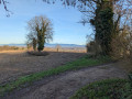
(2) Turn left and follow the road for 150 m, staying on the footpath. Cross carefully at the pedestrian crossing, then turn onto Rue de Mulhouse. Stay on the path on the right (Rennweg) and continue straight on until you reach the lovely view of Zimmersheim, where there is a bench.
(3) First turn left then right, and join the Red Diamond-marked path towards Vue des Alpes (do not follow the signs for Zimmersheim). Stay at the edge of the forest. Follow the Red Ring markings to the left (beautiful view of the Alps).
(4) Continue on the same trail towards Eschentzwiller, the old tile works. You’ll reach the Yellow Triangle trail.
(5) Follow it to the left towards the old tile works, Eschentzwiller.
(6) Cross Rue de Bruebach carefully, first turning right then left, and continue to follow the Yellow Triangle markings. Enter the forest and reach a crossroads.
(7) Turn left, now following the Yellow Cross markings towards Zimmersheim. Continue straight on along the Chemin then Rue de Dietwiller. At the junction with Rue de la Colline, turn right whilst following the same markings. You will reach the start of a path.
(8) Turn left, following the Yellow Cross markings. You will reach Rue d'Eschentzwiller. Cross carefully to reach the church car park (S/E).
 Visorando Member
 Moderate