Country:
 City:
City:


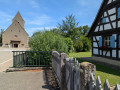

The starting point is in front of the village church, at the junction of Rue du Général de Gaulle and Magstatt-le-Bas, on the D21. You can park along the whole length of Rue du Général de Gaulle.
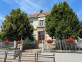
(S/E) With Stetten Church behind you, head down Rue du Général de Gaulle. Walk past the town hall.
(1) At the Fork in the road (fire station), head diagonally right up Rue des Alliés and from here follow the ‘Blue Ring’ signposts. Continue along this road until you leave the village, then carry on along the dirt track. Pass a picnic area and ignore a path that turns left.
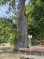
(2) Carry on straight ahead towards Helfrantzkirch (ignore a path leading uphill to the right towards Magstatt-le-Bas). At a Fork in the road at the edge of the forest, turn left, still heading towards Helfrantzkirch. Pass the Tafelbaum Oak (bench, information board).
(3) At the next Fork in the road, head slightly to the left. Walk alongside a copse with a large blockhouse.
(4) At the T-junction, turn left towards Uffheim. At the next junction, carry on straight ahead and enter the forest. From here on, the path becomes narrow in places and obscured by vegetation. Make sure you always follow the Blue Ring signposts. You’ll occasionally walk alongside the Oberried stream. On two occasions, ignore a wide, unmarked path and take the wooden walkways instead. You’ll reach the village at No. 17 Rue de la Paix and continue for a further fifty metres or so.
(5) At the junction (sports ground on the left), head up to the right into Rue de la Liberté (leaving the Blue Ring markings behind). At the T-junction, turn right and walk past a large farm.
(6) At the next junction (bench, wayside cross), turn left, continuing to walk alongside the farm. Just after passing under the high-voltage power lines, head diagonally down to the left onto a path that runs between two fields. Continue along this path for nearly a kilometre until you reach the county road. Once there,carefully cross the road at the pedestrian crossing, then cross the small park to reach Rue du Vallon and turn left.
(7) When the street turns sharply right, take the cycle path that branches off diagonally to the left (recently built and therefore not shown on the map). At the next junction, turn right onto a dirt track. After a few hundred metres, at a junction, carry straight on.
(8) At the next junction, head downhill to the left, following the ‘Green Disc’ signposting. Pass a metal canopy with an information board, then ignore a path coming from the right.
(9) At the next junction (bench, wayside cross), turn left (leaving the Green Disc signposting). Pass under the high-voltage power lines. After a few hundred metres, join the tarmac road and reach the village via number 23 Rue des Vignes. Ignore the side streets on the right. At the junction, turn left onto Rue de Magstatt-le-Bas. You’ll soon reach the church (S/E).

 Visorando Member
 Moderate