Bruebach Circular Route

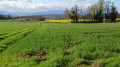
A short, leisurely walk, half of which is in the shade.

Details

29948504
Creation:
Last update:
Last review:
  • Walking
    Activity: Walking
  • ↔
    Distance: 4.04 mi
  • ◔
    Average duration: 2h 05 
  • ▲
    Difficulty: Easy

  • ⚐
    Back to start: Yes
  • ↗
    Ascent: + 299 ft
  • ↘
    Descent: - 299 ft

  • ▲
    Highest point: 1,247 ft
  • ▼
    Lowest point: 958 ft
  • ⚐ Country: France
  • ⚐ City: Bruebach (68440)
  • ⚑
    Start/End: N 47.69486° / E 7.358912°
  • ❏
    IGN map(s): Ref. 3720ET, 3721ET
  • Hour-by-hour weather

Description of the walk

The start is in Bruebach at the end of Rue du Kerlisweg, at the junction with Rue de Steinbrunn. From Mulhouse, take the last street on the right before leaving the village and park at the other end.

(S/E) Head north-west along the unpaved track which passes through a wooded area and leads to a four-way junction (waymark).

(1) Look out for the return path on your right. Take the path on the left, marked with a Yellow Rectangle, continuing straight on and following the edge of the woodland on your right until you reach a three-way junction.

(2) Carry on straight ahead, ignoring the path on the right which leads into the forest. Then cross through the undergrowth, followed by a field, until you reach a fork at the edge of the woodland.

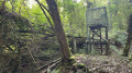
(3) Enter the woodland via the path on the right, marked with a Blue Disc. Walk straight through the woodland and reach a fork in the path once you’ve emerged from the woods.

(4) Carry on straight ahead. Leave the Blue Disc markings behind and reach the next junction, at the edge of a woodland.

(5) Take the path on the right, signposted with a Red Triangle. Ignore a path on the right, enter a neighbourhood in Bruebach and arrive at a three-way junction, at the corner of No. 11.

(6) Turn right onto Rue d’Altkirch, signposted with a Yellow Rectangle, and rejoin the route you have already taken.

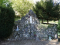
(1) At the wayside shrine, turn left, following the route in the opposite direction to the outward journey, to return to the car park (S/E).

Waypoints

  1. S/E : mi 0 - alt. 1,158 ft - End of Rue du Kerlisweg
  2. 1 : mi 0.3 - alt. 1,165 ft - Crossroads at the end of the circular loop
  3. 2 : mi 0.87 - alt. 1,211 ft - Junction, go straight on
  4. 3 : mi 1.35 - alt. 1,247 ft - Junction, turn right
  5. 4 : mi 1.92 - alt. 1,010 ft - Junction, go straight on
  6. 5 : mi 2.09 - alt. 958 ft - Junction, turn right
  7. 6 : mi 3.42 - alt. 1,115 ft - Three-way junction, turn right
  8. S/E : mi 4.04 - alt. 1,161 ft - End of Rue du Kerlisweg

Notes

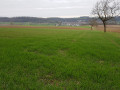
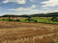
A bench and a lovely view of the Vosges await you as you emerge from the woods after (3).

Reviews and comments

4.4 / 5
Based on 3 reviews

Reliability of the description
4.7 / 5
Ease of following the route
4.3 / 5
Route interest
4.3 / 5
User 17583377

Overall rating : 3.3 / 5

Date of your route : Jul 29, 2025
Reliability of the description : ★★★★☆ Good
Ease of following the route : ★★★☆☆ Average
Route interest : ★★★☆☆ Average
Very busy route : No

POINT 1
Follow the yellow rectangle on the left, do not follow the yellow arrow painted on the post opposite.
Point 3
The trail entrance is not very visible. Follow the sign on the right at the edge of the woods and do not continue along the path into the woods.

Machine-translated

Mani et ceci
Mani et ceci

Overall rating : 5 / 5

Date of your route : Jun 17, 2024
Reliability of the description : ★★★★★ Very good
Ease of following the route : ★★★★★ Very good
Route interest : ★★★★★ Very good
Very busy route : No

A lovely route, with beautiful scenery.
I wouldn’t recommend it in very hot weather.
It’s a very exposed route, so it’s difficult in the intense heat.

Machine-translated

MONROB
MONROB

Overall rating : 5 / 5

Date of your route : Mar 11, 2024
Reliability of the description : ★★★★★ Very good
Ease of following the route : ★★★★★ Very good
Route interest : ★★★★★ Very good
Very busy route : No

The route is generally easy, except for those who find walking a little difficult, particularly on the downhill sections halfway along the route, when you head down into the Flaxlanden Forest.
However, as mentioned, it’s still a very beautiful walk where you can enjoy the peace and quiet, as it’s not very busy.

Machine-translated

Other walks in the area

For more walks, use our search engine .

The GPS track and description are the property of this route's author. Please do not copy them without permission.