Country:
 City:
City:


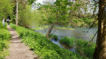

The start is on the D8B1, by the André Erbland Bridge, where there is a car park to leave your car.
(S/E) Facing the bridge, turn left onto a path marked with a Blue Diamond and ‘Route Philosophe’. Follow the River Ill on the left-hand side. Ignore the first unmarked path that turns left and go through a barrier, then take the next path (L’Illmattenweg) on the left to reach the housing estate. Go through another barrier, after which the path gives way to a tarmac road.
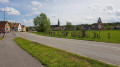
(1) At the Stop sign, at the T-junction, turn left onto Rue de Mulhouse and follow the Blue Rectangle with a white bar markings from here on. Ignore Rue du Gué, then, at the next junction, continue diagonally to the left along Rue de Mulhouse. Cross the road carefully, then, at the T-junction, turn right towards Richwiller. Cross the road carefully once more. Walk past the front of the village church.
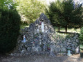
(2) Turn left onto Rue de l’Eglise towards Hochstatt. At the next roundabout, head diagonally left towards the Saint-Gall Chapel on Rue de Zillisheim. Immediately after turning into this street, use the pedestrian crossing and climb the steps marked with a sign prohibiting access to horse riders, towards the Saint-Gall Chapel. At the top of this winding path, where there is a bench, continue straight on at the junction. You’ll pass close to a water tower and carry on to the chapel.
(3) Continue along the path and pass under some high-voltage power lines. Enter the forest and reach a crossroads at a place called Gallenhoelzchen.
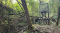
(4) Carry on straight ahead towards Hochstatt. Walk alongside a reservoir, a remnant of German military infrastructure, after which the path begins to descend. At a junction, near plot number 3, turn left; then, immediately afterwards, ignore a path that veers diagonally to the left and continue straight down the slope. As you emerge from the forest and pass under the high-voltage power lines, carry on until you reach a gate and a wayside cross
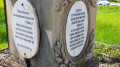
(5). Cross the Route de Didenheim (D8B3) at the pedestrian crossing and carry on straight ahead to enter the village of Hochstatt via a war memorial. Cross a bridge over a stream, then turn left onto Rue de la Chapelle. Carry on up this street, passing a care home and a post office, until you reach the top, where there is a small chapel and a ‘Hochstatt Chapelle’ bus stop; continue along this street towards the bell tower until you reach the next junction.
(6) Carry on straight ahead along Grand Rue. Walk past an open space with a fountain and benches and continue to the village church. After a small car park, head diagonally down to the left, passing the town hall with its war memorial. After a fountain, ignore the Blue Rectangle with a white cross marking on your right on Grand Rue and carry on straight ahead along Rue de Zillisheim. At a left-hand bend, ignore Rue des Bergers. Walk along the right-hand side of the cemetery, staying on Rue de Zillisheim (do not turn left uphill – this is simply an entrance to the cemetery). Cross the road carefully to get to the right-hand side of the carriageway (there is no pavement on the other side) and reach the junction with Route de Didenheim.
(7) Cross carefully and continue straight on towards Zillisheim along the D18, then cross the road carefully again to stay on the left-hand side (there is no pavement on the other side either). Carry on until you leave the village of Hochstatt, cross a stream via a bridge and take the cycle path that runs alongside the road on the left. Enter the village of Zillisheim. Pass a car park and a football pitch, and reach a junction.
(8) Turn left towards the Episcopal Private School. From here, follow the Blue Diamond signposts. At a set of traffic lights, ignore the bridge over the Ill on the right, heading towards the school, and continue diagonally to the left, past a barrier and a ‘Authorised Persons Only’ sign. Enter the forest and cross a stream. Ignore the paths leading uphill to the left and continue along the tarmac road towards Didenheim.
(9) When the path curves slightly to the left, ignore a path cutting across the fields to the right, then pass under the high-voltage power lines. Carry on straight ahead at the next junction. When you reach some houses, continue to follow the same signposting, turning right at house number 67. Pass through a gate. The tarmac road gives way to a dirt track. Go round the last house on the street on the left. Then walk along the left bank of the stream. Pass under the high-voltage power lines one last time and carry on until you return to your starting point (S/E).

 Visorando Member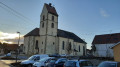


 Moderate
 Tourist office