Sundgau route: Hundsbach-Franken

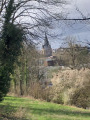
Below the Hochistross, the high road from Altkirch to Basel, villages dot the Thalbach valley. The old grain mill in Hundsbach has recently been restored, much to the delight of artists and history lovers.

Details

179240
Creation:
Last update:
Last review:
  • Walking
    Activity: Walking
  • ↔
    Distance: 3.75 mi
  • ◔
    Average duration: 1h 55 
  • ▲
    Difficulty: Moderate

  • ⚐
    Back to start: Yes
  • ↗
    Ascent: + 184 ft
  • ↘
    Descent: - 194 ft

  • ▲
    Highest point: 1,253 ft
  • ▼
    Lowest point: 1,060 ft
  • ⚐ Country: France
  • ⚐ City: Haut-Rhin (68)
  • ⚑
    Start/End: N 47.602626° / E 7.333086°
  • ❏
    IGN map(s): Ref. 3721ET
  • Hour-by-hour weather

Photos

Description of the walk

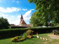
Park in front of the church in Hundsbach.

(S/E) Take Rue Principale to the east. Pass in front of the former presbytery, which has been converted into the town hall.

(1) Turn right onto Rue des Ruisseaux (blue circle), then further on, turn right again onto Rue des Champs. After a few metres (wooden rural cross), take the path on the left (no entry). 250 metres further on, at the crossroads, continue straight ahead. Continue in the same direction (south-east) until you reach the tarmac road 1.5 kilometres further on.

(2) At the T-junction (Club Vosgien signpost), turn left towards Franken (yellow rectangle). Stay on the small road, heading generally north-northeast then north. Pass under the power line.

(3) At the crossroads, cross the D16 road (Rue de Bâle), continue straight ahead along Rue Principale (yellow rectangle) and cross a stream.

(4) At the next fork, turn left onto Rue Principale (yellow rectangle). After the cemetery, turn left down Rue Saint-Georges (red circle). Just before the bridge, turn right onto the path that runs alongside the river. Keep going in the same direction (west).

(5) After the housing estate, turn left towards the village (red circle). Cross the bridge over the Thalbach and, when you reach the main street, turn right. A few metres further on, in the bend (watch out for traffic!), turn left onto Rue Sainte-Odile and go up to the building overlooking the road.

Retrace your steps along Rue Principale and continue to the left (west). After the bridge over the Hundsbach, take the fork you took on the way there.

(1) Return to the church (S/E).

Waypoints

  1. S/E : mi 0 - alt. 1,070 ft - Hundsbach Church
  2. 1 : mi 0.1 - alt. 1,060 ft - Fork
  3. 2 : mi 1.38 - alt. 1,178 ft - T-junction
  4. 3 : mi 2.16 - alt. 1,132 ft - Junction with Route D16. Towards - Thalbach (ruisseau) - Affluent de l'Ill
  5. 4 : mi 2.41 - alt. 1,096 ft - Franken
  6. 5 : mi 3.22 - alt. 1,083 ft - Crossroads
  7. S/E : mi 3.75 - alt. 1,070 ft - Hundsbach Church

Worth a visit

Reviews and comments

4.5 / 5
Based on 9 reviews

Reliability of the description
4.9 / 5
Ease of following the route
4.8 / 5
Route interest
3.8 / 5
User 13563129

Overall rating : 4.7 / 5

Date of your route : Oct 21, 2025
Reliability of the description : ★★★★★ Very good
Ease of following the route : ★★★★★ Very good
Route interest : ★★★★☆ Good
Very busy route : No

Lovely walk

Machine-translated

Nine 68
Nine 68

Overall rating : 4.7 / 5

Date of your route : Jul 09, 2025
Reliability of the description : ★★★★★ Very good
Ease of following the route : ★★★★★ Very good
Route interest : ★★★★☆ Good
Very busy route : No

A quiet little outing after the heatwave, no views, best enjoyed in spring or autumn.

Machine-translated

jenny2
jenny2

Overall rating : 4 / 5

Date of your route : Mar 29, 2021
Reliability of the description : ★★★★☆ Good
Ease of following the route : ★★★★☆ Good
Route interest : ★★★★☆ Good
Very busy route : No

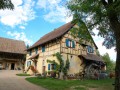
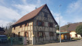
A pleasant, easy route. Beautiful, typically Sundgau buildings, some of them very old, line the route.
We extended the route to the St Brice Chapel, which is well signposted.

Machine-translated

Dany68300
Dany68300

Overall rating : 4.7 / 5

Date of your route : Aug 13, 2020
Reliability of the description : ★★★★★ Very good
Ease of following the route : ★★★★★ Very good
Route interest : ★★★★☆ Good
Very busy route : No

Very nice walk

Machine-translated

Bebopeloula
Bebopeloula

Overall rating : 4.7 / 5

Date of your route : Jun 06, 2020
Reliability of the description : ★★★★★ Very good
Ease of following the route : ★★★★★ Very good
Route interest : ★★★★☆ Good
Very busy route : No

A pleasant, easy walk.

Machine-translated

81wi0834
81wi0834

Overall rating : 4.3 / 5

Date of your route : Jun 14, 2020
Reliability of the description : ★★★★★ Very good
Ease of following the route : ★★★★★ Very good
Route interest : ★★★☆☆ Average
Very busy route : No

The perfect route for a peaceful stroll...
Guy

Machine-translated

randoline88
randoline88

Overall rating : 4.7 / 5

Date of your route : Aug 19, 2018
Reliability of the description : ★★★★★ Very good
Ease of following the route : ★★★★★ Very good
Route interest : ★★★★☆ Good

Easy walk with no climbs. Few shaded areas, best done in the cool of the morning. Thank you for this hike.

Machine-translated

danijela
danijela

Overall rating : 4.3 / 5

Date of your route : Jun 25, 2017
Reliability of the description : ★★★★★ Very good
Ease of following the route : ★★★★★ Very good
Route interest : ★★★☆☆ Average

Nice little walk.

Machine-translated

cathiebot68
cathiebot68

Overall rating : 4.3 / 5

Date of your route : May 08, 2017
Reliability of the description : ★★★★★ Very good
Ease of following the route : ★★★★☆ Good
Route interest : ★★★★☆ Good

A very pleasant and peaceful walk along the edge of forests and fields.
Best avoided during hot weather as there is little shade.

There is a small error between the route and the description at the very end. We chose to follow the description, which took us away from the road.

Machine-translated

Other walks in the area

For more walks, use our search engine .

The GPS track and description are the property of this route's author. Please do not copy them without permission.