


Refine your search for walks in Le Mont
Le Mont walks
 Ascent of the Côte du Mont from La Petite Raon
 Visorando Member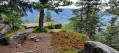
 7.01 mi
 +1,250 ft
 -1,253 ft
 4h 20
4h 20
 Average
 Departure from La Petite-Raon (Vosges)
An opportunity to reach the summit of this beautiful hill, all the way to the Roche de la Motelotte and its television relay station.
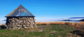
The Haute Loge Smugglers' Trail in Moussey
 9.88 mi
+2,031 ft
-2,031 ft
6h 20
Average
Departure from Moussey (Vosges) (Vosges)
9.88 mi
+2,031 ft
-2,031 ft
6h 20
Average
Departure from Moussey (Vosges) (Vosges)
From Moussey (Vosges), a circular hike that passes through the Rouges Terres to climb the Hautes Chaumes and then the Haute Loge: 360° view. Return to the starting point via the Sentier des Passeurs. This section of the historic trail is the Vosges part, with the French part starting at the Maison Forestière de Salm in Alsace. From 1940 onwards, this trail was used by smugglers to guide escapees, those refusing to participate in the STO (compulsory labour service) and all kinds of people who wanted to flee Nazi barbarism to free France. Most of the elevation gain is concentrated in the first part of the hike, up to Haute Loge.
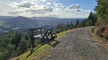
The Col du Dialtrepoix from Senones Abbey
 6.59 mi
+1,207 ft
-1,207 ft
4h 05
Average
Departure from Senones (Vosges)
6.59 mi
+1,207 ft
-1,207 ft
4h 05
Average
Departure from Senones (Vosges)
This varied and fairly easy hike starts in front of Senones Abbey and climbs to the Quatre-Bancs crossroads and then the Col du Dialtrepoix in a fairly wild environment. On the way back, you descend gently along a forest road that offers wide views of the valley at times.
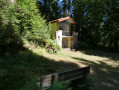
From Senones towards La Roche Mère Henry and the Malfosse Chapel
 9.62 mi
+1,827 ft
-1,818 ft
8h 05
Average
Departure from Senones (Vosges)
9.62 mi
+1,827 ft
-1,818 ft
8h 05
Average
Departure from Senones (Vosges)
A circular walk starting from Senones, climbing up Rue de Lauviot, passing the ruins from the First World War. Passing the Fontaine de la Loge des Gardes, then arriving at the Quatre Bancs crossroads to climb towards the Roche Mère Henry, with a beautiful viewpoint and ruins from the First World War.
The route continues along the “Chemin de la Roche Mère Henry” memorial trail, passing German and French remains from the First World War, then the Croix du Pelé and the Sartorio Monument, before reaching the Croix de Malfosse crossroads. We then head towards the Chêne de la Vierge and the Malfosse Chapel. We return to the Quatre Bancs crossroads and descend along a small path, passing a blockhouse and the Source des Oiseaux.
La Roche Mère Henry via the Malfosse Chapel
 5.46 mi
+1,365 ft
-1,368 ft
3h 40
Average
Departure from Senones (Vosges)
5.46 mi
+1,365 ft
-1,368 ft
3h 40
Average
Departure from Senones (Vosges)
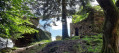
This is a hike with two different atmospheres: first a little mysterious and timeless with the Adrienne Fountain and the Malfosse Chapel, then historical and educational with the Roche Mère Henry memorial trail and its belvedere offering a breathtaking view of Senones and the Rabodeau valley.
Haute Loge route on the Passeurs trail
 4.57 mi
+1,125 ft
-1,125 ft
3h 05
4.57 mi
+1,125 ft
-1,125 ft
3h 05
 Easy
Departure from Le Saulcy (Vosges)
Easy
Departure from Le Saulcy (Vosges)
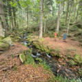
A fun hiking trail where around forty very diverse works produced during previous biennials remain in place. From the start, the ascent runs alongside the Grand Goutte stream and leads to stubble fields halfway along the route, offering a 360° view of breathtaking horizons. We reach the highest point at an altitude of 933 metres. The descent is just as interesting, with many surprises along the way.
La Roche de Haute Pierre and La Roche Mère-Henry via La Croix de Malfosse
 7.28 mi
+906 ft
-899 ft
4h 10
Average
Departure from Senones (Vosges)
7.28 mi
+906 ft
-899 ft
4h 10
Average
Departure from Senones (Vosges)
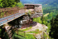
Here is a walking route between Senones and Moyenmoutier, offering beautiful views of both towns and the Rabodeau Valley. Remains from the First World War can be seen towards the end of the route.
Rouges Terres and Hautes Chaumes route
 9.66 mi
+1,601 ft
-1,565 ft
5h 50
Average
Departure from Moussey (Vosges) (Vosges)
9.66 mi
+1,601 ft
-1,565 ft
5h 50
Average
Departure from Moussey (Vosges) (Vosges)
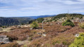
This hike starts on a forest trail in a wild environment and then continues in open country on the Hautes Chaumes. Next, head south towards the Abri de la Haute Loge shelter, then north to walk along the ridge. Return via the Basse des Loges and the Chemin des Italiens.
Les Chavons and Les Hautes Chaumes from Moussey
 6.90 mi
+1,401 ft
-1,401 ft
4h 25
Average
Departure from Moussey (Vosges) (Vosges)
6.90 mi
+1,401 ft
-1,401 ft
4h 25
Average
Departure from Moussey (Vosges) (Vosges)
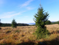
A beautiful hike in the heart of nature to the Hautes Chaumes from Moussey. The length and elevation gain are perfect for an average hiker.
The Four Fountains
 7.01 mi
+1,801 ft
-1,795 ft
4h 50
Average
Departure from Celles-sur-Plaine (Vosges)
7.01 mi
+1,801 ft
-1,795 ft
4h 50
Average
Departure from Celles-sur-Plaine (Vosges)
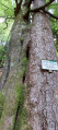
A hike in the forest of Celles-sur-Plaine, from Pain de Sucre to Roche du Coquin. Discover an observatory built and used by the Germans from 1915 onwards to alert the anti-aircraft defences along the route, knowing that the French air force was entering Alsace via the Col du Donon.
Champenay sandstone
 Tourist office10.34 mi
+1,916 ft
-1,909 ft
6h 25
Average
Departure from Plaine (Bas-Rhin)
Tourist office10.34 mi
+1,916 ft
-1,909 ft
6h 25
Average
Departure from Plaine (Bas-Rhin)
Champenay is known for its quartzite sandstone quarry. This is a red sandstone veined with white, known as ‘grès des Princes’ in reference to the former status of this territory, which was the Principality of Salm. At the highest point of the route, there are old France–Germany boundary markers dating from 1870–1918. Finally, the route passes through the refreshing Falle Valley and past the lake of the same name.
Circular route straddling Alsace and Lorraine, starting from Champenay
13.01 mi
+2,549 ft
-2,539 ft
8h 10
 Difficult
Departure from Plaine (Bas-Rhin)
Difficult
Departure from Plaine (Bas-Rhin)
At the Col du Hantz, we cross into Lorraine; then, after a fairly long stretch along a quiet road, we follow a stream along an impressive medieval cobbled path, adorned with installations by ‘art student’ from the University of Nancy; a little further up, the tranquillity of a secluded peat bog is disturbed only by birdsong. The Chemin des Passeurs then takes us to La Haute-Loge and La Chatte Pendue. A journey for lovers of nature and history.
The Fontenelle site - The National Necropolis and Cote 627
 4.66 mi
+830 ft
-827 ft
2h 50
Easy
Departure from Ban-de-Sapt (Vosges)
4.66 mi
+830 ft
-827 ft
2h 50
Easy
Departure from Ban-de-Sapt (Vosges)
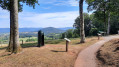
The walk takes you through the Fontenelle site and its surroundings, which were the scene of fighting during the First World War.
The Fontenelle National Necropolis and the hamlets that fell for France
 3.85 mi
+341 ft
-367 ft
2h 05
Easy
Departure from Ban-de-Sapt (Vosges)
3.85 mi
+341 ft
-367 ft
2h 05
Easy
Departure from Ban-de-Sapt (Vosges)
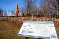
The Fontenelle National War Memorial is a major site commemorating the Vosges Front during the First World War. This route passes through hamlets that no longer exist, of which only a sign remains today to indicate their former existence.
Circular route around Saulxures
 6.71 mi
+755 ft
-764 ft
3h 45
Average
Departure from Saulxures (Bas-Rhin)
6.71 mi
+755 ft
-764 ft
3h 45
Average
Departure from Saulxures (Bas-Rhin)
A pleasant walk around Saulxures, much of it in the shade. Beautiful views along the route.
The three observatories above Celles-sur-Plaine
 12.80 mi
+2,585 ft
-2,556 ft
8h 10
Difficult
Departure from Celles-sur-Plaine (Vosges)
12.80 mi
+2,585 ft
-2,556 ft
8h 10
Difficult
Departure from Celles-sur-Plaine (Vosges)
A circular hike starting from Celles-sur-Plaine, climbing up into the forest towards the three German observatories from the First World War. La Pierre Piquée, then the Pain de Sucre, passing by the Vierge de Dialtrepoix, and ending at the highest point, the Tête du Coquin, passing by the Coquin and Riangoutte fountains. The walk is partly signposted by Tourisme de Mémoire signs.La Pierre Piquée, with its parapets and blockhouses, just outside the site, Le Pain de Sucre with its ramparts and a beautiful view from the top of Le Coquin.
The Bois de Belfays Wind Farm (long version)
 8.68 mi
+1,417 ft
-1,398 ft
5h 15
Average
Departure from Ban-de-Sapt (Vosges)
8.68 mi
+1,417 ft
-1,398 ft
5h 15
Average
Departure from Ban-de-Sapt (Vosges)
A walk offering a close-up view of the wind turbines at Bois de Belfays. In this longer version, you reach the wind farm via Pré Leroy (La Grande Fosse) and return via Pré Lannequin (Châtas).
Circular between Bionville and the Col de la Chapelotte
 10.60 mi
+1,824 ft
-1,804 ft
6h 30
Average
Departure from Allarmont (Vosges)
10.60 mi
+1,824 ft
-1,804 ft
6h 30
Average
Departure from Allarmont (Vosges)
A circular route following the border with Germany between 1870 and 1918 and the German and French fortifications from the First World War between Bionville and the Col de la Chapelotte.Walk along the ridge, between the rocky outcrops, blockhouses and trenches, following the Sentier de Mémoire (Memory Trail) between Roches Ganaux and Col de la Chapelotte.
Chapel of Bipierre - Les Hautes Chaumes - Lake Maix
 9.65 mi
+1,493 ft
-1,493 ft
5h 45
Average
Departure from Vexaincourt (Vosges)
9.65 mi
+1,493 ft
-1,493 ft
5h 45
Average
Departure from Vexaincourt (Vosges)
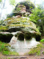
A circular hike starting in the forest and leading to the remarkable rock formation of the Chapelle de Bipierre, then continuing along the ridge via the Hautes Chaumes, with views of the Donon throughout. The hike ends at the peaceful Lac de la Maix.
Bois de la Pierre à Cheval, Col de la Chapelotte and Haut de Faîte
 11.75 mi
+1,991 ft
-1,991 ft
6h 35
Difficult
Departure from Pierre-Percée (Meurthe-et-Moselle)
11.75 mi
+1,991 ft
-1,991 ft
6h 35
Difficult
Departure from Pierre-Percée (Meurthe-et-Moselle)
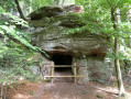
Starting from the Pierre Percée 14/18 Interpretation Centre, climb towards the Roches de la Soye, the Pierre à Cheval and the Vue. Pass through the historic Col de la Chapelotte. Climb towards the Haut de Faîte to visit the German remains from the 1914–18 war: a former hospital, command post and blockhouse. Walk through the Bois de Grandviller to see two German underground shelters, remnants of the 1914–18 war.Descent along a small path to see the German blockhouses and, below them, the French remains from the trench warfare between 1915 and 1917. Return via the Gros Pin, the Grotte des Poilus, the Rocher de l’Arche and the Grotte Dame Galle dating from 1135.
From Lac de la Plaine to Lac du Vieux Pré
 3.80 mi
+663 ft
-636 ft
2h 20
Easy
Departure from Pierre-Percée (Meurthe-et-Moselle)
3.80 mi
+663 ft
-636 ft
2h 20
Easy
Departure from Pierre-Percée (Meurthe-et-Moselle)
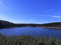
The Vallée de la Plaine or "Belle Vallée" (Beautiful Valley) boasts two lakes, a paradise for hikers and sports enthusiasts, where water, nature and forest are intimately linked.
Lac de la Maix and Haut du Bon Dieu
 6.02 mi
+771 ft
-745 ft
3h 25
Average
Departure from Vexaincourt (Vosges)
6.02 mi
+771 ft
-745 ft
3h 25
Average
Departure from Vexaincourt (Vosges)
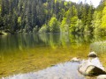
Leaving from the Lac de la Maix, in a beautiful setting, we pass through the Clairière de Prayé, the Haut du Bon Dieu and the charming Fontaine Colas Lorrain spring. We also visit two sites of trough or cup rock. A hike through beautiful woodland with pleasant stretches of open country.
La Chatte Pendue from Étang du Coucou
 4.12 mi
+1,145 ft
-1,135 ft
2h 55
Average
Departure from La Broque (Bas-Rhin)
4.12 mi
+1,145 ft
-1,135 ft
2h 55
Average
Departure from La Broque (Bas-Rhin)
Mainly on shaded paths through the woods, this hike offers various points of interest, including the pretty Étang du Coucou lake surrounded by fir trees, the Chatte Pendue with its magnificent view of the Bruche valley and the Champs du Feu massif, and the Romanesque ruins of Salm Castle.
La Chatte Pendue and La Haute Loge, starting from Étang du Coucou
 6.43 mi
+1,490 ft
-1,476 ft
4h 15
Average
Departure from La Broque (Bas-Rhin)
6.43 mi
+1,490 ft
-1,476 ft
4h 15
Average
Departure from La Broque (Bas-Rhin)
This walk will allow you to admire some stunning views whilst enjoying the tranquillity of the frequently used forest paths. A walk mainly through the forest, offering a chance to enjoy the cool, refreshing air.
Salm Castle, La Chatte Pendue and the Maxe peat bog
 8.12 mi
+1,339 ft
-1,329 ft
4h 55
Average
Departure from La Broque (Bas-Rhin)
8.12 mi
+1,339 ft
-1,329 ft
4h 55
Average
Departure from La Broque (Bas-Rhin)
A circular walk mainly through forest. Starting from the enchanting setting of the Étang du Coucou, you will discover the ruins of the Château de Salm, currently undergoing restoration. You will then climb up to the promontory of the Chatte Pendue with its orientation table, make a short stop at the Monument des Passeurs, and then follow a slightly wilder path to the Tourbière de la Maxe.
July 2022 modification of the route between (8) and (9) due to poor trail maintenance: temporarily leave the blue cross markings in place.
Circular starting from the Étang du Coucou
 9.25 mi
+2,093 ft
-2,077 ft
6h 05
Average
Departure from La Broque (Bas-Rhin)
9.25 mi
+2,093 ft
-2,077 ft
6h 05
Average
Departure from La Broque (Bas-Rhin)
This walk leads to the Chatte Pendue viewpoint and the summit of the Hautes Loges, which offer a breathtaking 360° view of the neighbouring peaks: Donon, Rocher de Mutzig, the Champ du Feu massif and the Col du Hantz.The only challenging part is the climb up to La Chatte Pendue. So, take it easy to start with.
The Chatte Pendue circular path from the Ferme-auberge du Bambois
 Tourism professional
 11.50 mi
+2,480 ft
-2,457 ft
7h 25
Difficult
Departure from La Broque (Bas-Rhin)
11.50 mi
+2,480 ft
-2,457 ft
7h 25
Difficult
Departure from La Broque (Bas-Rhin)
In the Bruche Valley, this circular route on the heights of Rothau, starting from the Étang du Coucou, takes us towards the peaks of La Chatte Pendue and La Haute Loge. The Auberge du Bambois is the perfect stop for a gourmet meal.
The Saâles ridges
6.67 mi
+1,063 ft
-1,063 ft
4h 00
Average
Departure from Saales (Bas-Rhin)
Set in the centre of a two-kilometre-long plateau, surrounded by mountains, the village of Saâles was built on the Via Salinaria at a convenient crossing point over the Vosges. The village has maintained its role as a market town throughout history. As early as 1743, it was granted the privilege of holding a fair and a market. In 1924, the rebuilt town hall housed the market halls on its ground floor.
The Climont and the Voyemont from Saales
11.83 mi
+2,139 ft
-2,133 ft
7h 20
Average
Departure from Saales (Bas-Rhin)
Climont rises to an altitude of 965 metres. The Julius Tower stands atop its summit, offering a 360-degree view of Alsace and the Black Forest. This walk takes you to the summit starting from Saales. Half of the walk is on flat ground. A further quarter is uphill, and another quarter is downhill. The climbs aren’t very long, but they are quite steep, technical and stony. Most of the walk takes place in the forest. The return route takes you past the Voyemont and the Roche des Fées, offering views of the Bruche Valley and the Bas-Rhin on one side, and the Vosges department on the other.
Lake Pierre Percée – Discovering the battles of the Great War
 9.72 mi
+1,499 ft
-1,490 ft
5h 45
Average
Departure from Pierre-Percée (Meurthe-et-Moselle)
9.72 mi
+1,499 ft
-1,490 ft
5h 45
Average
Departure from Pierre-Percée (Meurthe-et-Moselle)
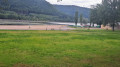
Discover an artificial lake that supplies water to the cooling system of the Cattenom nuclear power station. The battles of the Great War near Celles-sur-Plaine.
The Haute Pierre route in Moyenmoutier
 6.37 mi
+1,365 ft
-1,348 ft
4h 05
Average
Departure from Moyenmoutier (Vosges)
6.37 mi
+1,365 ft
-1,348 ft
4h 05
Average
Departure from Moyenmoutier (Vosges)
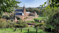
A fairly challenging walk on the hills above Moyenmoutier to explore the ruins of the Château de la Haute Pierre and its 360° panorama. Then technical sections through the Roches de la Balance and de Lanceux before reaching the Croix de Malfosse crossroads for a gentle descent back to the abbey grounds.
From the Vieux Pré dam to Pierre-Percée Castle
 4.04 mi
+482 ft
-466 ft
2h 15
Easy
Departure from Pierre-Percée (Meurthe-et-Moselle)
4.04 mi
+482 ft
-466 ft
2h 15
Easy
Departure from Pierre-Percée (Meurthe-et-Moselle)
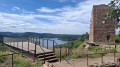
A short circular loop that runs alongside Lake Pierre-Percée before climbing up to the village of the same name and circling the nearby castle. Also known as Château de Salm, it has been open to visitors since May 2026 following a spectacular renovation. This offers walkers and other nature lovers the chance to finally rediscover this iconic site perched above the lake.
Lake Maix, the David Garden and the Haute-Côte
 9.30 mi
+1,798 ft
-1,788 ft
5h 50
Difficult
Departure from Vexaincourt (Vosges)
9.30 mi
+1,798 ft
-1,788 ft
5h 50
Difficult
Departure from Vexaincourt (Vosges)
Keen to explore the archaeological sites around Lac de la Maix and its surroundings, we followed the trails marked by the Club Vosgien. On the way back after La Haute-Côte, we came across a few sections that reminded us a little of the legendary Roches or Hirschsteine trails between La Schlucht and the Hohneck; namely, very rocky paths featuring quite challenging sections interspersed with numerous springs.
Best avoided during wet weather
The Virgin of Vohné as seen from the Vieux Pré Dam on Lake Pierre Percée
 1.70 mi
+472 ft
-476 ft
1h 10
Easy
Departure from Pierre-Percée (Meurthe-et-Moselle)
1.70 mi
+472 ft
-476 ft
1h 10
Easy
Departure from Pierre-Percée (Meurthe-et-Moselle)
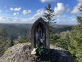
An easy, family-friendly walk through the forest on the shores of Lac de Pierre Percée. Ascent to Vohné, at an altitude of 526 m.
Le Petit Canada
 7.53 mi
+607 ft
-584 ft
4h 00
Average
Departure from Pierre-Percée (Meurthe-et-Moselle)
7.53 mi
+607 ft
-584 ft
4h 00
Average
Departure from Pierre-Percée (Meurthe-et-Moselle)
With its dam, the Roches de la Xaveure – some of which are shaped like animals – Salm Castle (or Château de Pierre-Percée) and the little village that bears its name, Lake Pierre-Percée offers landscapes with a distinctly Canadian feel.
Vexaincourt - Col Pourrio - Lac de la Maix
 7.77 mi
+1,512 ft
-1,516 ft
4h 55
Average
Departure from Vexaincourt (Vosges)
7.77 mi
+1,512 ft
-1,516 ft
4h 55
Average
Departure from Vexaincourt (Vosges)
A pleasant hike in warm weather as it is mainly in the shade and mostly on paths, allowing you to discover Lac de la Maix.
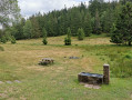
Tête des Blanches Roches – Les Hautes Chaumes – Les Rouges Terres
 10.46 mi
+1,539 ft
-1,549 ft
6h 10
Average
Departure from Moussey (Vosges) (Vosges)
10.46 mi
+1,539 ft
-1,549 ft
6h 10
Average
Departure from Moussey (Vosges) (Vosges)
A pleasant walk, alternating between woodland and open countryside, including a section across the Hautes-Chaumes.
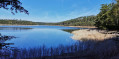
From Lake Pierre-Percée to the Roches de la Xaveure and Marie Fontaine
 4.66 mi
+535 ft
-512 ft
2h 35
Easy
Departure from Pierre-Percée (Meurthe-et-Moselle)
4.66 mi
+535 ft
-512 ft
2h 35
Easy
Departure from Pierre-Percée (Meurthe-et-Moselle)
This is a lovely walk that winds along the shores of Lake Pierre-Percée and leads you to the surprising Roches de la Xaveure and Marie Fontaine rock formations. As a bonus, you will pass through the charming little village of Pierre-Percée and, when it is possible again, visit the ruins of Salm Castle and its magnificent view of the lake.
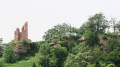
Tour of the village of Pierre Percée: lake, castle and rocky outcrops
 8.98 mi
+1,388 ft
-1,368 ft
5h 20
Average
Departure from Pierre-Percée (Meurthe-et-Moselle)
8.98 mi
+1,388 ft
-1,368 ft
5h 20
Average
Departure from Pierre-Percée (Meurthe-et-Moselle)
A very pretty circular route around the village of Pierre-Percée. It will take you from the shores of the lake to the Château de Salm, passing through the rocky outcrops of Marie Fontaine, La Xaveure and the Sentier des Roches. You will come across a few remnants of the First World War not far from the Col de la Chapelotte and several viewpoints, including the Roche de la Soye, on a more winding and technical section, with a less rugged return via the Musée de La Ménelle and theGR® 533.
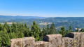
L'Alhan - Le Climont - The source of the Bruche
 9.68 mi
+2,037 ft
-2,031 ft
6h 15
Difficult
Departure from Bourg-Bruche (Bas-Rhin)
9.68 mi
+2,037 ft
-2,031 ft
6h 15
Difficult
Departure from Bourg-Bruche (Bas-Rhin)
A beautiful hike with stunning views of all the surrounding valleys: the Bruche Valley, Donon, Saint-Dié-des-Vosges, Val de Villé, Sainte-Croix-aux-Mines, Haut-Koenigsbourg, etc.
It is quite difficult due to its length, elevation gain and rough terrain (narrow paths on the edge of the void or muddy forest paths).
The Hang clearing at the foot of Climont
6.95 mi
+860 ft
-876 ft
3h 55
Average
Departure from Bourg-Bruche (Bas-Rhin)
This walk winds through a haven of peace and tranquillity at the foot of one of the valley's legendary peaks: Climont (966 m). The Bruche river rises at an altitude of 660 m and then crosses a vast basin: the Hang clearing. This is where families of glassmakers settled in 1723. Le Hang continued to prosper thanks to the arrival of Mennonite farmers of Swiss origin. They found here a place conducive to their pastoral and community life.
The tour of Roc du Taurupt via Haut de Chaumont
 6.49 mi
+955 ft
-955 ft
3h 50
Average
Departure from Bionville (Meurthe-et-Moselle)
6.49 mi
+955 ft
-955 ft
3h 50
Average
Departure from Bionville (Meurthe-et-Moselle)
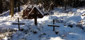
A hike at the foot of the highest point in the Meurthe-et-Moselle department, in a mainly forest setting, far from the crowds and the beaten track. A moving visit to the graves of German soldiers from the First World War.
La Corbeille
 11.93 mi
+1,677 ft
-1,670 ft
6h 55
Average
Departure from Moussey (Vosges) (Vosges)
11.93 mi
+1,677 ft
-1,670 ft
6h 55
Average
Departure from Moussey (Vosges) (Vosges)
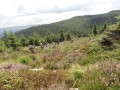
From the Col de Prayé to the Lac de la Maix via La Corbeille, walk along the peaks to discover some interesting sights: cup-marked stones, remains from the First World War, views of Alsace and Donon.
16/09/2024: Starting point changed. The access road and car park at Lac de la Maix are inaccessible for an indefinite period.
The Celtic Camp at La Bure
 8.37 mi
+1,181 ft
-1,171 ft
4h 55
Average
Departure from Saint-Jean-d'Ormont (Vosges)
8.37 mi
+1,181 ft
-1,171 ft
4h 55
Average
Departure from Saint-Jean-d'Ormont (Vosges)
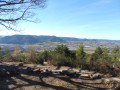
A circular hike near Saint-Dié to discover the Celtic camp of La Bure, a Gallic and Gallo-Roman fortified site listed as a historic monument.
It is located on a vast rocky promontory, offering a magnificent view of the Meurthe valley. A discovery trail has been created, punctuated by around fifteen information panels.
La Vierge Clarisse
 6.65 mi
+984 ft
-984 ft
3h 55
Average
Departure from Badonviller (Meurthe-et-Moselle)
6.65 mi
+984 ft
-984 ft
3h 55
Average
Departure from Badonviller (Meurthe-et-Moselle)
From the Col de la Vierge Clarisse, where you leave your vehicle, you will hike between the weathered rocks and then follow a steep path that will take you to La Menelle before climbing back up to the village of Pierre Percée and finally following the peaceful banks of its lake.
Le Climont and the source of the Bruche
6.74 mi
+1,250 ft
-1,247 ft
4h 10
Average
Departure from Bourg-Bruche (Bas-Rhin)
This walk winds through a haven of peace and tranquillity towards one of the legendary peaks of the Bruche Valley. Surrounded by green, wooded landscapes, Le Climont is the region's water tower. Three rivers originate in its vicinity: the Bruche, Giessen and Fave. This spot is marked by a stele created by sculptor Raymond Keller from a block of sandstone donated by the Champenay quarry.
Exploring Climont
 7.66 mi
+1,440 ft
-1,407 ft
4h 45
Average
Departure from Bourg-Bruche (Bas-Rhin)
7.66 mi
+1,440 ft
-1,407 ft
4h 45
Average
Departure from Bourg-Bruche (Bas-Rhin)
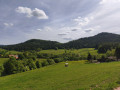
A lovely walk in the Bruche Valley, with the climb up to Climont offering magnificent scenery. The ascent between (2) and (3) follows a footpath and is a bit of a challenge but well worth the effort. The descent is more gradual and follows a forest track.
Rocks and surroundings of Lac de Pierre Percée
 10.14 mi
+955 ft
-951 ft
5h 30
Average
Departure from Badonviller (Meurthe-et-Moselle)
10.14 mi
+955 ft
-951 ft
5h 30
Average
Departure from Badonviller (Meurthe-et-Moselle)
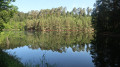
A lovely, easy circular walk that takes you successively to the Roches de la Xaveure, the rugged shores of Lac de Pierre Percée and the Roche des Corbeaux with its beautiful viewpoint. The return journey follows part of the same route to Les Roches Bataillons, ending at the starting point at Les Trois Sapins.
Cascade de la Crache, Rocher and Dolmen de la Hazelle
 7.32 mi
+1,181 ft
-1,165 ft
4h 25
Average
Departure from Grandfontaine (Bas-Rhin) (Bas-Rhin)
7.32 mi
+1,181 ft
-1,165 ft
4h 25
Average
Departure from Grandfontaine (Bas-Rhin) (Bas-Rhin)
Set off to explore the Cascade de la Crache waterfall, the Rocher de la Hazelle rock with its view over the Plaine valley, and the Dolmen de la Hazelle dolmen above the village of Raon-sur-Plaine.
The Donon Forts
 7.09 mi
+853 ft
-830 ft
4h 00
Average
Departure from Grandfontaine (Bas-Rhin) (Bas-Rhin)
7.09 mi
+853 ft
-830 ft
4h 00
Average
Departure from Grandfontaine (Bas-Rhin) (Bas-Rhin)
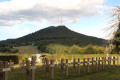
A hike along the Donon fortified positions trail. From September 1914, the Vosges front stabilised on the ridges and the Donon became a defensive position of prime importance. In 1915, the Germans embarked on a colossal construction project.
Les Deux Donon
 10.59 mi
+2,543 ft
-2,546 ft
7h 05
Difficult
Departure from Grandfontaine (Bas-Rhin) (Bas-Rhin)
10.59 mi
+2,543 ft
-2,546 ft
7h 05
Difficult
Departure from Grandfontaine (Bas-Rhin) (Bas-Rhin)
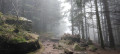
Circuit passing through the peaks of Grand and Petit Donon, using the marked trails of the Club Vosgiens and theGR®5.
Forestry work is taking place for one month until May 2024 between (10) and (11).