Country:

 City:
City:


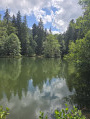
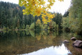
Car park next to Étang du Coucou, easily accessible.
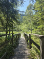
(S/E) In the car park, opposite the pond, look for a path leading up into the forest (marked with a Red Disc). Along the path, you’ll pass three wooden footbridges. Follow the Red Disc markings until you reach the metal staircase leading into the nature reserve.
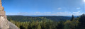
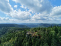
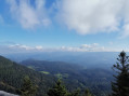
(1) Take this staircase (marked with a Blue Cross – Yellow Rectangle – Red Disc). Follow the markings carefully until you reach La Chatte Pendue. There is an orientation board and a splendid view. There are no tables or benches, but plenty of rocks where you can sit and admire the scenery. Then continue along the path, following the same markings, down the slope. Take the metal staircase to leave the nature reserve, then continue along the forest track (marked with a Green Disc towards the Monument des Passeurs).
(2) Take the Route Forestière des Quatre Hêtres (marked with a Yellow Rectangle – Blue Cross – Green Disc). Continue along the gently sloping forest track until you reach a Fork in the road.
(3) Turn left twice (marked with a Green Disc and a Yellow Rectangle). Walk past the Monument des Passeurs and continue along the forest track.
(4) At the junction, go straight on, then turn right at the next junction and left, following the signs for La Haute Loge to complete a circular route.
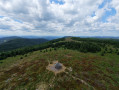
(5) Complete the circular route , taking time to admire the view from La Haute Loge. Return to the junction (4)
(4) Take the Route Forestière de la Maxe (on the left when returning from La Haute Loge – on the right when coming from the Monument des Passeurs). Follow this forest track; it is unmarked but easy to follow.
(6) Just past the hut/house, take the hairpin bend to the right (marked with a Blue Disc – sign for Basse Madeleine 738 m), cross the Ruisseau de Framont and follow the path towards the Marais de la Maxe.
(7) Continue along the path which winds its way down through the forest (marked with a Green Disc and a Blue Disc). You can admire the Marais de la Maxe from the end of a wooden jetty. Continue along the main path until you reach a fork.
(8) Take the hairpin bend to the left (marked with Green Disc – Blue Disc) and return to the Étang du Coucou car park (S/E).
 Visorando Member


 Tourism professional
 Difficult