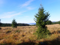
Ascent of the Côte du Mont from La Petite Raon

An opportunity to reach the summit of this beautiful hill, all the way to the Roche de la Motelotte and its television relay station.

Details

24487788
Creation:
Last update:
Last review:
  • Walking
    Activity: Walking
  • ↔
    Distance: 7.01 mi
  • ◔
    Average duration: 4h 20 
  • ▲
    Difficulty: Moderate

  • ⚐
    Back to start: Yes
  • ↗
    Ascent: + 1,250 ft
  • ↘
    Descent: - 1,253 ft

  • ▲
    Highest point: 2,405 ft
  • ▼
    Lowest point: 1,152 ft

Photos

Description of the walk

Park near the town hall in La Petite Raon.

(S/E) With your back to the town hall, turn right onto the main street for 100 m, then turn left up the street on the right towards Autocasse Lecomte.

(1) Very soon, just before a tall statue of the Virgin Mary perched on the left, turn off onto the path branching off to the right (Red Ring).

(2) Continue to the right along the Chemin du Fourion, then turn left at the end and leave this residential area to head up to the right into the forest.
After twenty minutes and a long stretch with unobstructed views of the surrounding area, you’ll reach a fork. Ignore the Red Ring-marked path which climbs to the left.

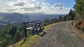
(3) Turn right here; there is a bench at the start of the small, traffic-free road leading to the village of Le Mont.

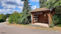
(4) In the village of Le Mont, walk past the ‘Abri aux Livres’ on your left, continue on, and, after the town hall (on your right) and two fountains (now dry), head up the narrow lane on your left (Rue du Haut Bout).

(5) At the end of the tarmac road, take the path on the right (Route du Mont via footpath – Yellow Ring). You’ll come to a junction.

(6) Carry on towards the Roche de la Motelotte, a television relay station.
After a sharp bend to the left, continue for 500 m, then take a very sharp right-hand bend and continue uphill.

(7) At the junction with the return path leading off to the right, carry on straight ahead uphill (Roche de la Motelotte 10 mins).

(8) At the Roche de la Motelotte, continue towards the television relay station. Carry on to reach the junction you passed on the way out.

(7) Stay on the same forest track, which is the return route (Yellow Ring). After at least 2 km of descent, you’ll see a first path leading down to the right (Red Ring). Ignore this path, which leads to the Moussey road; very soon, another path appears on the right.

(9) Take this path (also marked with a Red Ring) and continue downhill.

(10) At the end of this path, turn right (note that for this section, the signposting you are following does not correspond to the markings on the IGN Top 25 map). You will come to a Fork in the road.

(11) Carry on straight ahead, ignoring the Red Ring marked path which branches off to the left. Continue downhill, passing the Autocasse Lecomte (on the left) and arriving at the cemetery.

(1) Carry on straight ahead to reach the town hall of La Petite Raon (S/E).

Waypoints

  1. S/E : mi 0 - alt. 1,155 ft - La Petite Raon Town Hall - Rabodeau (rivière)
  2. 1 : mi 0.19 - alt. 1,204 ft - Crossroads at the end of the circular loop
  3. 2 : mi 0.49 - alt. 1,234 ft - Chemin du Fourion
  4. 3 : mi 1.5 - alt. 1,476 ft - Junction
  5. 4 : mi 1.9 - alt. 1,483 ft - Shelter at Les Livres
  6. 5 : mi 2.17 - alt. 1,611 ft - Fork in the road
  7. 6 : mi 2.57 - alt. 1,785 ft - Junction towards the Roche de la Motelotte
  8. 7 : mi 3.22 - alt. 2,201 ft - Junction
  9. 8 : mi 3.41 - alt. 2,356 ft - Roche de la Motelotte
  10. 9 : mi 5.36 - alt. 1,742 ft - Turn right at the junction
  11. 10 : mi 5.89 - alt. 1,496 ft - Junction
  12. 11 : mi 6.05 - alt. 1,434 ft - Fork in the road
  13. S/E : mi 7.01 - alt. 1,152 ft - La Petite Raon Town Hall

Notes

Parking is available in the car park behind the church, next to the town hall.
It is also possible to cycle to the town hall in La Petite Raon via the cycle path that starts at Étival-Clairefontaine station and passes through Moyenmoutier and Senones (12 km in total, with no elevation gain).

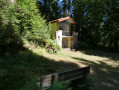
Shelter at the entrance to the village of Le Mont
Emergency shelter at the Relais de Télévision cottage (summit of the Côte du Mont)

Worth a visit

Along the route:
A fountain in front of La Petite Raon town hall.
Several fountains in the village of Le Mont.

Reviews and comments

4.3 / 5
Based on 2 reviews

Reliability of the description
4.5 / 5
Ease of following the route
4.5 / 5
Route interest
4 / 5
User 11929758

Overall rating : 4 / 5

Date of your route : Aug 24, 2025
Reliability of the description : ★★★★☆ Good
Ease of following the route : ★★★★☆ Good
Route interest : ★★★★☆ Good
Very busy route : No

I have completed this circuit twice.
The second time (on 24 August), numerous tree cuttings hid a marker and blocked the path.

This made it difficult to descend and retrieve the obstructed marker.

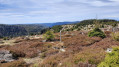
The view is superb, with a 180° panorama over the rocks.
but not at the foot of the relay

Machine-translated

lgn68
lgn68
• Edited:

Overall rating : 4.7 / 5

Date of your route : Sep 17, 2023
Reliability of the description : ★★★★★ Very good
Ease of following the route : ★★★★★ Very good
Route interest : ★★★★☆ Good
Very busy route : No

We didn’t see anyone, and the views were rather limited – apart from when we were on the rock, all you can see are trees. That said, it’s still an interesting route.

Machine-translated

Other walks in the area

For more walks, use our search engine .

The GPS track and description are the property of this route's author. Please do not copy them without permission.