Country:

 City:


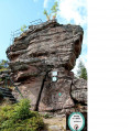
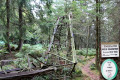
To reach the start point from Saint-Dié-des-Vosges, head towards the Col des Raids via the D49. At Robache, follow signs for the Cascade des Molières and park in the small car park at the Cascade des Molières next to a bridge.
(S/E) Go through the gate and walk about a hundred metres along the Robache stream. You’ll reach the Cascade des Molières.
(1) Leave the return path on your left and head right into the forest, following the path marked with yellow-white-yellow Yellow Rectangles (GRP® de la Déodatie) towards Paradis. Ignore any paths branching off to the right or left and continue to a Y-junction.
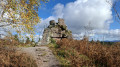
(2) Leave the GRP® and turn left onto the ‘Belle Ninon’ path, marked with a Yellow Cross, towards Roche des Fées – Roche du Chapeau. Cross a road, ignore a path marked with a Blue Cross on the right and reach another junction.
(3) Turn left onto the path marked with a Green Cross towards Roche du Chapeau.
(4) After this viewpoint, turn right towards Sapin Sec, still following the Green Cross markings. Pass a path on the left and continue for about a hundred metres to reach the hairpin bend, at the Grand Tournant junction.
(5) Take the unmarked path on the right signposted ‘Paradis’; at the first junction, keep to the right, then continue for about 350 metres, heading south-west down a steep descent until you reach the junction with a path marked with a Yellow Diamond.
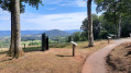
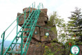
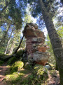
(6) Turn left onto this path towards La Roche des Fées, where there is a viewing platform and a scenic viewpoint.
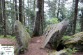
(7) Turn left again towards the Sapin Sec, following the Yellow Diamond markings. After about 150 m, the path turns left then right; carry on straight ahead at the following junctions until you reach the Roche des Cailloux, where you can enjoy the view.
(8) Carry on in the same direction, passing the Roche des Oiseaux.
(9) Pass the Roche du Hoff to reach the Sapin Sec shelter.
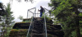
(10) Stay on the path marked with Yellow Diamonds (Sentier des Ducs), pass the Roche du Sapin Sec (901 m) and reach a raised orientation table, then continue to the Tête du Chariot at a Y-junction.
(11) Turn right towards the Col du Chariot, reaching it after approximately 300 m.
(12) Turn right onto the Red Triangle-marked trail, then leave it immediately to the left to join a forest track. Take this track by turning left; it is joined by a marked trail coming from the left, then reaches a multi-way junction at the place known as “Grand Chargeoir des Hautes Voies”.
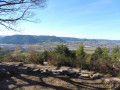
(13) Continue straight ahead along the uphill road and walk to the end of this road, which turns south (marked with a Red Cross). At the next junction, head straight ahead (marked with a Green Cross) to reach the Roche d’Ormont; take a moment here at the viewpoint to enjoy the scenery.
(14) Head towards the Tête de Raves, following the Yellow Diamond markings; this is also the Déodatie GRP® trail. Make your way to this summit.
(15) Set off again to the left, heading due west, following the Yellow Diamond markings and signs for “Tête de Poilu”.
(16) Pass the Roche des Abris and continue westwards along the path dotted with military remains. This will take you to the Col du Chariot.
(12) Carry on straight ahead in the opposite direction to your outward journey to reach the junction at the Roche du Chariot.
(11) Turn right, following the ‘Red Saltire’ signpost, and begin the descent. Cross a forest track and continue down a steep slope until you rejoin this forest track.
(17) Leave the signposted route at the second left, onto the Route forestière du Bois Leroy, and continue the descent.
(18) At the next junction, turn right onto the GR®533 (Green Rectangle signposting). Cross a forest track and turn sharply left to continue on the GR®. You’ll reach the junction by the Molières waterfall.
(1) Follow the track to the right and you’ll soon reach the car park (S/E).
 Visorando Member

 Easy