Country:

 City:
City:




The walk starts from the car park at the Vieux-Pré dam, which can be reached via the D182a coming either from Celles-sur-Plaine (Vosges side) or from Badonviller (Meurthe-et-Moselle side).
(S/E) Head up towards the shelter opposite the dam.
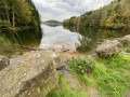
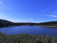
(1) From here, follow the Green Disc markings, which take you as close as possible to the lake, which will be on your left. Continue along the path, which frequently moves closer to or further away from the lake. You’ll reach the jetty at the Anse de Pierre Percée car park.
(2) Head towards the road, cross it, keeping slightly to the right, then take the path that climbs immediately to the left: there is a signpost for Pierre-Percée. After a short climb, you’ll enter the village of Pierre-Percée.
(3) Turn left and walk past the town hall, then the church on your right. Continue straight on along a dirt track with wooden steps to make the climb easier.
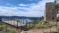
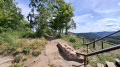
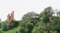
(4) Once at the top, head left towards Pierre-Percée Castle. Continue along the path, then climb the steps on the left leading up to the rocky outcrop where the castle stands. The castle reopened on 6 May 2026 following a long period of renovation work. A ten-metre-high viewing platform jutting out over the cliff and a staircase leading to the top of the tower now offer a unique panoramic view of the lake and the Vosges. And a beautiful, fully secured area allows you to walk around the rocky outcrop – the ideal spot to sit down and enjoy a snack whilst taking in the various views.
(5) After a visit that is sure to stir deep emotions, head back down the same staircase and take the path on the right to return to the village of Pierre-Percée. At the bottom of the steps, you can also turn left and walk round the castle at the base via a small, steep and slippery (in wet weather) path, as indicated on the signs.
(3) Once you reach the village of Pierre-Percée, walk through the centre (with the town hall on your left) and continue straight on along the Chemin d’Ortomont, keeping an eye out for the ‘Red Ring’ markings. Continue along a forest track, carefully following these markings, until you reach a three-way junction at the Vierge de Para, on your left.
(6) Head straight on for about 600 m
(7) Look out for the Red Ring signpost and turn sharply right. Continue along the path, which winds its way through the vegetation. You will then come to a short, steep flight of steps just before reaching the road, which you will need to climb.
(1) Pass the information shelter you visited on the way out to reach the car park (S/E).


 Visorando Member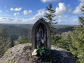

 Moderate

 Difficult