Country:

 City:
City:


Ask to be dropped off in front of the Brasserie du Donon, where there is plenty of parking. 15 Donon, 67130 Grandfontaine.
(S) Cross the D392 road. Take the path heading due south, which leads to the military cemetery you can see above you.
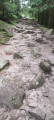
(1) Walk alongside the cemetery and carry on straight ahead. Turn left onto a forest track, which you’ll leave almost immediately to turn right at the three-way junction. After about 150 metres, turn right onto the forest track. Carry on straight ahead.
(2) At the Haute Abraye shelter, situated beside the forest track, turn left and follow this track.
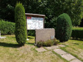
(3) You will arrive at the Étoile 1 crossroads, where there is a memorial stone commemorating the fact that, in 1940, the 154th Infantry Regiment chose to burn its flag there rather than let it fall into enemy hands.
Carry on straight ahead, towards the Col de Prayé, following the path marked with a Blue Cross.
(4) At the Col de Prayé, cross the road and turn left onto the path marked with a Blue Ring.
(5) The path climbs to the Tête de Bipierre. Once you reach the ridge, take the time to visit the Bipierre Chapel (see practical information). Return to the ridge and head right. From here, the path follows the Franco-German border as it stood between 1870 and 1918. You’ll come across numerous boundary markers bearing an ‘F’ (France) on the western side and a ‘D’ (Deutschland) on the eastern side, as well as a line across the top to mark the border. Continue to follow the Blue Ring to the next summit, the Tête des Blanches Roches. From there, the path descends slightly, heading north-west, to a forest track which you’ll take to the left.
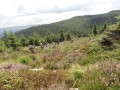
(6) After about 750 metres, take the path on the left, marked by the Red Ring and the Red Disc, which climbs towards the cup-marked stones. Continue along the path which leads you to the Hautes Chaumes ridge, amidst the heather.
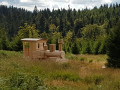
(7) On your left you’ll find the ruins of the ‘marcairie’ (or ‘marcairerie’). You will then emerge onto a forest track. It is from this track that the walk passes the various sculptures scattered throughout the countryside along the Sentier des Passeurs (see practical information). From the forest track, you will very soon see a small path on your right – the markings for which are no longer very clear – which climbs towards the summit of the Haute Loge.
(8) Summit of the Haute Loge and shelter. Descend from the summit of the Haute Loge on the other side, following the path marked with a Red Ring.
(9) There are a number of sculptures dating from various editions of the Sentier des Passeurs at the small pass you cross. Turn left and, about 100 metres further on, look for the path marked with a Yellow Rectangle (GR®532) which branches off to your right (see Practical Information). Pass under the high-voltage power line. Pass a pylon on your left.
(10) The Yellow Rectangle path follows the contour lines before taking you over the ridge and down onto the eastern slope. All you have to do now is let yourself descend to the Col du Hantz.
(11) There you’ll find a memorial stone commemorating a deportation that took place during the Occupation. The path leading to St-Blaise-la-Roche, marked with the Yellow Triangle, starts a little below this memorial stone on your left, due east. The sign indicates a 2-hour walk to Saint-Blaise, but a keen walker can cover the distance in 1 hour 30 minutes. You’ll follow this route all the way to Saint-Blaise station.
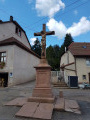
(12) As you pass through the small village of Champenay, note the large cross erected in the square by Father Uhlrich in 1896, who promised 40 days’ indulgence to anyone who recited “devoutly before this cross 6 Our Fathers, 5 Hail Marys and the Creed”. Those were the days… Continue along the Yellow Triangle towards the village of Plaine.
(13) In Plaine, head down towards St-Blaise, still following the Yellow Triangle. Pass by the Étang du Breux. Just before the railway bridge, turn left and follow the railway line. This will save you from having to cross the village, which is always a bit of a hassle due to the fairly heavy traffic.
(14) After about 700 metres, this time go under the railway line and turn left. The SNCF station, the end of our journey, is barely 200 metres away (E).

 Visorando Member
 Moderate
 Tourism professional