La Roche de Haute Pierre and La Roche Mère-Henry via La Croix de Malfosse

Here is a walking route between Senones and Moyenmoutier, offering beautiful views of both towns and the Rabodeau Valley. Remains from the First World War can be seen towards the end of the route.

Details

33993713
Creation:
Last update:
Last review:
  • Walking
    Activity: Walking
  • ↔
    Distance: 7.28 mi
  • ◔
    Average duration: 4h 10 
  • ▲
    Difficulty: Moderate

  • ⚐
    Back to start: Yes
  • ↗
    Ascent: + 906 ft
  • ↘
    Descent: - 899 ft

  • ▲
    Highest point: 2,201 ft
  • ▼
    Lowest point: 1,621 ft

Photos

Description of the walk

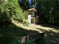
To reach the Quatre Bancs shelter from Senones, take Rue de Malfosse as far as Clos Malpré, then Rue Jean Aurange, which leads into the forest. At a bend with a gazebo, follow the sign for “La Roche Mère Henry”. The Quatre Bancs shelter is at the next junction.

(S/E) Head west along the tarmac road and, immediately on your left, take the first fork. Follow this track to the Croix de Malfosse.

(1) Continue straight ahead, keeping slightly to the right, following the path marked with a Green Rectangle to reach the Roches de Lanceux.

(2) Turn left and follow the route that passes beneath the rocks to appreciate the grandeur of the site. Return to the original route after these rocks and continue to the left. Pass by the Roche de la Balance and the Roche du Grand Nez.

(3) At the three-way junction, keep left following the Green Rectangle markings and head for the Roche de Haute Pierre.

(4) Retrace your steps for about 100 m, then head to the right and begin the descent.

(5) At the junction, carry on straight ahead along the path, continuing to descend, until you reach the forest track.

(6) Continue along this track to the left for 1.5 km until you come out onto a tarmac road.

(7) Continue uphill and return to the Croix de Malfosse.

(1) Head east along the gently ascending path marked with a Green Rectangle.

(8) At the fork after the Sartorio Monument, turn right, staying on the path marked with a Green Rectangle, to reach the Roche Mère Henry.

(9) Begin the descent along the path marked with a Green Rectangle to return to the car park at the Quatre Bancs shelter (S/E).

Waypoints

  1. S/E : mi 0 - alt. 1,900 ft - Quatre Bancs car park
  2. 1 : mi 1.58 - alt. 1,942 ft - Crossroads - Croix de Malfosse (Senones)
  3. 2 : mi 2.09 - alt. 2,041 ft - Roche de Lanceux junction
  4. 3 : mi 2.93 - alt. 2,064 ft - Junction
  5. 4 : mi 3.48 - alt. 1,850 ft - Roche de - Haute Pierre (575m)
  6. 5 : mi 3.64 - alt. 1,778 ft - Junction on the descent
  7. 6 : mi 3.94 - alt. 1,696 ft - Forest track
  8. 7 : mi 4.91 - alt. 1,627 ft - Tarmac road
  9. 8 : mi 6.35 - alt. 2,073 ft - Sartorio Monument junction
  10. 9 : mi 6.94 - alt. 2,162 ft - Roche Mère Henry
  11. S/E : mi 7.28 - alt. 1,900 ft - Quatre Bancs car park

Worth a visit

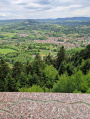
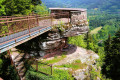
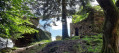
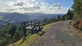
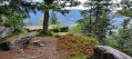
Views over Moyenmoutier from the Roche de Haute Pierre and over Senones from the Roche Mère Henry.
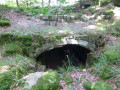
Along the stretch between Croix de Malfosse and Roche Mère Henry, there are remains from the First World War.

Places to visit in the immediate vicinity.

Senones Abbey.
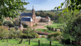
Moyenmoutier Abbey Church.
National necropolis and foreign military cemetery between Senones and Moyenmoutier.

Reviews and comments

4.6 / 5
Based on 3 reviews

Reliability of the description
4.3 / 5
Ease of following the route
4.7 / 5
Route interest
4.7 / 5
Ptibusy
Ptibusy

Overall rating : 5 / 5

Date of your route : May 03, 2026
Reliability of the description : ★★★★★ Very good
Ease of following the route : ★★★★★ Very good
Route interest : ★★★★★ Very good
Very busy route : No

A very beautiful walk: plenty to see: imposing sandstone cliffs (Lanceux, Grand Nez, etc.), breathtaking views (Haute Pierre, La Roche Mère) and interesting remnants from the First World War.
The description is accurate.
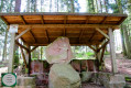
We had a picnic at Haute Pierre on a dolmen in the shade, surrounded by magnificent scenery.
Best done in good weather for the views and the shade of the forests
Thanks to the creator of this walk

Machine-translated

sorciere54
sorciere54

Overall rating : 4 / 5

Date of your route : Aug 24, 2025
Reliability of the description : ★★★★☆ Good
Ease of following the route : ★★★★☆ Good
Route interest : ★★★★☆ Good
Very busy route : No

We took a slightly different route. When we arrived at Clos Malpré, we went straight up the path marked with red triangles, passing the remains of the First World War along the way. Then higher up, we saw the blue circles... at the start of the four benches... the Sartorio monument, ruins, the Malfosse cross, the chapel, several fountains, before returning to the four benches, La Roche Mathieu, and the red triangle trail... then to the car park...

Machine-translated

Phikamano
Phikamano

Overall rating : 4.7 / 5

Date of your route : Apr 13, 2025
Reliability of the description : ★★★★☆ Good
Ease of following the route : ★★★★★ Very good
Route interest : ★★★★★ Very good
Very busy route : Yes

A walk best done in fine weather so you can enjoy the views...
Otherwise, it’s an interesting walk 👍👍

Machine-translated

Other walks in the area

For more walks, use our search engine .

The GPS track and description are the property of this route's author. Please do not copy them without permission.