Country:

 City:
City:


Park in the car park at Saales station.
Unmarked
(S/E) From the station car park, turn your back on the station and take Rue de la Clairie on the right. At the junction with the Grand Rue D1420, turn right and cross the railway line. Then take the first right onto Rue de la Croix, turn left at the junction, then continue straight ahead until you reach the cross.
(1) Then turn left to stay on the street (admire the Voyemont on your right). Continue along Chemin de la Pierrechelle until you reach the railway line.
(2) Go under the bridge and keep to the right at the junction. You’ll come to a wayside shrine with a statue of the Virgin Mary.
Blue Cross signposting
(3) Turn right, then ignore a path on the left and go under the railway bridge. Ignore a path leading off to the right and head uphill straight ahead. At the Y-junction, keep right to leave the forest and reach a road. Note the Voyemont on the right.
(4) Turn right, then immediately left, onto a track that enters the forest. As soon as you enter the forest, ignore a path on the right and stay on the track on the left until you reach a major junction.
(5) Ignore the two paths on the right and head straight ahead onto a track through the forest, following a sort of ridge. Then stay on the ridge, ignoring the paths on the left, until you reach a cross.
(6) At the junction after the cross, keep going uphill to the right. Ignore a path joining from the right, and continue until you reach a three-way junction.
(7) Follow the track to the left of the gate and, further on, ignore a path – not marked on maps – which climbs to the right.
Markings: Yellow Cross
Ignore the path leading down to the left and continue to a wide path on the right.
(8) This is where the going gets tough. Cross the track and take the stony path that starts opposite. At the next track, turn right, then quickly left, joining a path. At the hairpin bend, head left onto a grassy path, before continuing the climb to the right and reaching another track. Make a quick first turn left then right, and join the track ahead.
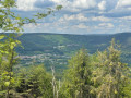
(9) Continue along the path opposite, which remains just as stony and narrow, but is out in the open and offers some lovely views. The path curves to the right and joins a track, which you should follow to the right until you reach a junction.
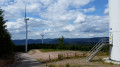
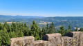
(10) Turn left onto the path and tackle the final stretch of the climb. Ignore the grassy paths branching off to the right and left to reach the summit plateau. Then follow the orange markings along a faint path to reach the Julius Tower. Climb to the top of the tower to enjoy the sublime panorama.
(11) Then head back down; with your back to the tower and facing the finishing path, take the one just to its left. At the bend, veer completely to the left and begin a descent along a wide, stony track offering splendid views. Pass a path on the left and reach another Fork in the road.
Signposting: Red Rectangle with a white cross
(12) Turn sharply right and, at the next Fork in the road, stay on the descending track. Do the same at the following Fork in the road, and you’ll reach a third Fork in the road.
(13) Head down to the left. In the forest, ignore a path overgrown with grass on the left, then cut across one track and reach another.
(14) Turn right, then head completely left. At the next Y-junction, continue to the right to descend slightly. Then ignore a path heading to the right, before reaching a large crossroads. Continue straight on, ignoring an intersection. Do the same at the next Fork in the road; then, at the third Fork in the road, keep left before arriving at a larger crossroads.
(15) Continue straight on, along an uphill path. At the inconspicuous junction, keep to the right, and you’ll reach a Fork in the road with a hanging bin on the left.
No signposting
(16) Turn left, then pass a path on the left, followed immediately by another on the right, before reaching a bend.
Red Saltire Signpost
(17) Continue uphill straight ahead, then pass the track on the left.
Red Triangle signpost
Turn right, until you reach the junction for the Pierre aux Fées and the Voyemont.
(18) Head up to the left to reach a track.
(19) Head straight ahead, passing a shelter. At the junction with a grassy path, turn right, then left, and then right again. At the end of the path, you’ll reach the summit of the Voyemont, as well as the Roche des Fées and its panoramic views.
(20) Head back down the same way to the Fork in the road just past the shelter.
(19) Keep to the left, before leaving the path for a track on the right, and reaching a wide track. Follow this down, then keep to the left. Ignore a path on the left, and you’ll soon reach another Fork in the road.
Signpost: Red Rectangle with a white cross
(21) Continue straight ahead along Chemin Heissat and reach a crossroads at the edge of the forest.
(22) Keep to the left, cross over the railway line, and reach the D420 main road.
No signposting
Turn right, follow the road and reach the Col de Saales. Once you have passed the pass sign, turn right onto a path which curves to the left, running alongside the railway line, before reaching the station (S/E).
 Tourist office
 Visorando Member
 Difficult