Country:

 City:
City:


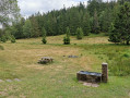
To reach the start car park, coming from Strasbourg via the D392, drive past the two hotels at the Col du Donon. After the second hotel, at thefirst right-hand bend, continue straight on along the tarmac-surfaced Prayé forest road for 5 km to find a car park, 500 m past the Col de Prayé.
(S/E) From the car park, follow the Prayé Forest Road to the right until you reach thefirst junction with a path on the left.
(1) Turn left and follow the path marked ‘Green Disc – Red Cross’ towards the Tête des Blanches Roches. Ignore the paths branching off to the right and join a wide forest track.
(2) Turn left onto it and continue to follow the same markings until you reach the Tête des Blanches Roches crossroads.
(3) Turn right, ignore the path on the left and then another on the right, and follow the wide track (Route forestière des Hautes Chaumes) marked with a Red Cross and Green Disc. It heads south; after a few hundred metres, a path branches off to the left.
(4) Leave the forest road and turn left onto the path, which is still marked with a Red Cross and a Green Disc. Pass by the Pierre à Cupules and walk alongside the stubble fields. Continue to the Ruins of La Marcairie – Haute Loge.
(5) Turn sharply right towards Le Lacet, following the Red Triangle markings. After about 400 m, ignore a path branching off to the left and continue northwards. You’ll reach the hamlet of Le Lacet just before a wide right-hand bend.
(6) Leave the track and follow the path on the left, still marked with Red Triangles, heading north-west. Continue in the same direction until you reach the junction with a path marked with a Blue Ring.
(7) Leave the footpath and follow the Blue Ring markings on the path leading off to the left towards Le Lançoir des Marais. Ignore any paths crossing to the right or left and follow the footpath to the Parking des Chavons car park, past the bridge over a stream and the junction with a wide track.
(8) At the car park, turn right and follow the small road (Rue de la Haie l’Abbé), then cross the stream to the right. Continue left onto the Chemin des Italiens, marked with the Blue Ring. It follows the bank of the Ruisseau du Grand Bras towards marker 41, known as ‘de la Maix’.
(9) Turn left and follow the path marked with a Red Triangle towards Le Haut du Bon-Dieu. You’ll come to a junction with several paths.
(10) Turn right, then a few metres further on, turn right again. Follow this path for a few metres, then take theGRP® de la Déodatie, marked with a Yellow Ring, which branches off to the right and leads to a small car park at a crossroads.
(11) Continue along this path on the left to reach the Roger Laederich Refuge and, a few dozen metres further on, the car park at the start (S/E).

 Visorando Member


 Tourism professional
 Difficult