Lake Pierre Percée – Discovering the battles of the Great War

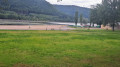
Discover an artificial lake that supplies water to the cooling system of the Cattenom nuclear power station. The battles of the Great War near Celles-sur-Plaine.

Details

42487
Creation:
Last update:
Last review:
  • Walking
    Activity: Walking
  • ↔
    Distance: 9.72 mi
  • ◔
    Average duration: 5h 45 
  • ▲
    Difficulty: Moderate

  • ⚐
    Back to start: Yes
  • ↗
    Ascent: + 1,499 ft
  • ↘
    Descent: - 1,490 ft

  • ▲
    Highest point: 1,860 ft
  • ▼
    Lowest point: 1,030 ft

Photos

Description of the walk

Please note: Update by the moderator on 4 July 2020: access to Salm Castle is no longer possible. Major restoration work began on 15 June 2020. Watch this space. Access to the castle has been restored since 2026 following a long period of works

Park in the car park near the dam at Lake Pierre Percée.
Note: Other starting points along the route may be considered (Pierre Percée jetty – Château de Salm – Vierge Clarisse).

(S/E) Turn right at the dam (Club Vosgien ‘Yellow Ring’ signposting);

(1) 100 metres further on, take the path on the left running alongside the lake.
After 4.5 km on this path, follow the ‘Blue Cross’ markings to the right.
Climb for 500 m to the car park, then on towards the ruins of Salm Castle (signposted).

(2) Return to the car park and take the path opposite, marked with a Green Rectangle.
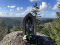
Follow these markings until you reach the statue of the Virgin Clarisse.

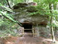
(3) Continue to the right as far as the ‘Grotte des Poilus’ (note: after the statue of the Virgin Clarisse, take a forest track for 400 m, then turn right onto a small, barely visible path, still following the Green Rectangle markings).

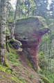
(4) At the grotto, take the path marked with a Yellow Disc for 400 m, passing close to the Rocher de l’Arche and then the Rocher de Dame Galle (accessible from the forest track).

(5) Turn left onto the forest track for 100 metres (Yellow Cross).
At the crossroads, take the path leading uphill (Yellow Triangle); pass Rocher de la Pierre à Cheval, then descend to the forest track (Blue Cross) and head to the right
After 450 m on this track, turn left at a bend, staying on the Blue Cross path towards Rocher de la Soye.
Stay on this path until you reach the RD182.

(6) Take the RD182, passing through the hamlet of La Ménelle – Musée de la Ménelle.
At the crossroads, there are two options: 1 (the route followed) or 2:
- take the Green Rectangle-marked path for 30 m, then follow the Yellow Triangle markings until you reach the 497-metre mark; turn left onto the Green Cross-marked path for 500 m. Turn left onto the forest track (Red Cross). After 660 m, take the Blue Ring trail and join the Yellow Ring trail, then head for the car park near the dam (E),
- take the RD182b – this is the route followed – to reach the junction near Celles-sur-Plaine.

(7) Continue to the car park past the Para forest lodge, then follow the Blue Ring trail to the Vierge de Para. Turn left and stay on the Blue Ring trail until you rejoin the Yellow Ring trail taken at the start of the walk. Turn left and head for the car park near the dam at Lac de la Pierre Percée (S/E).

Waypoints

  1. S/E : mi 0 - alt. 1,263 ft - Car park at the - Barrage du Vieux Pré (Pierre-Percée)
  2. 1 : mi 0.19 - alt. 1,306 ft - Path along the - Lac de Pierre-Percée
  3. 2 : mi 3.19 - alt. 1,562 ft - Château de Pierre Percée
  4. 3 : mi 4.43 - alt. 1,578 ft - Col de la Vierge Clarisse (493m)
  5. 4 : mi 5.07 - alt. 1,627 ft - Grotte des Poilus (Pierre-Percée)
  6. 5 : mi 5.38 - alt. 1,680 ft - Rocher de Dame Galle (Pierre-Percée)
  7. 6 : mi 6.98 - alt. 1,073 ft - Junction with the RD182
  8. 7 : mi 7.66 - alt. 1,033 ft - Celles-sur-Plaine - Plaine (rivière)
  9. S/E : mi 9.72 - alt. 1,270 ft - Car park at the Vieux Pré dam - Vieux Pré (ruisseau) - Affluent de la Plaine

Worth a visit

At the start or finish, take a look at the information boards describing the dam (well worth a look) on the hillock to the right of the dam.
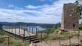
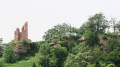
Ruins of Salm Castle with a remarkable view over the lake (information plaque fixed to the rock face before the steps).
Monument to the 363rd Infantry Regiment – Village of Pierre Percée.
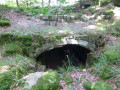
Remains of the Battle of the Col de la Chapelotte (August 1914 – 1915) – a cave used by the ‘poilus’ (French soldiers) as an advanced first-aid post.Very interesting explanations
(5) Reach the pass via the RF (Green Rectangle). From the pass, follow the directions given in the information sheet above. Well worth a detour as the remains from the Great War are impressive.
The Rocher de Dame Galle, on which a few ruins remain of the castle built by the Bishop of Metz to lay siege to Salm Castle.
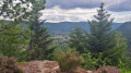
Remarkable views over the Celles-sur-Plaine valley from the Rocher de la Pierre à Cheval and the Rocher de la Soye.
Musée de la Menelle (free entry; open on Tuesdays and Thursdays from 2 pm to 6 pm, and on Saturdays and Sundays depending on the season. Information available on the Musée de la Menelle website) – Explanations and exhibits on the 1914–18 war and the battles in the Vosges.

Reviews and comments

4.5 / 5
Based on 85 reviews

Reliability of the description
4.4 / 5
Ease of following the route
4.4 / 5
Route interest
4.8 / 5
François 59
François 59

Overall rating : 5 / 5

Date of your route : May 02, 2025
Reliability of the description : ★★★★★ Very good
Ease of following the route : ★★★★★ Very good
Route interest : ★★★★★ Very good
Very busy route : No

Very satisfied with the hike, the Pierre Percée site is not lacking in points of interest: the dam, the remains of the 14-18 war, surprising geological formations (I extended the hike as far as the Xaveure rocks), it's well worth a look.
The Château de Salm is still closed.
Most of the route is in the undergrowth, which is just as well given the heat of the day.
François.

Machine-translated

Ludo212
Ludo212

Overall rating : 4 / 5

Date of your route : Apr 14, 2025
Reliability of the description : ★★★★☆ Good
Ease of following the route : ★★★★☆ Good
Route interest : ★★★★☆ Good
Very busy route : No

A lovely, very pleasant walk that reveals a number of relics and beautiful viewpoints

Machine-translated

vtx
vtx

Overall rating : 5 / 5

Date of your route : Jan 11, 2025
Reliability of the description : Not used / Not applicable
Ease of following the route : ★★★★★ Very good
Route interest : ★★★★★ Very good
Very busy route : No

I've come to do the full circuit At the beginning of January, there are no visitors, even though it's a bright but cold day.
I didn't follow the description but the gpx file was fine.
Very pleasant as a stranger to discover this varied nature and the traces of mankind over the centuries.
I'd like to thank the author for sharing this with me.

The only drawback is the long stretch of road in the last third, so it's better to follow the option in the description.

Au plaisir.

Vincent.

Machine-translated

PIDE54
PIDE54

Overall rating : 4 / 5

Date of your route : Jun 26, 2024
Reliability of the description : ★★★★☆ Good
Ease of following the route : ★★★★☆ Good
Route interest : ★★★★☆ Good
Very busy route : No

We only used part of the route during the week, namely Château de Salm and the section along the lake.
Note that the castle is currently being restored, so is inaccessible to the public (shame!). We'll be going back to do the whole thing 😏

Machine-translated

kiki70
kiki70

Overall rating : 5 / 5

Date of your route : Jul 05, 2024
Reliability of the description : ★★★★★ Very good
Ease of following the route : ★★★★★ Very good
Route interest : ★★★★★ Very good
Very busy route : No

Super hike, thanks for the explanations, we usually work with a GPS that broke down this time, the perfect description of the route enabled us to make this magnificent hike.

Machine-translated

gizmo
gizmo

Overall rating : 4 / 5

Date of your route : Apr 06, 2024
Reliability of the description : ★★★★☆ Good
Ease of following the route : ★★★★☆ Good
Route interest : ★★★★☆ Good
Very busy route : No

Nice walk, although the paths are stony in places; given the very sunny weather, we were hot, but the route should be shadier once the leaves have grown on the trees; lovely views; pleasant to walk along the lake, as the peace and quiet that still reigns there is soothing and the scenery enchanting; in summer it may be noisier....Note that you have to be careful if you want to see the Vierge de Para because it is very small, in a "little house" fixed to a tree; the same goes for the Vierge Clarisse, which is a little more visible because you have to walk past it. Magnificent and imposing rocky bar on the route
We covered around 17 km doing the whole circuit.

Machine-translated

eric dulche
eric dulche

Overall rating : 5 / 5

Date of your route : Mar 04, 2024
Reliability of the description : ★★★★★ Very good
Ease of following the route : ★★★★★ Very good
Route interest : ★★★★★ Very good
Very busy route : Yes

Nice walk to do

Machine-translated

François VERNIER
François VERNIER

Overall rating : 5 / 5

Date of your route : Feb 06, 2024
Reliability of the description : ★★★★★ Very good
Ease of following the route : ★★★★★ Very good
Route interest : ★★★★★ Very good
Very busy route : No

A very pleasant and picturesque route. It is not easy to identify the yellow rings at the start. The markings are there on the trees, but they are not very visible. It is better to follow the red ring or green disc signs, or even the GRP Pays de la Déodatie signposting. The same applies to the section after the grotte des poilus, where the yellow disc is not very visible because it is painted on the trees.
A small suggestion: from the Château de Salm car park, it is best to take the red ring path that leads along the Marie Fontaine rocks.

Machine-translated

User 11856963

Overall rating : 5 / 5

Date of your route : Dec 18, 2023
Reliability of the description : ★★★★★ Very good
Ease of following the route : ★★★★★ Very good
Route interest : ★★★★★ Very good
Very busy route : Yes

Very nice route with beautiful viewpoints

Machine-translated

Claire Boub
Claire Boub

Overall rating : 3.3 / 5

Date of your route : Aug 16, 2023
Reliability of the description : ★★☆☆☆ Disappointing
Ease of following the route : ★★★☆☆ Average
Route interest : ★★★★★ Very good
Very busy route : Yes

We had a hard time getting started on the circuit because it said to follow the yellow rings... but there weren't any, or the yellow circles were painted over and half faded. The markings need to be updated. You have to follow the red circles at the beginning. The end was also complicated. 2 options proposed but not clear....
It said 15.6 km, but we did 20 km... quite a difference...

Machine-translated

MANGEOT Dominique
MANGEOT Dominique

Overall rating : 5 / 5

Date of your route : Jul 24, 2023
Reliability of the description : ★★★★★ Very good
Ease of following the route : ★★★★★ Very good
Route interest : ★★★★★ Very good
Very busy route : Yes

A very pleasant route with rocky passages and beautiful viewpoints; I lengthened the route a little to satisfy my legs. Sahlm castle is being renovated, so we can't admire it too closely. Don't hesitate to take this lovely walk.

Machine-translated

Ksy
Ksy
• Edited:

Overall rating : 4.3 / 5

Date of your route : May 18, 2023
Reliability of the description : ★★★★☆ Good
Ease of following the route : ★★★★☆ Good
Route interest : ★★★★★ Very good
Very busy route : No

A fine route with no real major difficulties apart from a good climb at the end after the leisure centre with many points of interest, completed in 5? hours, including the break. However, the final mileage is almost 21 km; something to bear in mind from the start.

Machine-translated

mn54710
mn54710

Overall rating : 5 / 5

Date of your route : Apr 10, 2023
Reliability of the description : ★★★★★ Very good
Ease of following the route : ★★★★★ Very good
Route interest : ★★★★★ Very good
Very busy route : No

A very nice, varied circuit.
On Sunday, the road section wasn't very troublesome.
To quote an old review, the yellow rings have disappeared, but you can do without them.
Thanks to the author

Machine-translated

Stef1972
Stef1972

Overall rating : 5 / 5

Date of your route : Jan 08, 2023
Reliability of the description : ★★★★★ Very good
Ease of following the route : ★★★★★ Very good
Route interest : ★★★★★ Very good
Very busy route : No

Superb walk
Very nice route

Machine-translated

lgn68
lgn68

Overall rating : 4.7 / 5

Date of your route : Oct 23, 2022
Reliability of the description : ★★★★★ Very good
Ease of following the route : ★★★★☆ Good
Route interest : ★★★★★ Very good
Very busy route : No

A very pleasant route with rocky sections and beautiful viewpoints. The less pleasant part is the road section, but it can't be avoided.

Machine-translated

Other walks in the area

For more walks, use our search engine .

The GPS track and description are the property of this route's author. Please do not copy them without permission.