Exploring Climont

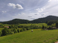
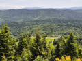
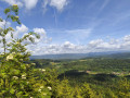
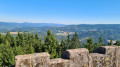
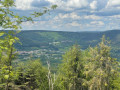
A lovely walk in the Bruche Valley, with the climb up to Climont offering magnificent scenery. The ascent between (2) and (3) follows a footpath and is a bit of a challenge but well worth the effort. The descent is more gradual and follows a forest track.

Details

97636796
Creation:
Last update:
Last review:
  • Walking
    Activity: Walking
  • ↔
    Distance: 7.66 mi
  • ◔
    Average duration: 4h 45 
  • ▲
    Difficulty: Moderate

  • ⚐
    Back to start: Yes
  • ↗
    Ascent: + 1,440 ft
  • ↘
    Descent: - 1,407 ft

  • ▲
    Highest point: 3,166 ft
  • ▼
    Lowest point: 1,732 ft

Photos

Description of the walk

Parking is available in the car park located before the hamlet of La Fraise. To get there, on leaving Bourg-Bruche, head towards the hamlet of La Goutte, then the hamlet of La Fraise.

Blue Cross signposting

(S/E) With your back to the car park, follow the path leading off to the right. At the next junction, follow the path to the left, pass in front of Ferme Caroline and continue to the next junction.

Blue Ring markings

(1) Follow the path to the left until the next junction.

Yellow Cross and Red-White-Red Rectangle Markings

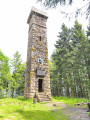
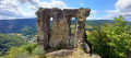
(2) Turn onto the path on the right, which winds its way up to the summit of Climont, where the Julius Tower is located.

(3) Then follow the path, which also winds downwards, to the junction.

(4) Continue along the path to the left and head for the next junction.

No signposting

(5) First turn right then left and continue along the path, following it to the next junction before Le Hang.

(6) Turn left and head for the junction located after the Ferme de l'Abatteux.

Red Saltire

(7) Turn right, cross the Bruche for the third time, pass in front of the Ferme du Nouveau Chemin, which breeds horses and sells products made from mare’s milk, then continue to the hamlet of La Fraise and the car park at the start (S/E).

Waypoints

  1. S/E : mi 0 - alt. 1,929 ft - Car park before the hamlet of La Fraise
  2. 1 : mi 1.28 - alt. 2,159 ft - Crossroads – turn left
  3. 2 : mi 2.09 - alt. 2,254 ft - Crossroads – turn right towards the - tour julius
  4. 3 : mi 3.43 - alt. 3,166 ft - Julius Tower - Mt. Climont
  5. 4 : mi 5 - alt. 2,146 ft - Crossroads – turn left. Near the source of the - Bruche (rivière)
  6. 5 : mi 5.36 - alt. 1,982 ft - Crossroads
  7. 6 : mi 6.3 - alt. 1,775 ft - Crossroads before Le Hang - Bruche (rivière)
  8. 7 : mi 6.82 - alt. 1,762 ft - Crossroads after the Ferme de l'Abatteux
  9. S/E : mi 7.66 - alt. 1,932 ft - Car park before the hamlet of La Fraise

Notes

(3) Picnic table and benches next to the Julius Tower.

Worth a visit

(3) The Julius Tower at the summit of Climont.

The Ferme du Nouveau-Chemin with its mare’s milk products.

Other walks in the area

For more walks, use our search engine .

The GPS track and description are the property of this route's author. Please do not copy them without permission.