Circular route straddling Alsace and Lorraine, starting from Champenay

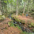
At the Col du Hantz, we cross into Lorraine; then, after a fairly long stretch along a quiet road, we follow a stream along an impressive medieval cobbled path, adorned with installations by ‘art student’ from the University of Nancy; a little further up, the tranquillity of a secluded peat bog is disturbed only by birdsong. The Chemin des Passeurs then takes us to La Haute-Loge and La Chatte Pendue. A journey for lovers of nature and history.

Details

3086407
Creation:
Last update:
Last review:
  • Walking
    Activity: Walking
  • ↔
    Distance: 13.01 mi
  • ◔
    Average duration: 8h 10 
  • ▲
    Difficulty: Difficult

  • ⚐
    Back to start: Yes
  • ↗
    Ascent: + 2,549 ft
  • ↘
    Descent: - 2,539 ft

  • ▲
    Highest point: 3,058 ft
  • ▼
    Lowest point: 1,522 ft

Description of the walk

Coming from Plaine, we park on the left before the bridge or a little further on, opposite the school in Champenay.

(S/E) We head west and walk past the school. The tarmac road begins a gentle climb towards the siliceous sandstone quarry. We follow the Yellow Triangle signpost.

(1) At the first junction, at the end of the meadow on our left, we turn left onto a wide, flat forest track heading towards the Col du Hantz.

(2) We leave this forest track as it rounds a wide bend to the left. We take the path on the right, which climbs gently, and follow the course of the stream to the next junction. Upon reaching a wider track, we turn left uphill to the next junction.

(3) We ignore the path leading off to the left and turn right. The path is flat and runs alongside a fenced-off plot on the right. At the next junction, we continue to the right.

(4) We leave this path and turn left onto a narrower track. We stay on this route, which features a series of gentle ascents and descents, always marked with Yellow Triangles, until we reach the Col du Hantz.

(5) At the Col du Hantz, we walk round the monument honouring the Resistance fighters and enter the forest via a wide, flat path, then immediately turn left onto a path marked with a Yellow Rectangle and a Blue Diamond, which climbs steeply.

We come out onto a track, which we leave as it curves to the right, turning left instead onto a wide, flat track marked with a Blue Ring.

(6) At the first hairpin bend, we turn sharply left and then, after a few metres, we turn right. The descent is steep before we tackle a further series of hairpin bends to the left and then to the right, leading to the Pont de Salm and a tarmac road.

(7) We turn right onto this small tarmac road for a relatively long climb, signposted with a Red Ring and a Blue Diamond, until we reach a large crossroads which also marks the end of the tarmac surface.

(8) We enter the forest, following the river on our right. It is essential that we stay on the path so as not to damage this gift of nature, though this does not prevent us from admiring the clarity of the water as it meanders languidly through the vegetation.

As we emerge from the forest, we find ourselves on golden stubble dotted with a few stately fir trees, and we cross a wide track to join the gently ascending path marked with a Yellow Rectangle and a Blue Triangle, following it until we reach a junction signposting ‘La Haute Loge’ to the right.

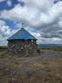
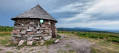
(9) We are now on the Sentier des Passeurs coming from Moussey. We then turn left onto a very wide, uphill path. At the next junction, we turn left. After about a hundred metres, we take the path on the right, marked with a Red Triangle, up to the Haute Loge and its lovely little round stone hut.

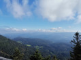
(10) We are treated to a 360° panorama and, on a clear day, we are lucky enough to catch a glimpse of the peaks of the Bernese Oberland in Switzerland.

(11) After a short rest and a light snack, we turn back and head down to the Chaume.

(9) At the crossroads, we follow the signs for Chatte Pendue straight ahead along the flat path marked with a Blue Saltire and a Yellow Rectangle. We take this path, which was once paved by Polish female prisoners, to whom a monument is dedicated. At the next crossroads, we do not take the Chatte Pendue signpost but stay on this lovely path, which curves slightly to the left and descends gently.

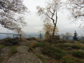
(12) At the crossroads, we turn right. We follow a path marked with a Red Disc. We turn right until we reach a footbridge allowing us to cross over the wire fence, and we climb up to Chatte Pendue with its majestic rock, its orientation table and its magnificent panoramic view of the Principality of Salm.

(13) We descend to the other side, from where, through a few clearings in the forest, we catch sight of Champenay and its quarry. After the footbridge that takes us out of the fenced-off, protected area, we continue straight on along the wide path, which soon leads us down the slope.

(14) We leave the path at a junction which requires our full attention as we set off along a trail marked by a clearly signposted descent with Yellow Disc markings. We follow the route and markings closely, passing to the right of the Étang de la Falle.

(15) We continue on to reach the Maison Forestière de la Falle and, via the Route de la Falle, we reach the Champenay car park (S/E).

Waypoints

  1. S/E : mi 0 - alt. 1,522 ft - Car park opposite the school in Champenay
  2. 1 : mi 0.32 - alt. 1,624 ft - Crossroads
  3. 2 : mi 0.74 - alt. 1,640 ft - Crossroads
  4. 3 : mi 1.33 - alt. 1,988 ft - Crossroads
  5. 4 : mi 1.71 - alt. 2,001 ft - Crossroads
  6. 5 : mi 2.35 - alt. 2,100 ft - Col du Hantz (640m)
  7. 6 : mi 2.97 - alt. 2,087 ft - Junction
  8. 7 : mi 4.54 - alt. 1,529 ft - Crossroads
  9. 8 : mi 5.94 - alt. 1,929 ft - Crossroads
  10. 9 : mi 7.7 - alt. 2,835 ft - Crossroads
  11. 10 : mi 8.16 - alt. 3,054 ft - Abri de la Haute Loge
  12. 11 : mi 8.27 - alt. 3,041 ft - La Haute Loge
  13. 12 : mi 9.81 - alt. 2,628 ft - Crossroads
  14. 13 : mi 10.36 - alt. 2,953 ft - La Chatte Pendue
  15. 14 : mi 11.01 - alt. 2,582 ft - Crossroads
  16. 15 : mi 12.34 - alt. 1,614 ft - Étang de la Falle
  17. S/E : mi 13.01 - alt. 1,526 ft - Car park opposite the school in Champenay

Notes

It goes without saying that, for this moderately difficult hike, walking boots are essential. There are no facilities for replenishing supplies of food or water, except for those who do not mind drinking water from the stream.

(5) After the Col du Hantz, a very pleasant alternative route is possible along the ridge by following the Yellow Rectangle; however, the approach to the scree slope, whilst magnificent, is very difficult to spot and is best left to those in the know or the adventurous.
On reaching the Haute Loge, and depending on the weather, an extra layer of clothing may be necessary given the exposure.

Worth a visit

For the very brave and the very lucky, setting off very early in the morning might allow you to catch a glimpse of a capercaillie or a grumpy old male wild boar.
The stretch of tarmac after the Pont de Salm may not be particularly pleasant, but what a reward awaits on the climb alongside the stream up to this delightful peat bog.

Between (8) and (9), the gently ascending path offers a succession of installations created by students from the University of Nancy, as well as magnificent cobblestones dating back to medieval times. It is one of the most original routes we know of in the Vosges. We also admire one of the most beautiful and unassuming peat bogs in the Vosges mountains and its ‘bus stop’ created by a budding artist.

Reviews and comments

5 / 5
Based on 2 reviews

Reliability of the description
5 / 5
Ease of following the route
5 / 5
Route interest
5 / 5
Pierre K67
Pierre K67

Thank you. Lovely walks

Machine-translated

Jacky D
Jacky D

The bog was completely flooded; there were little waterfalls and water everywhere along the whole route, even on the path in places. It was actually a magnificent sight – a good pair of shoes is absolutely essential at the moment!

Machine-translated

Pierre K67
Pierre K67

and the little bog, still as idyllic as ever?
Thank you for your feedback on the walk

Machine-translated

Jacky D
Jacky D

Overall rating : 5 / 5

Date of your route : Feb 22, 2024
Reliability of the description : ★★★★★ Very good
Ease of following the route : ★★★★★ Very good
Route interest : ★★★★★ Very good
Very busy route : No

A lovely walk we went on during the week, so there was no one around – we were completely on our own. Thank you for sharing this.

Machine-translated

Pierre K67
Pierre K67

Have a good hike, Alain. If the sun’s out, you won’t be disappointed.

Machine-translated

Alain-P
Alain-P

A route I haven’t yet travelled.

Machine-translated

Pierre K67
Pierre K67

Thanks, Rémy
Enjoy your hikes
Pierre

Machine-translated

Remysapin@club-internet.fr

Overall rating : 5 / 5

Date of your route : Apr 22, 2022
Reliability of the description : Not used / Not applicable
Ease of following the route : ★★★★★ Very good
Route interest : ★★★★★ Very good
Very busy route : No

We only did part of this magnificent route (16 km, 480 m elevation gain, moderate difficulty). Setting off from Pont de Salm, we climbed up to La Haute Loge, then made our way back towards the Col du Hantz via the Chaumes and the Hautes Chaumes forest track, before descending back to Pont de Salm. The stretch between points 8 and 9 is truly magnificent in spring, and fortunately the ‘art installations’ do not detract too much from this exceptional setting. The view from the La Haute Loge hut is also quite remarkable. The section across the Chaumes along the old path (marked by a Yellow Rectangle on an old map) is indeed a bit of an adventure, which is why, after the first third of the way, we joined the forest road (marked by the current Yellow Rectangle). To enjoy the exceptional stretch between points 8 and 9 as part of a shorter walk, I’d recommend driving to point 8 (where there are plenty of car parks), walking to La Haute Loge and back (points 10 and 11) and, once back at point 9, heading down via the Blue Triangle.

Machine-translated

Pierre K67
Pierre K67

Hello
Well, that’s a really interesting piece of information; I thought the works on display were by pupils from a school in Nancy.
Thanks, and enjoy your walk
Pierre

Machine-translated

dAiles-F
dAiles-F

Hello,

I would just like to point out that the artworks on display between the Radier de Barfontaine (8) and La Haute Loge (11) have been created by professional artists from a wide range of backgrounds as part of the ‘Biennale d’art sur le Sentier des passeurs’ event. Every two years, new artworks are installed, joining those that remain in place from one Biennale to the next. Currently, more than sixty artworks are on display along a 9 km circular route starting and ending at the Radier de Barfontaine. Guided tours are available throughout the summer of 2020, and you are, of course, welcome to explore the route at your own pace. Full details (including a map and guide) can be found on the website www.sentier-des-passeurs.fr.
Thank you, and enjoy your visit!

Machine-translated

Other walks in the area

For more walks, use our search engine .

The GPS track and description are the property of this route's author. Please do not copy them without permission.