osiris130

 Visorando Member
 VIP
VIP Premium user
 - Location: Langlade (30980)
- Gender: man
Sign up:
Published route(s)
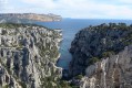
 Calanques from Marseille to Cassis - Stage 2
 12.85 mi
 +3,140 ft
 -3,514 ft
 8h 40
8h 40
 Difficult
 Departure from Marseille (Bouches-du-Rhône)
From Luminy to Cassis via the Devenson Cliffs.
Panoramic hike passing through the most beautiful eastern calanques of Marseille: Sugiton, En-Vau and Port-Pin.
You are in the Calanques National Park, which is subject to specific regulations. Failure to comply with these regulations may result in a fine of up to €1,500.
Crossing the Calanques from Marseille to Cassis
 23.16 mi
+5,942 ft
-5,860 ft
2 days
Difficult
Departure from Marseille (Bouches-du-Rhône)
23.16 mi
+5,942 ft
-5,860 ft
2 days
Difficult
Departure from Marseille (Bouches-du-Rhône)
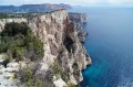
Cross the calanques in two days, arriving/departing from Luminy in between.
Pass under the Falaise des Toits and above the Falaises du Devenson and, among others, through the Calanques de Marseilleveyre, Sormiou, Sugiton, En-Vau and Port-Pin.
You are in the Calanques National Park, which is subject to specific regulations. Failure to comply with these regulations may result in a fine of up to €1,500.
Calanques from Marseille to Cassis - Stage 1
 10.18 mi
+2,769 ft
-2,346 ft
7h 05
Difficult
Departure from Marseille (Bouches-du-Rhône)
10.18 mi
+2,769 ft
-2,346 ft
7h 05
Difficult
Departure from Marseille (Bouches-du-Rhône)
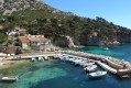
From Callelongue to Luminy. Coastal hike passing through the most beautiful western calanques of Marseille, Marseilleveyre, Sormiou and La Triperie.
You are in the Calanques National Park, which is subject to specific regulations. Failure to comply with these regulations may result in a fine of up to €1,500.
 Croix de Verse via the Cheiron forest
 6.82 mi
+1,516 ft
-1,427 ft
5 hrs
6.82 mi
+1,516 ft
-1,427 ft
5 hrs
 Average
Departure from Alpes-Maritimes
Average
Departure from Alpes-Maritimes
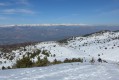
A beautiful snowshoe hike (or not in winter) with no difficulty and panoramic views of the Mercantour peaks and the French Riviera on a clear day.
After a pleasant first section in the Cheiron forest, you cross a small valley before climbing up to Plan des Baumetes and reaching the Crête du Cheiron at Croix de Verse (1,706 m).
360° view of the sea at Argentera!
GR® 20 - Stage 13: from Usciolu to the Croci sheepfold (new route from 2011)
 8.29 mi
+1,713 ft
-2,369 ft
5h 20
Difficult
Departure from Cozzano (Corse-du-Sud)
8.29 mi
+1,713 ft
-2,369 ft
5h 20
Difficult
Departure from Cozzano (Corse-du-Sud)
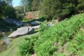
Stage 13 between the Usciolu PNRC refuge and the Croci sheepfold follows the new route via Matalza (since 2011). A stage with not much elevation gain, but one that should not be underestimated. The start along the ridge is a bit technical up to Punta di a Scaddatta. Then a descent through the forest, crossing fields of ferns before a gruelling climb, part of which is on a track, up to the Croci sheepfold on the Coscione plateau.
 Col de Vence – Coursegoules – Plateau Saint Barnabé
 14.39 mi
+1,460 ft
-1,444 ft
2.5 hrs
Average
Departure from Coursegoules (Alpes-Maritimes)
14.39 mi
+1,460 ft
-1,444 ft
2.5 hrs
Average
Departure from Coursegoules (Alpes-Maritimes)
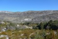
Circular route between the Col de Vence, Coursegoules, the Bois de Garavagne and the Plateau Saint Barnabé at the foot of the Massif du Cheiron.
The 4,000 steps and return via Aire de Côte
 16.15 mi
+4,186 ft
-4,206 ft
11h 05
Difficult
Departure from Valleraugue (Gard)
16.15 mi
+4,186 ft
-4,206 ft
11h 05
Difficult
Departure from Valleraugue (Gard)
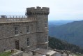
From Valleraugue, take the famous 4000-step trail that climbs up to the Mont-Aigoual observatory.
To complete the loop, follow theGR®6for a long descent through the forest towards Aire de Côte, before finishing with a crossing of the chestnut grove above the hamlet of Berthezène.
Oppidum de Nages and the Village of Langlade
 5.29 mi
+617 ft
-617 ft
3h 00
5.29 mi
+617 ft
-617 ft
3h 00
 Easy
Departure from Langlade (Gard)
Easy
Departure from Langlade (Gard)
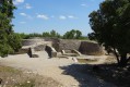
A walk in scrubland from Langlade to the Gallo-Roman site of the Oppidum de Nages offering a view of the entire Vaunage with the Cevennes, the sea and Pic-Saint-Loup in the distance.
It ends with a visit to the village of Langlade with its narrow streets, mill, its temple, its 2 squares... and its ancient houses.
Saint-Etienne-de-Tinée - Lacs de Vens - Small Pass of Tortisse
 7.52 mi
+5,942 ft
-1,342 ft
7 hrs
7.52 mi
+5,942 ft
-1,342 ft
7 hrs
 Very difficult
Departure from Saint-Étienne-de-Tinée (Alpes-Maritimes)
Very difficult
Departure from Saint-Étienne-de-Tinée (Alpes-Maritimes)
First stage of a two-day hike in the Haute-Tinée.
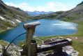
Ascent to the magnificent Lacs de Vens and the small pass of Tortisse via the Claï valley and Lac des Babarottes.
Plenty of marmots and chamois around the Lacs de Vens and below the small pass of Tortisse.
Small pass of Tortisse – Cime du Fer – Saint-Étienne-de-Tinée
 9.23 mi
+1,955 ft
-6,621 ft
5h 55
Difficult
Departure from Saint-Étienne-de-Tinée (Alpes-Maritimes)
9.23 mi
+1,955 ft
-6,621 ft
5h 55
Difficult
Departure from Saint-Étienne-de-Tinée (Alpes-Maritimes)
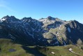
Before descending back to Saint-Etienne-de-Tinée, you climb to the Cime du Fer (2,700 m), which offers a superb 360° view, notably of the Tête de Moïse (3,104 m) and the magnificent Mont Viso (3,841 m).
Then we descend alongside the Tortisse torrent before heading back towards the Lacs de Vens and climbing up to the Lac des Babarottes.
We continue along a section of the Chemin de l’Énergie until we catch sight of Mont Ténibre.
We then finish with a long descent (-1,200 m) down to the village.
Tour of the Tête du Lac Autier
 7.16 mi
+2,989 ft
-2,989 ft
5h 55
Difficult
Departure from Belvédère (Alpes-Maritimes)
7.16 mi
+2,989 ft
-2,989 ft
5h 55
Difficult
Departure from Belvédère (Alpes-Maritimes)
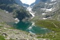
A beautiful loop in the Gordolasque valley that takes you close to five lakes, including the superb Lac Autier and Lac Niré. There are also some beautiful waterfalls, including the vast Cascade de l'Estrech. Numerous chamois can be seen throughout the hike. A few ibex and marmots can be spotted below the Lac de la Fous dam.
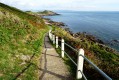
Coastal hike through Mumbles
 3.72 mi
+404 ft
-381 ft
2h 05
Easy
Departure from Mumbles (Swansea)
3.72 mi
+404 ft
-381 ft
2h 05
Easy
Departure from Mumbles (Swansea)
A pleasant coastal loop starting from The Mumbles then through Limeslade and Langland bay.
Rutting season in Courmes
 4.07 mi
+1,102 ft
-1,102 ft
2h 50
Easy
Departure from Courmes (Alpes-Maritimes)
4.07 mi
+1,102 ft
-1,102 ft
2h 50
Easy
Departure from Courmes (Alpes-Maritimes)
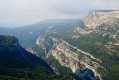
A short circular hike above the village of Courmes, ideal during the deer rut at dawn or dusk. Thrills guaranteed!
A brief stop on the Saint-Barnabé plateau offers beautiful views of the Cheiron massif to the north and the village of Gourdon overlooking the Gorges du Loup to the south.
Eze and Mont Bastide via the Frédéric Nietzsche trail
 3.94 mi
+1,942 ft
-1,929 ft
3h 30
Average
Departure from Èze (Alpes-Maritimes)
3.94 mi
+1,942 ft
-1,929 ft
3h 30
Average
Departure from Èze (Alpes-Maritimes)
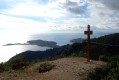
A loop starting from Eze Bord de Mer, climbing up to the village of Eze via the Frédéric Nietzsche trail, then ascending Mont Bastide via the David trail for a superb view of Cap Ferrat and the Nice hinterland.
Descend via the Savaric trail through the beautiful villas of Eze Bord de Mer.
Ridge and Sanctuary of the Madonna of Utelle
 5.73 mi
+1,713 ft
-1,716 ft
4h 10
Average
Departure from Utelle (Alpes-Maritimes)
5.73 mi
+1,713 ft
-1,716 ft
4h 10
Average
Departure from Utelle (Alpes-Maritimes)
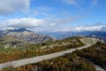
A loop starting from Utelle, a charming village perched in the Vésubie Valley. The first part is wild and rocky on a ledge above the Vésubie, followed by a gentle climb through an amazing forest of terraced fields. The final climb, steeper up to the Crête de la Madone d'Utelle, offers a 360° view of the coastline, the Var Valley, the peaks of the Mercantour and the Nice hinterland. Finally, the descent offers numerous views of the village of Utelle.
Cime de Roccassièra
 6.85 mi
+1,896 ft
-1,890 ft
4h 50
Average
Departure from Lucéram (Alpes-Maritimes)
6.85 mi
+1,896 ft
-1,890 ft
4h 50
Average
Departure from Lucéram (Alpes-Maritimes)
Starting from the Col de Porte, a panoramic hike between the Vésubie Valley and the Paillons Valley offers a splendid view of the Alpes-Maritimes and the Mercantour mountain range.
Eguisse Mine and Rocca Sparvièra Ruins
 6.39 mi
+2,989 ft
-2,986 ft
5h 30
Difficult
Departure from Duranus (Alpes-Maritimes)
6.39 mi
+2,989 ft
-2,986 ft
5h 30
Difficult
Departure from Duranus (Alpes-Maritimes)
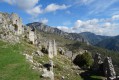
A circular forest hike passing by the old Eguisse Mine, with a return trip to the Saint-Michel Chapel and the ruins of Rocca Sparvièra.
Lac Nègre and Cime de Frémamorte
 11.36 mi
+3,894 ft
-3,898 ft
6 hrs
Very difficult
Departure from Saint-Martin-Vésubie (Alpes-Maritimes)
11.36 mi
+3,894 ft
-3,898 ft
6 hrs
Very difficult
Departure from Saint-Martin-Vésubie (Alpes-Maritimes)
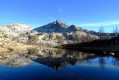
A very beautiful round trip hike in Haute-Vésubie from the Salèse car park. There are numerous lakes, including the large Lac Nègre, and beautiful panoramic views at the Col de Frémamorte and the peak of the same name.
Pen y Fan
 4.65 mi
+1,572 ft
-1,552 ft
3h 30
Easy
Departure from Glyn Tarell (Powys)
4.65 mi
+1,572 ft
-1,552 ft
3h 30
Easy
Departure from Glyn Tarell (Powys)
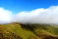
A circular hike which allows easy access to Pen y Fan (886 m); the highest peak in the Brecon Beacons and South Wales. A walk through stunning landscapes, surrounded by sheep.
Very busy intinerary in high season.
Lac du Mercantour and Col de Cerise
 5.71 mi
+3,845 ft
-3,819 ft
6h 00
Difficult
Departure from Saint-Martin-Vésubie (Alpes-Maritimes)
5.71 mi
+3,845 ft
-3,819 ft
6h 00
Difficult
Departure from Saint-Martin-Vésubie (Alpes-Maritimes)
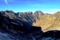
A short but challenging hike in a wild valley in Haute-Vésubie.
Rocky landscape, a pretty lake and a beautiful view of several Italian peaks, including Monte Matto (3,088 m).
Cap du Dramont
 2.82 mi
+571 ft
-548 ft
1h 50
Easy
Departure from Saint-Raphaël (Var) (Var)
2.82 mi
+571 ft
-548 ft
1h 50
Easy
Departure from Saint-Raphaël (Var) (Var)
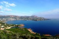
A pleasant walk with superb views of the bays of Agay and Saint-Raphaël, the Estérel Massif and the Île d'Or.
Baous de la Gaude and Saint-Jeannet
 6.71 mi
+1,978 ft
-1,978 ft
4h 50
Average
Departure from Saint-Jeannet (Alpes-Maritimes) (Alpes-Maritimes)
6.71 mi
+1,978 ft
-1,978 ft
4h 50
Average
Departure from Saint-Jeannet (Alpes-Maritimes) (Alpes-Maritimes)
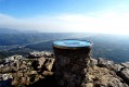
A double loop in a landscape combining heath, karst plateau and numerous dry stone terraces.
The climb up the two baous offers exceptional views of the coastline from Cap Ferrat to Cap d'Antibes... not to mention the view of the hinterland from the Baou de Saint-Jeannet with the Saint-Barnabé plateau, the Cherion Massif and the peaks of the Mercantour between the Argentera and Mont Bégo.
Return via the Plateau du Baou, where you can discover two drystone shelters.
The Rocher de Roquebrune
 4.00 mi
+1,184 ft
-1,181 ft
2h 50
Difficult
Departure from Roquebrune-sur-Argens (Var)
4.00 mi
+1,184 ft
-1,181 ft
2h 50
Difficult
Departure from Roquebrune-sur-Argens (Var)
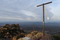
A short but energetic walk that is exposed towards the end. Enjoy the stunning views from the top of Rocher de Roquebrune with its famous ochre colours.
Along the Bisse du Trient
 3.99 mi
+1,175 ft
-1,191 ft
2h 50
Easy
Departure from Valais
3.99 mi
+1,175 ft
-1,191 ft
2h 50
Easy
Departure from Valais
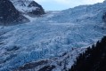
Starting from Col de la Forclaz (1527m), a short and easy out-and-back walk along the Bisse du Trient (irrigation channel) to the Chalet du Glacier (1583m), which offers a fine view of the Glacier du Trient and the Petite Pointe d'Orny (3187m).
⚠️ Part of the trail has been damaged by a landslide. Bypassing is possible, but the walk is not accessible for baby carriages and wheelchairs (see practical info).
Saint-Jean-Cap-Ferrat Tower
 6.17 mi
+404 ft
-427 ft
3h 10
Easy
Departure from Saint-Jean-Cap-Ferrat (Alpes-Maritimes)
6.17 mi
+404 ft
-427 ft
3h 10
Easy
Departure from Saint-Jean-Cap-Ferrat (Alpes-Maritimes)
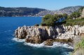
A classic of the Maralpine coast, this coastal walk goes around Pointe Sainte-Hospice and Cap-Ferrat. Ideal for a sunny day out of season.
Cime de Restaud, Roc de l'Orméa and Mont Carpano
 8.00 mi
+2,982 ft
-3,012 ft
6h 15
Difficult
Departure from Alpes-Maritimes
8.00 mi
+2,982 ft
-3,012 ft
6h 15
Difficult
Departure from Alpes-Maritimes
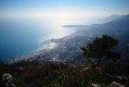
This panoramic hike is a loop starting from the hilltop village of Castellar and climbing the Cime de Restaud (1,148 m), the Roc de l'Orméa (1,132 m) and Mont Carpano (772 m) on the border ridge.
Superb views over the French Riviera from Menton to Monaco and Vintimille. Beautiful views of the hinterland too, with the peaks of the Pays Mentonnais and the snow-capped peaks of the Mercantour.
La Sainte-Victoire: from Pic des Mouches to Croix de Provence
 12.77 mi
+2,976 ft
-2,986 ft
7 hrs
Very difficult
Departure from Vauvenargues (Bouches-du-Rhône)
12.77 mi
+2,976 ft
-2,986 ft
7 hrs
Very difficult
Departure from Vauvenargues (Bouches-du-Rhône)
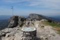
A long circular hike starting from Vauvenargues that follows the Sainte-Victoire ridge from the Pic des Mouches to the Croix de Provence.
Pointe de Siricocca, Pic de Garuche and Mont Ours
 5.60 mi
+2,162 ft
-2,136 ft
4h 25
Average
Departure from Sainte-Agnès (Alpes-Maritimes)
5.60 mi
+2,162 ft
-2,136 ft
4h 25
Average
Departure from Sainte-Agnès (Alpes-Maritimes)
Loop hike above Sainte-Agnès with the ascent of three peaks that do not present any difficulties: the Pointe de Siricocca (and its fort-sheepfold), the Pic de Garuche (and its bunker) and the Mont Ours (and its DFCI guard post at the top of a white oak forest).
Diverse panoramic views of the coast, the Mercantour and the Nice hinterland.
Le Mouton d'Anou from Le Broc
 8.68 mi
+2,185 ft
-2,182 ft
5h 55
Average
Departure from Le Broc (Alpes-Maritimes)
8.68 mi
+2,185 ft
-2,182 ft
5h 55
Average
Departure from Le Broc (Alpes-Maritimes)
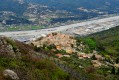
A circular hike starting from the charming village of Le Broc. A steep climb through the forest leads to the buried Gravière canal, which you follow along a track through the woods before reaching a clear view of Mont Vial and the Mercantour near the hamlet of Les Combes. The climb up the Mouton d'Anou via a track and then a narrow path offers a beautiful 360° panorama from Cap d'Antibes to Mercantour. The descent is via a pleasant path through the woods.
Tour of La Napoule
 4.06 mi
+764 ft
-778 ft
2h 30
Average
Departure from Mandelieu-la-Napoule (Alpes-Maritimes)
4.06 mi
+764 ft
-778 ft
2h 30
Average
Departure from Mandelieu-la-Napoule (Alpes-Maritimes)
Easy circular walk starting from Port de la Rague.
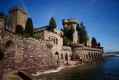
The walk begins with an ascent towards Mont Thurney at the entrance to the Estérel, then descends into a dry valley and on through woodland (eucalyptus then pine) before reaching San Peyre and its 360° orientation point (panoramic views of the Lérins Islands, the Bay of Cannes and the Mercantour).
Descent through La Napoule, then along the coastal path past the castle to the beaches of La Raguette and La Rague.
Tour of Cap Martin
 4.23 mi
+502 ft
-505 ft
2h 25
Easy
Departure from Roquebrune-Cap-Martin (Alpes-Maritimes)
4.23 mi
+502 ft
-505 ft
2h 25
Easy
Departure from Roquebrune-Cap-Martin (Alpes-Maritimes)
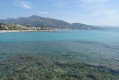
An easy walk, mostly along the coast on the customs officers' path between Monaco and Menton, which runs along the Bay of Roquebrune with the beautiful Buse beach and goes around Cap Martin.
Coastal path from Camarat to L'Escalet
 3.36 mi
+302 ft
-656 ft
1h 50
Easy
Departure from Ramatuelle (Var)
3.36 mi
+302 ft
-656 ft
1h 50
Easy
Departure from Ramatuelle (Var)
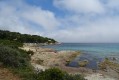
An easy walk along the coast between Camarat Lighthouse and L’Escalet on the Saint-Tropez peninsula.
Beautiful Mediterranean scenery amongst pine trees and turquoise waters. On arrival, a refreshing dip on the magnificent beach at L’Escalet will do you a world of good!
⚠️ 21/08/2026: Please read the practical information carefully before setting out on this walk.
The Lacs de Vens from Le Pra
 9.74 mi
+3,481 ft
-3,478 ft
7h 30
Difficult
Departure from Saint-Étienne-de-Tinée (Alpes-Maritimes)
9.74 mi
+3,481 ft
-3,478 ft
7h 30
Difficult
Departure from Saint-Étienne-de-Tinée (Alpes-Maritimes)
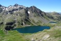
A magnificent hike in the Haute-Tinée offering varied panoramas and one of the most beautiful series of lakes in the Mercantour!
The climb from Le Pra is gradual and easy, with the Cime de la Bonnette behind you. You then pass under the strange Aiguilles de Tortisse before arriving at the Col du Fer (view of Mont Viso).
After the Collet de Tortisse, you arrive at the arch, where you can enjoy a splendid panorama of the Lacs de Vens and the peaks of the Trou de l'Âne!
The Valmasque Park and the Fontmerle Pond
 3.33 mi
+325 ft
-344 ft
1h 50
Easy
Departure from Mougins (Alpes-Maritimes)
3.33 mi
+325 ft
-344 ft
1h 50
Easy
Departure from Mougins (Alpes-Maritimes)
A family walk in the Valmasque heath, ideal for a picnic near the Étang de Fontmerle.
The lake is covered with lotus flowers, which bloom from July to mid-September.
Old Aspremont
 2.22 mi
+1,024 ft
-1,024 ft
1h 55
Average
Departure from Aspremont (Alpes-Maritimes) (Alpes-Maritimes)
2.22 mi
+1,024 ft
-1,024 ft
1h 55
Average
Departure from Aspremont (Alpes-Maritimes) (Alpes-Maritimes)
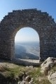
Starting from the charming village of Aspremont, this short but challenging round trip hike takes you up to Vieil Aspremont, the ruins of the old village abandoned in 1426.
Monséguise plateau
 7.02 mi
+1,660 ft
-1,670 ft
4h 40
Average
Departure from Le Broc (Alpes-Maritimes)
7.02 mi
+1,660 ft
-1,670 ft
4h 40
Average
Departure from Le Broc (Alpes-Maritimes)
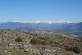
This hike starts in the hilltop village of Le Broc and takes you to the Monséguise plateau, which offers a rare view of the Alpes-Maritimes.
After a gradual climb through the Vallon de la Sine, you reach the plateau via a short climb along the "piste du gaz". At the top, you can see the Mediterranean, from the Estérel to nearby Nice, and the peaks of the Nice hinterland as far as the Mercantour!
On the descent, there are numerous views of the hilltop villages of the Nice hinterland.
Cime des Collettes
 4.45 mi
+1,739 ft
-1,732 ft
3h 35
Average
Departure from Toudon (Alpes-Maritimes)
4.45 mi
+1,739 ft
-1,732 ft
3h 35
Average
Departure from Toudon (Alpes-Maritimes)
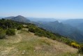
This circular hike starting from the village of Toudon provides access to one of the main peaks of the Mont Vial massif between Var and Estéron.
On the menu for this hike: pine forests and broom scrub, grassy terraces of abandoned countryside, a slightly steep passage at the foot of a limestone cliff, panoramic views of Cheiron, the Var valley, Mercantour... and even Nice and the sea on a clear day.
Le Bruguet and the Brague
 8.36 mi
+984 ft
-971 ft
4h 40
Average
Departure from Valbonne (Alpes-Maritimes)
8.36 mi
+984 ft
-971 ft
4h 40
Average
Departure from Valbonne (Alpes-Maritimes)
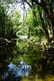
This long hike, mainly through woodland, starts in the charming village of Valbonne and takes you to the small wild valley of Bruguet (dry in summer).
After a long stretch of heathland, you will follow the Brague, a small river that can be devastating (see the floods of October 2015) flowing through an almost virgin forest. At the beginning of the season, swimming is possible in a few spots.
Moderator's note: there are a few difficulties on this hike; see the comments at the bottom of this page
Cipières and Le Loup
 3.53 mi
+850 ft
-850 ft
2h 20
Average
Departure from Cipières (Alpes-Maritimes)
3.53 mi
+850 ft
-850 ft
2h 20
Average
Departure from Cipières (Alpes-Maritimes)
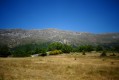
This short but challenging hike starts in Cipières, a village at the foot of the Calern plateau facing the Cheiron massif, and takes you to the banks of the Loup, a 49km coastal river (the second longest in the Alpes-Maritimes) through deciduous forests.
Once you reach the banks of the Loup, you will walk along the buried Foulon aqueduct, which supplies water to Grasse and the surrounding area.
Unfortunately, although the river is right by the path, it remains difficult to access.
Via Roc de l'Orri d'Ignaux
 8.48 mi
+2,303 ft
-2,300 ft
5h 55
Average
Departure from Sorgeat (Ariège)
8.48 mi
+2,303 ft
-2,300 ft
5h 55
Average
Departure from Sorgeat (Ariège)
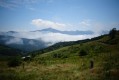
This circular hike above Ax-les-Thermes, towards the summit of Roc de l'Orri d'Ignaux, will take you to a 360° viewpoint over the western part of the Ariège Pyrenees.
Pic de Cabanatous via the Bassiès lakes
 9.71 mi
+3,871 ft
-3,862 ft
7 hrs
Very difficult
Departure from Auzat (Ariège)
9.71 mi
+3,871 ft
-3,862 ft
7 hrs
Very difficult
Departure from Auzat (Ariège)
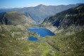
A difficult but exceptional hike offering panoramic views of the Ariège Pyrenees.
After a steep climb to the Bassiès lakes, you will walk along them before gaining height and reaching the Pic de Cabanatous, a viewpoint offering a 360° view from Tarbésou to Mont Vallier.
Cirque de Cagateille and Étang de la Hillette
 5.28 mi
+2,694 ft
-2,694 ft
6 hrs
Very difficult
Departure from Ustou (Ariège)
5.28 mi
+2,694 ft
-2,694 ft
6 hrs
Very difficult
Departure from Ustou (Ariège)
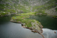
This hike, which presents no difficulty until you reach the foot of the Cirque de Cagateille, will make you sweat to reach the Étang de la Hillette.
But it's well worth the effort to discover this little Pyrenean fjord!
Les Cluots
 7.59 mi
+2,835 ft
-2,828 ft
5h 55
Difficult
Departure from Beuil (Alpes-Maritimes)
7.59 mi
+2,835 ft
-2,828 ft
5h 55
Difficult
Departure from Beuil (Alpes-Maritimes)
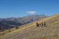
This hike, starting from the Gorges du Cians road, takes you up Les Cluots, a mountain located in a steppe area above the red pelite of the Cians.
Set back from the Mercantour massif, the summit offers a superb 360° panorama of the Alpes-Maritimes.
The old village of Châteauneuf-les-Moustiers
 1.73 mi
+443 ft
-443 ft
1h 10
Easy
Departure from La Palud-sur-Verdon (Alpes-de-Haute-Provence)
1.73 mi
+443 ft
-443 ft
1h 10
Easy
Departure from La Palud-sur-Verdon (Alpes-de-Haute-Provence)
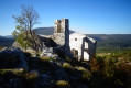
A short walk to the abandoned village of Châteauneuf-les-Moustiers, ideal for a picnic with panoramic views of the Montdenier massif, the heights of the Verdon or the Mourres area.
Châteauneuf-les-Moustiers was abandoned at the beginning of the 20th century. The remaining ruins are impressive in size and number.
Pic-Saint-Loup from Saint-Mathieu-de-Tréviers
 5.34 mi
+1,821 ft
-1,821 ft
4h 00
Average
Departure from Saint-Mathieu-de-Tréviers (Hérault)
5.34 mi
+1,821 ft
-1,821 ft
4h 00
Average
Departure from Saint-Mathieu-de-Tréviers (Hérault)
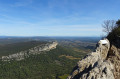
Pic-Saint-Loup, the legendary peak in the Montpellier hinterland. Here, I suggest approaching it from the east via Saint-Mathieu-de-Tréviers.
This shaded, less frequented route through the woods takes you past the ruined castle of Montferrand.
At the summit, you can enjoy views of the Alps, the Pyrenees, Mont Ventoux, the Cévennes and the Mediterranean.
Col de la Lombarde
 3.19 mi
+830 ft
-830 ft
2.5 hrs
Easy
Departure from Isola (Alpes-Maritimes)
3.19 mi
+830 ft
-830 ft
2.5 hrs
Easy
Departure from Isola (Alpes-Maritimes)
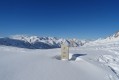
An easy snowshoe hike on a south-facing slope, offering access to the Col de la Lombarde and, consequently, a beautiful view over a wide Italian valley.
Pontevès, Petit Bessillon and Vallon des Carmes
 6.60 mi
+1,617 ft
-1,624 ft
4h 25
Average
Departure from Barjols (Var)
6.60 mi
+1,617 ft
-1,624 ft
4h 25
Average
Departure from Barjols (Var)
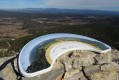
A loop with three major points of interest:
- the village of Pontevès and its ruined castle at the top of the village,
- the climb up the Petit Bessillon, offering a beautiful view of the Var department, and its technical descent,
- the return to Barjols via the Vallon des Carmes and its waterfalls (currently closed, see practical information).
Unfortunately, the first hour of the hike is mainly on roads in order to complete the loop.
The Mourre Nègre loop, passing by the old Saint-Pierre castle
 5.28 mi
+2,011 ft
-2,011 ft
4h 10
Average
Departure from Auribeau (Vaucluse)
5.28 mi
+2,011 ft
-2,011 ft
4h 10
Average
Departure from Auribeau (Vaucluse)
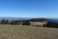
The Mourre Nègre, the highest point in the Luberon mountain range, offers breathtaking views from its crest, stretching from the Étang de Berre to the Southern Alps and including the Sainte-Victoire and Mont Ventoux peaks.
On the way down, passing through the Vallon du Roumi, you can get close to the ruins (currently being restored) of the ancient Château Saint-Pierre and the adjoining chapel of the same name.
Cima Valdritta (Monte Baldo)
 4.05 mi
+2,402 ft
-2,398 ft
3h 55
Difficult
Departure from Avio (Provincia di Trento)
4.05 mi
+2,402 ft
-2,398 ft
3h 55
Difficult
Departure from Avio (Provincia di Trento)
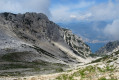
Cima Valdritta (2,218 m) is the highest point of Monte Baldo. Situated on the eastern shore of Lake Garda, this mountain range is often shrouded in cloud on summer afternoons.
This walk, which alternates between woodland, scrubland and a very rocky final stretch, offers beautiful panoramic views of the Val d’Adige and the other surrounding peaks, not to mention a few views of Lake Garda.
The final few metres do not present any technical difficulty, but some sections are quite vertiginous.