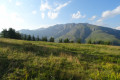
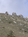
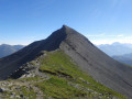
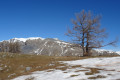
The Tête du Garnier as seen from the Col de l’Espaul

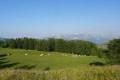
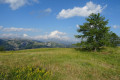
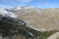
A short, easy walk, apart from the climb up the Tête du Garnier, offering lovely panoramic views of the resort of Valberg, the peaks of the upper Var valley, Mont Mounier and the eastern part of the Mercantour.

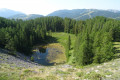
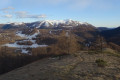
On the way down, you’ll come across the enclosed lake of Beuil, which is unusual in that it has no outlet.

Details

n°12075358
Creation:
Last update:
Last review:
  • Walking
    Activity: Walking
  • ↔
    Distance: 2.59 mi
  • ◔
    Average duration: 1h 45 
  • ▲
    Difficulty: Easy

  • ⚐
    Back to start: Yes
  • ↗
    Ascent: + 617 ft
  • ↘
    Descent: - 610 ft

  • ▲
    Highest point: 6,243 ft
  • ▼
    Lowest point: 5,656 ft

Photos

Description of the walk

From Valberg, take the Route de la Colle, pass the golf club and park in the Col de l’Espaul car park.

(S/E) From the pass, follow the yellow-marked path which heads eastwards into the forest, towards Beuil via Le Clot.

After a few minutes, on a level track, the path turns right to reach marker no. 38, near some drinking troughs.

(1) Turn right onto a faint track that climbs through the forest. The gradient steepens rapidly; continue straight up a barely marked path.

(2) At a small plateau, a track branches off to the left. Ignore this and continue climbing to the right, staying on the steepest sections of the slope.

As you emerge from the forest, continue climbing alongside it, then head for the summit, marked by a cairn.

(3) From the summit, after a well-deserved break to take in the views, head back down to the left towards the meadow below the Tête du Garnier, following a path marked in yellow.

Follow this path until you are looking out over Lac de Beuil.

Carry on until you reach a junction (marker no. 37) in the forest, near the lake.

(4) At marker no. 37, turn right towards the Col de l’Espaul along a very easy-going path. Continue in this direction to the pass and return to the starting point. (S/E).


Waypoints

  1. S/E : mi 0 - alt. 5,728 ft - Col de l'Espaul
  2. 1 : mi 0.75 - alt. 5,659 ft - Marker no. 38
  3. 2 : mi 1.13 - alt. 6,024 ft - Junction - Tête du Garnier
  4. 3 : mi 1.31 - alt. 6,243 ft - Tête du Garnier
  5. 4 : mi 1.9 - alt. 5,768 ft - Marker 37 - Lac de Beuil
  6. S/E : mi 2.59 - alt. 5,728 ft - Col de l'Espaul

Notes

This walk is classified as easy, but the ascent of the Tête du Garnier is still quite steep.

Make sure you wear suitable footwear and take water with you.

Reviews and comments

4.8 / 5
Based on 2 reviews

Reliability of the description
5 / 5
Ease of following the route
5 / 5
Route interest
4.5 / 5
User 2939952

Overall rating : 5 / 5

Date of your route : Sep 21, 2026
Reliability of the description : ★★★★★ Very good
Ease of following the route : ★★★★★ Very good
Route interest : ★★★★★ Very good
Very busy route : No

This route is classified as easy, but you should still be aware that the climb up to the Tête d’Ungarnier is very steep for average hikers. However, the reward is there when you reach the summit: a stunning, breathtaking view. We had a picnic at Lac de Beuil before heading back down to the car park.

Machine-translated

danielaime06
danielaime06

Overall rating : 4.7 / 5

Date of your route : Jul 19, 2025
Reliability of the description : ★★★★★ Very good
Ease of following the route : ★★★★★ Very good
Route interest : ★★★★☆ Good
Very busy route : No

I walked the route in the opposite direction – that is, starting from the lake – without any difficulty.
Once you reach the Tête du Garnier plateau, the scenery is magnificent.
It’s also worth spending a little time at Lac de Beuil – it’s tiny, but the surroundings are lovely
Thanks to the author!

Machine-translated

Other walks in the area

For more walks, use our search engine .

The GPS track and description are the property of this route's author. Please do not copy them without permission.