The Entremon Gorges and the Mediano Dam

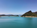
This spectacular hike through the Entremon Gorges leads to the Mediano dam, from where, depending on the season and water level, you’ll see a bell tower rising from the middle of the lake of the same name. This is the former village of Mediano, which was submerged during the construction of the dam.

Details

101768300
Creation:
Last update:
Last review:
  • Walking
    Activity: Walking
  • ↔
    Distance: 4.20 mi
  • ◔
    Average duration: 3h 45 
  • ▲
    Difficulty: Moderate

  • ⚐
    Back to start: Yes
  • ↗
    Ascent: + 2,136 ft
  • ↘
    Descent: - 2,142 ft

  • ▲
    Highest point: 1,834 ft
  • ▼
    Lowest point: 1,512 ft

Photos

Description of the walk

Park at the side of the road just past the Puente del Entremon on the right when coming from the A-138 (Meson de Liguerre).

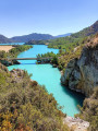
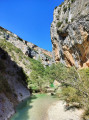
(S/E) Walk up the road for a few metres, then cross to the left to find a path that climbs towards the gorge to the north. Follow this steep path, which has a few sections requiring you to use your hands or a handrail. As you approach the cliffs, the path, which follows the course of the Cinca upstream, veers to the right.

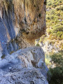
(1) Here is a tricky section. The path is carved into the cliff face. It is narrow and vertiginous, but you can get through without difficulty by keeping well to the right and holding onto the handrail. Shortly afterwards, a short section fitted with rungs may require you to use your hands. The path then continues gently through the woodland. Towards the end, a somewhat steep climb with worn steps leads to a wide track.

(2) Follow it straight on, then take the road on the right which passes through a tunnel (a head torch isn’t essential; there’s a rather temperamental motion sensor, but in any case this section isn’t long). At the tunnel exit, continue along this road, pass through a second tunnel and descend via a flight of steps to reach the crest of the dam. A lovely view over Lake Mediano and the iconic bell tower of the village of the same name.

(3) Retrace your steps along the same route as on the way out to return to the car park (S/E).

Waypoints

  1. S/E : mi 0 - alt. 1,522 ft - Car park - Puente del Entremon
  2. 1 : mi 0.91 - alt. 1,663 ft - Tricky section
  3. 2 : mi 1.62 - alt. 1,585 ft - Trail
  4. 3 : mi 2.11 - alt. 1,683 ft - Dam - Embalse de Mediano
  5. S/E : mi 4.2 - alt. 1,516 ft - Car park - Puente del Entremon

Notes

Stony terrain. Make sure you wear suitable footwear. Best avoided in very hot weather, even though much of the route is in the shade (especially in the morning).

A tricky section for those prone to vertigo: the path is carved into the rock on the cliff face. There is a handrail for support. Shortly afterwards, there is also a section with rungs cut into the rock, but this time without any risk of vertigo. Not recommended for dogs or young children (under 8 years old).

The elevation gain is slightly underestimated. The technical nature of the terrain, as well as the narrow section carved into the cliff face, also explain why this hike is classified as ‘moderate’.

Other walks in the area

For more walks, use our search engine .

The GPS track and description are the property of this route's author. Please do not copy them without permission.