The Pont de Brion and the Himalayan Footbridge over the Ébron

Here is a short route that forms a circular route starting from the Pont de Brion and passing via the Ébron Himalayan Footbridge near Lac de Monteynard-Avignonnet.

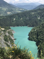
A proper little hike with spectacular views over the tributary that feeds into the lake.

Details

105958643
Creation:
Last update:
Last review:
  • Walking
    Activity: Walking
  • ↔
    Distance: 1.92 mi
  • ◔
    Average duration: 1h 35 
  • ▲
    Difficulty: Moderate

  • ⚐
    Back to start: Yes
  • ↗
    Ascent: + 807 ft
  • ↘
    Descent: - 686 ft

  • ▲
    Highest point: 2,552 ft
  • ▼
    Lowest point: 1,883 ft
  • ⚐ Country: France
  • ⚐
    Areas: Alps, Dauphiné
  • ⚐ City: Lavars (38710)
  • ⚑
    Start/End: N 44.867627° / E 5.672019°
  • ❏
    IGN map(s): Ref. 3236OT, 3236OTR, 3336OT, 3336OTR
  • Hour-by-hour weather

Photos

Description of the walk

Park in the car park to the left of the RD 34 upstream from the Pont de Brion when coming from Lavars or Mens.

(S/E) Cross the Ébron via the bridge (on the pavement). Continue along the road until you reach the first bend.

(1) Take the path that climbs to the right on the other side of the road towards the Pas de Berlioz. Cross the RD 34 carefully just above and continue up a steep but sustained climb to a junction in the woods beneath a power line, near a grave in honour of Aurélia Gaymard (who apparently died from a snake bite).

(2) Turn sharply right onto a gentle descent until you reach the top of the cliffs. The path then runs along the cliffs to the left before, at Pas du Berlioz, heading into the forest. At the next junction, keep right, following the sign for the Passerelle de l’Ébron.

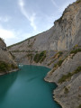
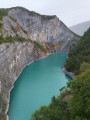
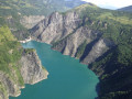
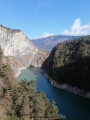
As you emerge from the forest, you’ll come to a track; turn right to enjoy the viewpoint over the Ébron Gorges and the Pont de Brion, then head down to the footbridge.

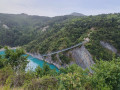
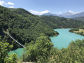
(3) Cross this beautiful 180-metre-long footbridge. Be careful – it can sway if it’s windy or busy! Then head back up the other side, following the main path, to a small viewpoint over the Pont de Brion, indicated by a sign.

(4) Leave the signposted path by following a clearly marked single track to the right, which quickly leads to the RD 34. Then follow the road to the right to return to the starting point. (E)

Waypoints

  1. S/E : mi 0 - alt. 1,883 ft - Pont de Brion
  2. 1 : mi 0.22 - alt. 2,005 ft - Turn-off onto the RD 34
  3. 2 : mi 0.67 - alt. 2,549 ft - Aurélia Gaymard’s grave
  4. 3 : mi 1.3 - alt. 1,946 ft - Passerelle sur L'Ebron
  5. 4 : mi 1.58 - alt. 2,073 ft - Signpost: Pont de Brion
  6. S/E : mi 1.92 - alt. 1,975 ft - Pont de Brion

Notes

Please note: although the distance is very short, the elevation gain is significant. This is a proper little hike. Make sure you wear suitable footwear (such as trail or hiking boots). Walking poles can help on the ascent or descent.

There are a few slightly vertiginous sections. Take care with children.

Worth a visit

The Himalayan footbridge is impressive. So is the Brion bridge, as are the gorges formed by the Ébron in this area.

You can also go on a longer hike, taking in the footbridge over the Drac a little further on...

Other walks in the area

For more walks, use our search engine .

The GPS track and description are the property of this route's author. Please do not copy them without permission.