Parking is available in the large car park next to the clinic. Access by bus is also possible.
(S/E) Take the path that climbs gently at the southern end of the car park, then turn left immediately above a field to go over the top of the car park.
(1) At the first bend, take the hairpin bend to the right and follow the path as it winds its way up, after passing a farm, to a pass (Bargallasattel).
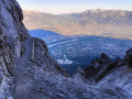
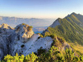
(2) Take the path that climbs straight up to the left into the mountain pasture, following the ridge at the edge of the woodland on the western slope. Stay close to this ridge and ignore the path that branches off to the right. After a short, level stretch heading east, one final short climb through the woods quickly leads to the summit (a fine cross; 360° panoramic view, notably of the Rhine Valley and the surrounding ravines).
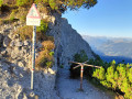
(3) Retrace your steps a few metres, then turn left onto a cliff-side path strewn with roots. This section isn’t particularly exposed or vertiginous compared to what lies ahead… Reach an unnamed pass and head down to the left onto a very rocky and slippery path that zigzags through a large scree slope. A few handrails and steps will help with the descent. Trekking poles can be very useful (if not essential) on the steepest sections. Keep to the left at a junction and climb slightly to reach another pass (Gafleisattel; a sign warns of the risk of rockfalls).
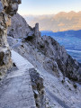
(4) Take the path to the left which crosses the cliffs. The path is narrow, sometimes slippery, but above all vertiginous. Fortunately, handrails are provided on the most exposed sections. After just over a kilometre, you’ll come to a more conventional path which descends into the forest.
(5) At the next junction, head down to the right. After a left-hand bend, you’ll reach the junction where the circular route begins.
(1) Head down the path to the right to return to the car park via the same route as at the start (S/E).
 Visorando Member
 Moderate
 Difficult