Descent of the Aveyron and the Tarn

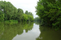
From the Gué de Piquecos to the Lafrançaise Bridge, this canoeing and kayaking trip of around twelve kilometres will take you down these two wild waterways amidst tall deciduous trees, winding your way through the fields.

Details

11673904
Creation:
Last update:
Last review:
  • Boating/Canoeing/Kayaking
    Activity: Boating/Canoeing/Kayaking
  • ↔
    Distance: 6.82 mi
  • ◔
    Duration according to the author: 2 hrs 
  • ▲
    Difficulty: Easy

  • ⚐
    Back to start: No
  • ↗
    Ascent: + 7 ft
  • ↘
    Descent: - 20 ft

  • ▲
    Highest point: 243 ft
  • ▼
    Lowest point: 220 ft
  • ⚐ Country: France
  • ⚐ City: Piquecos (82130)
  • ⚑
    Start: N 44.095748° / E 1.31625°
  • ⚑
    End: N 44.113932° / E 1.248015°
  • Hour-by-hour weather

Photos

Description of the walk

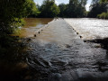
The start point is at the Gué de Piquecos. Below the village, as you approach Les Granges from Montastruc, head down to the right.

For a peaceful start, head for the launch area on the left bank, on the other side of the ford.
Alternatively (should the ford be impassable), you can set off on the right-hand side before the ford.

(S) Paddle down the Aveyron on the right-hand side, where the current is strongest.
Follow the river, paddling at a steady pace. The descent is very peaceful and rapids are extremely rare and cause little turbulence.

After a few bends and a long straight stretch, you’ll reach a left-hand bend near a ruined building on the right bank.

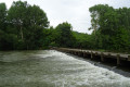
(1) Pass what appears to be the ruins of a mill, and continue, keeping well to the left of a rapid which can be a little choppy when the Aveyron is in flood.
A little further on, pass under a pretty road bridge which will take you to the confluence with the Tarn.

(2) On reaching the Tarn, carry on following the current to the right, paddling as the current on this wide river is very slow.

About 3 km further on, you’ll see the pretty Lafrançaise bridge. The finish is on the right bank, a few dozen metres before the bridge (E).

Waypoints

  1. S : mi 0 - alt. 240 ft - Piquecos Ford - Aveyron (rivière)
  2. 1 : mi 3.82 - alt. 226 ft - Ruined mill
  3. 2 : mi 4.54 - alt. 223 ft - RD 927 road bridge
  4. E : mi 6.82 - alt. 226 ft - Lafrançaise Bridge boat launch - Tarn (rivère)

Notes

If you have two vehicles, park one at the car park by the launch ramp at the Lafrançaise bridge on the D45 towards Meauzac.

During low water levels, you may occasionally hit a few rocks or the riverbed.

Take care in the rapids during high water.

Remember to bring life jackets and plenty of provisions.

Worth a visit

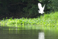
Throughout the journey, you’ll be able to see plenty of egrets and herons.

Reviews and comments

4.7 / 5
Based on 2 reviews

Reliability of the description
4.5 / 5
Ease of following the route
5 / 5
Route interest
4.5 / 5
M-L
M-L

Overall rating : 4.7 / 5

Date of your route : Dec 01, 2024
Reliability of the description : ★★★★★ Very good
Ease of following the route : ★★★★★ Very good
Route interest : ★★★★☆ Good
Very busy route : No

An easy trip, with a good water level as of 1 December, and small waves and eddies to have some fun. Suitable for beginners to kayaking and canoeing.

Machine-translated

osiris130
osiris130 ★

Hello Fanfoue,

Thank you for your feedback.

As for the duration of the trip, it’s true that when we were heading downstream, the current was quite strong.
Although I do remember having to paddle quite hard! My wrist reminded me of that for a few days after the trip...

Machine-translated

fanfoue
fanfoue

Overall rating : 4.7 / 5

Date of your route : Oct 07, 2023
Reliability of the description : ★★★★☆ Good
Ease of following the route : ★★★★★ Very good
Route interest : ★★★★★ Very good
Very busy route : No

The kayak trip is advertised as taking 2 hours: perhaps for a very experienced paddler. That said, we were probably close to low water levels, as we had to drag the kayak on foot four or five times before finding enough depth to continue (including once on the Tarn). So 2½ hours at low water! Lots of egrets and herons. A lovely finish at Lafrançaise (with the pretty Saula bridge), where the church overlooks the surrounding area.

Machine-translated

For more walks, use our search engine .

The GPS track and description are the property of this route's author. Please do not copy them without permission.