Country:

 City:
City:


Parking is available in the car park (paid) behind the Imst Tourist Office.
(S/E) Walk round the block containing the tourist information centre from the north and head towards the church. Walk round the church on the left-hand side and head up the quay on the left bank of the river.
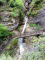
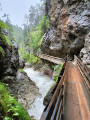
(1) On leaving the village, a sign marks the start of the Rosengarten Gorge (Rosengartenschlucht). Follow this path, which consists of a series of footbridges, as it follows the river upstream, alternating between the left and right banks. Please note: some sections are slippery (crumbly ground) and may cause gravel or even stones to fall onto people below. Take care. After passing through a tunnel, the path soon reaches the road leading to Hoch-Imst.
(2) Take the footbridge to the right towards Hoch-Imst. The path continues on the left bank with a gentle climb. Once you reach level ground, you can take a very short detour by keeping to the left to visit the Blaue Grotte. Then head back and you’ll come to a wider path. Turn right to reach Hoch-Imst, crossing a large car park.
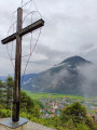
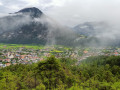
(3) Go round the restaurant opposite on the left, skirting a large meadow. As you enter the woodland, turn right and follow the path which then descends to a pretty cross (Wetterkreuz) overlooking the village and the valley.
(4) Turn right towards Imst until you reach the top of Imst. Take the street on the left, then turn right; at the end of this street, take the steps leading down to the right to complete a circular route.
(1) Follow the river to the left to return to the starting point, going round the church on the left (S/E).
 Tourist office

 Visorando Member
 Difficult
 Easy
Easy