Circular Lauberhorn from Kleine Scheidegg

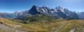
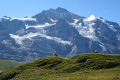
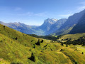
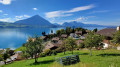
The Lauberhorn is a modest peak, yet legendary amongst downhill skiers, situated above Kleine Scheidegg. It offers a superb panorama of the Grindelwald and Lauterbrunnen valleys, but above all of the majestic trio formed by the Eiger, the Mönch and the Jungfrau.

Details

105199187
Creation:
Last update:
Last review:
  • Walking
    Activity: Walking
  • ↔
    Distance: 2.80 mi
  • ◔
    Average duration: 2h 25 
  • ▲
    Difficulty: Moderate

  • ⚐
    Back to start: Yes
  • ↗
    Ascent: + 1,283 ft
  • ↘
    Descent: - 1,283 ft

  • ▲
    Highest point: 8,048 ft
  • ▼
    Lowest point: 6,759 ft

Photos

Description of the walk

The walk starts from Kleine Scheidegg, which is accessible by train from Grindelwald or Lauterbrunnen via Wengen.

(S/E) Take the path that climbs northwards between the chalets to the last one, situated behind a promontory overlooked by a small platform.

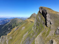
(1) Turn left onto a path that climbs towards Lauberhorn. Climb up a small ridge amongst the rocks, then cross the south-east face of Lauberhorn, passing beneath the cable car. This will take you to the south ridge.

(2) Climb up to the right towards the top station of the cable car, then continue to the left to reach the summit, where two benches offer a peaceful spot to enjoy the exceptional views.

(3) Retrace your steps along the same route.

(2) Carry on straight ahead to another cable car, the Lauberhornschulter, which goes up towards Wengen.

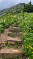
(4) Turn left onto a lovely, albeit steep, track that leads back to Kleine Scheidegg. (E)

Waypoints

  1. S/E : mi 0 - alt. 6,765 ft - Kleine Scheidegg
  2. 1 : mi 0.37 - alt. 6,916 ft - Rotstecki
  3. 2 : mi 1.16 - alt. 7,772 ft - Southern Ridge
  4. 3 : mi 1.42 - alt. 8,048 ft - Lauberhorn (2472 m)
  5. 4 : mi 1.95 - alt. 7,582 ft - Lauberhornschulter
  6. S/E : mi 2.8 - alt. 6,765 ft - Kleine Scheidegg

Worth a visit

The crowds around Grindelwald, Lauterbrunnen or Kleine Scheidegg can be off-putting. But rest assured, once you’ve started walking and climbing up into the mountain pastures, you’ll find it much more peaceful. We came across no more than ten people during our hike in August 2026!

Other walks in the area

For more walks, use our search engine .

The GPS track and description are the property of this route's author. Please do not copy them without permission.