Country:

 City:
City:


Park near the church at La Bâtie or at the very start of the Chemin des Collets (which is closed to traffic a few metres further on). Arrive early, as there are few parking spaces.
Yellow/Green signposting
(S/E) Head up the Chemin des Collets towards Plan Giraud Vert until you reach the Barri junction, which you’ll reach quickly.
(1) At Le Barri, continue to the left, still heading towards Plan Giraud Vert. At the end of the track, cross the stream.
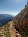
(2) Follow the path to the right towards the Pas des Bachassons. The ascent through the forest is gradual, and the gradient becomes steeper as you approach the ravines. On leaving the forest, the route follows a somewhat uneven stony path.
Continue in this way to the Ravin des Serres and Ravin du Maupas, then on to the Pas de Bachassons.
(3) Turn right towards the Cabane des Aiguillettes. Descend into the plain, straight ahead, towards the Grand and Petit Veymont.
(4) Just before reaching the foot of the ascent to the Grand Veymont, turn off the path to the right to climb towards the Col des Veymonts, then the Petit Veymont, which stands out against the landscape with its very slender, pointed summit.
Descend into the meadow, then cross a small dry stream to climb back up through the grass to the pass, passing beneath the Petit Veymont. You may spot ibex in the scree on the left, below the Grand Veymont.
(5) At the pass, watch the numerous marmots striking a pose.
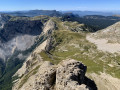
Take care with the sheer drop down to Gresse-en-Vercors. One wrong step and it’s a fall of several tens of metres!
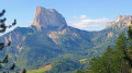
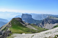
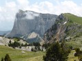
The climb to the summit, on the right, is straightforward: head up the grassy slope and aim for the first cairn on the left. Then make your way to the final cairn, taking care, to enjoy the breathtaking view of Mont Aiguille.
(6) Retrace your steps to the pass and then onto the Grand Veymont path.
Signposted with a few yellow markers
(4) Turn right to begin the ascent of the Grand Veymont via a stony, well-marked path.
After a climb that becomes a little monotonous towards the end, you’ll arrive below the summit, which is usually very busy. Climb up to the right to reach the summit cairn.
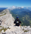
(7) Wander around the summit to find a quiet vantage point , taking care as a fall on the eastern side would be fatal, then head back down the path to the right, following a diagonal descent down the slope of the Grand Veymont.
After a slightly steeper section, you’ll reach the Agnellerie site, where you may come across female ibex (étagnes) with their young – a great spot for some magnificent photos.
Just past this spot, the descent is very steep and rugged. Descend carefully to the Pas de la Ville.
Yellow/Green markings
(8) Head down to the right along the path that zigzags across to the other side of the ridge, on the eastern slope, until you reach the signpost marked ‘Sous le Pas de la Ville’.
(9) Then turn right, towards the Baraque du Veymont. The path passes beneath the impressive Grand Veymont ridge. If needed, you can get some water from a ravine at the Fontaine du Veymont.
(10) You’ll reach a track that descends to the Baraque du Veymont.
(11) Just before the hut, turn right and head uphill through the forest towards Tiolache. The ascent winds through the forest to the top of the Côte de Quinquambaye, where another stunning view of Mont Aiguille unfolds. Descend, following the marked path all the way, until you reach an unnumbered marker.
(12) Carry on straight ahead, towards Tiolache.
(13) Then head down to the right towards Le Barri, which you’ll reach quickly after crossing two dry streams (make sure you spot the path on the other side of the stream).
(1) At Barri, turn left towards La Bâtie. Three chairs in a field provide a spot for a final break, facing Mont Aiguille, before returning to the starting point (S/E).



 However, after point (3), the handrail has been removed!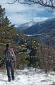



 Visorando Member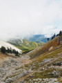
 Very difficult
 Association / Club / Walk leader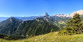
 Moderate