


Refine your search for walks in Pouru-Saint-Remy
Pouru-Saint-Remy walks
 From Douzy (Camping du Lac) to Chassepierre
 Visorando Member
 14.70 mi
 +958 ft
 -551 ft
 2.5 hrs
 Moderate
 Departure from Douzy (Ardennes)
From Lac de Douzy, after passing through the Forges de Brévilly industrial site – which was very active in the 19th century – we reach the nearby Belgian border (10 km) via a small road that turns into a track suitable for vehicles. From there, simply follow numbers 30, then 11, then 13 on the cycle network’s ‘points-nœuds’ system to reach the village of Chassepierre and the campsite on the banks of the Semois. Halfway along the route, after Muno, a short walk takes you to a remarkable geological feature.
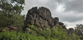
 La Roche à l'Appel, an exceptional natural treasure
 4.69 mi
+925 ft
-925 ft
3h 00
Moderate
Departure from Florenville (Province de Luxembourg)
4.69 mi
+925 ft
-925 ft
3h 00
Moderate
Departure from Florenville (Province de Luxembourg)
A few steps from the French border, La Roche à l'Appel is a geological curiosity located in one of the Gaume nature reserves, in the village of Muno. It appears as a chaotic pile of enormous blocks of Fépin puddingstone.
 Walk through the Ennemane valley and on to the Meuse valley
19.65 mi
+636 ft
-646 ft
3 hrs
Moderate
Departure from Remilly-Aillicourt (Ardennes)
This mountain bike route, which presents no technical difficulties, features two sections of greenway, traditional farm and forest tracks, and even a section of the Roman road that linked Reims to Trier.
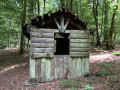
In the Mortehan forest: the four streams, La Roche au Sel, the Gros Chêne
 7.72 mi
+732 ft
-719 ft
4h 10
Moderate
Departure from Villers-Cernay (Ardennes)
7.72 mi
+732 ft
-719 ft
4h 10
Moderate
Departure from Villers-Cernay (Ardennes)
22 October 2025: first part of the route revised due to the recent installation of a fence on a forest plot.
An exclusively forest route, sometimes wild, near Belgium. Especially in its first part, it takes in natural areas that are rarely visited. Modest streams have carved out a surprising landscape here. La Roche au Sel, Le Gros Chêne, and L'Étang la Motte are worth a quick look in the second part of the route.
The Douaire, Lazareth and Bouillonnais paths
 11.27 mi
+1,257 ft
-1,250 ft
6h 15
Moderate
Departure from Givonne (Ardennes)
11.27 mi
+1,257 ft
-1,250 ft
6h 15
Moderate
Departure from Givonne (Ardennes)
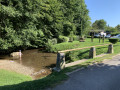
This route follows a variety of paths through a forest with a wide range of tree species. It is located almost entirely within the Sedan National Forest.
Along the Givonne and the Ruisseau des Fraichis
 7.58 mi
+676 ft
-650 ft
4h 05
Moderate
Departure from Givonne (Ardennes)
7.58 mi
+676 ft
-650 ft
4h 05
Moderate
Departure from Givonne (Ardennes)
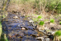
This forest walk features numerous small paths, with two main landmarks: the Givonne and the Ruisseau des Fraichis.
31/7/22: the footbridge over the Givonne at (6) has been fully restored
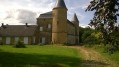
La Truche and Lombut Castle
 9.01 mi
+1,030 ft
-1,027 ft
5h 00
Moderate
Departure from Mouzon (Ardennes)
9.01 mi
+1,030 ft
-1,027 ft
5h 00
Moderate
Departure from Mouzon (Ardennes)
A walk starting from Mouzon, offering lovely views of the Meuse and Chiers valleys and the neighbouring villages throughout the route.
Circuit du Mortehan
18.93 mi
+1,969 ft
-1,962 ft
4 hrs
Moderate
Departure from Givonne (Ardennes)
This forest route follows a variety of paths, including many sections of the Pays Sedanais mountain bike routes and various forest trails in Villers Cernay, Francheval and Pouru-aux-Bois.The elevation changes are not excessive and the numerous streams that line the route add a special charm to this route.
This is a difficult route requiring some portage.
From the heights of Sedan to the Chasseurs d’Afrique memorial in Floing
 8.71 mi
+725 ft
-725 ft
4h 40
Moderate
Departure from Sedan (Ardennes)
8.71 mi
+725 ft
-725 ft
4h 40
Moderate
Departure from Sedan (Ardennes)
A lovely walk combining the idyllic charm of a pleasant country stroll with the educational aspect of a chapter in French history: the Battle of Sedan, which took place on1 September 1870 and led to the surrender of the French army the very next day and, consequently, the end of the Franco-Prussian War of 1870.
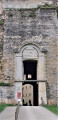
Discovering the Sedan region
 5.60 mi
+492 ft
-486 ft
3h 00
Moderate
Departure from Sedan (Ardennes)
5.60 mi
+492 ft
-486 ft
3h 00
Moderate
Departure from Sedan (Ardennes)
Set off to discover the historic sites that have shaped the Sedan region. Places steeped in history and emotion.
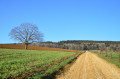
The Piot Cross at the start of the route from Wadelincourt
 11.01 mi
+1,230 ft
-1,214 ft
6h 10
Moderate
Departure from Wadelincourt (Ardennes)
11.01 mi
+1,230 ft
-1,214 ft
6h 10
Moderate
Departure from Wadelincourt (Ardennes)
A route with very few sections through woodland which, throughout the walk, offers hikers sweeping panoramic views over the Bar and Meuse valleys.
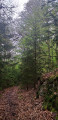
From Les Glaynées to Woaygnie
 4.79 mi
+371 ft
-374 ft
2h 30
4.79 mi
+371 ft
-374 ft
2h 30
 Easy
Departure from Illy (Ardennes)
Easy
Departure from Illy (Ardennes)
A short, leisurely walk through woodland with varied terrain.
Along the streams of Olly
 5.49 mi
+558 ft
-558 ft
3h 00
Easy
Departure from Illy (Ardennes)
5.49 mi
+558 ft
-558 ft
3h 00
Easy
Departure from Illy (Ardennes)
Amidst the greenery and the scents of the woodland, a short walk to the sound of babbling brooks that you cross by fording.
Following the water between the Givonne and the Hatrelle
5.81 mi
+597 ft
-577 ft
3h 10
Easy
Departure from Illy (Ardennes)
This walk, mostly through state-owned forest, will take you close to or past the Givonne and two of its main tributaries: the Ruisseau des Dix Frères and the Ruisseau de la Hatrelle. In places, you will also walk along the old route of the Bouillonnais, a small train that linked Sedan and Bouillon.
Sedan, the lake and the canal
 4.64 mi
+39 ft
-36 ft
2h 10
Easy
Departure from Sedan (Ardennes)
4.64 mi
+39 ft
-36 ft
2h 10
Easy
Departure from Sedan (Ardennes)
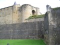
A walk around the lake in November, shrouded in mist, with a detour through the town centre and the renovated old quarters, then back along the canal, admiring the reflections of the bourgeois houses in its dark waters.
La Marfée
 5.69 mi
+358 ft
-335 ft
2h 55
Easy
Departure from Noyers-Pont-Maugis (Ardennes)
5.69 mi
+358 ft
-335 ft
2h 55
Easy
Departure from Noyers-Pont-Maugis (Ardennes)
The Col de la Marfée, the village of Chaumont and its superb inscriptions on the pediments of the houses, panoramic views of Cheuveuges, the Meuse valley and Sedan: this is what awaits you on this walk, which takes you effortlessly through meadows, fields and forest.
The Margueritte Division March
6.18 mi
+646 ft
-646 ft
3h 25
Easy
Departure from Ardennes
During the Franco-Prussian War of 1870, the sacrifice of the Chasseurs d’Afrique of the Margueritte Division earned the admiration of William I, who remarked, “Ah! What brave men.” Follow in their footsteps and discover the countryside and battlefields of the Sedan region.
Loops west of Bouillon along the Semois
 11.53 mi
+2,093 ft
-2,093 ft
7h 10
11.53 mi
+2,093 ft
-2,093 ft
7h 10
 Difficult
Departure from Bouillon (Belgique) (Province de Luxembourg)
Difficult
Departure from Bouillon (Belgique) (Province de Luxembourg)
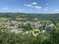
This is a fairly long hike through the woods, with good paths and signposted trails. There are some nice climbs and numerous views of the Semois, the Ardennes forest and Bouillon.
Bouillon – Florenville
 16.41 mi
+1,529 ft
-1,470 ft
8h 55
16.41 mi
+1,529 ft
-1,470 ft
8h 55
 Very difficult
Departure from Bouillon (Belgique) (Province de Luxembourg)
Very difficult
Departure from Bouillon (Belgique) (Province de Luxembourg)
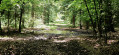
Leaving Bouillon and its castle to reach Florenville means linking the two ends of the Semois by crossing the plateau and its forests rather than following the river’s course and meanders; it is therefore a long climb followed by a gradual descent; it also means leaving a town on tarmac, travelling along stony paths and dirt tracks, crossing two fords, and returning to tarmac to reach the town again. And it’s a long walk of over 26 kilometres. The accommodation I’ve chosen in Florenville is the campsite.
From Bouillon Castle to Sedan Castle
14.14 mi
+1,385 ft
-1,601 ft
7h 40
Difficult
Departure from Bouillon (Belgique) (Province de Luxembourg)
This fully signposted cross-border trail links Bouillon Castle in Belgium to Sedan Castle in France.
This is one of the possible return routes for the hike from one castle to another across the border, hike no. 36479520
After following the Semois river, you will climb up to Corbion, a small village perched high in the municipality of Bouillon. Then, after crossing the border stream near the "Maison Verlaine", you will join the old Bouillonnais road, which will take you gently to the Sedan region.
When crossing the Épine suspension bridge
 6.93 mi
+1,407 ft
-1,417 ft
4h 25
Moderate
Departure from Bouillon (Belgique) (Province de Luxembourg)
6.93 mi
+1,407 ft
-1,417 ft
4h 25
Moderate
Departure from Bouillon (Belgique) (Province de Luxembourg)
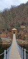
From the Pont de Cordemoy, climb the Auclin hill to discover its viewpoints and belvedere. Continue on to the viewpoints of the Abbaye Notre-Dame and L'Épine. Cross the 55-metre-long suspension bridge over the Semois at the Moulin de l'Épine. Set off to discover the viewpoint of the Rocher du Pendu, the botanical and geographical arboretum and finish with a view of Bouillon Castle from La Ramonette.
12 viewpoints overlooking the Semois, starting from Bouillon
 9.09 mi
+2,182 ft
-2,169 ft
6h 05
Moderate
Departure from Bouillon (Belgique) (Province de Luxembourg)
9.09 mi
+2,182 ft
-2,169 ft
6h 05
Moderate
Departure from Bouillon (Belgique) (Province de Luxembourg)
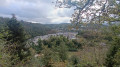
A short hike starting from Bouillon, to discover a few viewpoints and panoramic views over the Semois.Several car parks are available at the foot of the castle, at the eastern entrance to the tunnel (town side), as well as numerous bars and restaurants on the Quai du Rempart.
Iges Peninsula
4.89 mi
+253 ft
-256 ft
2h 30
Easy
Departure from Glaire (Ardennes)
The Iges peninsula, formed by a circular bend in the Meuse downstream from Sedan, has always been a crossing point. A secondary Roman road, linking the two major routes from Reims to Cologne and from Reims to Trier, passed through Iges and crossed the Meuse via a paved ford. Following the surrender of 1870, 80,000 French soldiers were crammed onto the peninsula in appalling conditions before being transferred to Germany, hence the name ‘Camp de la Misère’ (Camp of Misery) given to the peninsula.
The Ennemane Valley and the Margotte wind farm
 4.44 mi
+413 ft
-404 ft
2h 25
Easy
Departure from Raucourt-et-Flaba (Ardennes)
4.44 mi
+413 ft
-404 ft
2h 25
Easy
Departure from Raucourt-et-Flaba (Ardennes)
A short, easy route ideal for families. At the bottom of the valley, you’ll find a bit of local history and lovely views across the plateau.
The Himalayan-style footbridge over the Semois
 11.59 mi
+1,243 ft
-1,217 ft
6h 25
Difficult
Departure from Florenville (Province de Luxembourg)
11.59 mi
+1,243 ft
-1,217 ft
6h 25
Difficult
Departure from Florenville (Province de Luxembourg)
Let’s set off to discover the treasures and natural beauty of the Semois in its entirely wooded stretch between Sainte-Cécile and Herbeumont. As well as views of various meanders and the medieval castle of Herbeumont from the heights, the walk follows the river upstream for several kilometres before reaching the Himalayan-style footbridge, which was opened in early summer 2026. Although the route follows the left bank exclusively, crossing the Semois back and forth at height on the footbridge is an experience not to be missed (except for those prone to vertigo).
The Marfée massif, a promontory steeped in history
 9.14 mi
+863 ft
-843 ft
4h 55
Moderate
Departure from Sedan (Ardennes)
9.14 mi
+863 ft
-843 ft
4h 55
Moderate
Departure from Sedan (Ardennes)
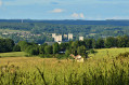
Rising to an altitude of 340 metres, the Marfée massif was particularly coveted during various conflicts. This wooded promontory, overlooking the Meuse valley, has witnessed many historic tragedies in the ‘Pays Sedanais’.
From the viewpoint, where more than ten villages can be seen, it is easy to understand the strategic importance of this key location near the border. Nearly 30,000 German and French soldiers are buried in the two cemeteries at Noyers.
Himalayan footbridge and Rocher du Chat in Sainte-Cécile
 4.88 mi
+928 ft
-935 ft
3h 05
Moderate
Departure from Florenville (Province de Luxembourg)
4.88 mi
+928 ft
-935 ft
3h 05
Moderate
Departure from Florenville (Province de Luxembourg)
Discover one of the region’s must-do walks, starting from the charming village of Sainte-Cécile!
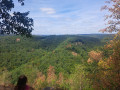
Ideal for visitors and lovers of stunning panoramic views, this superb circular route starts at the beginning of Rue de la Belle Hôtesse. Right from the start, you’ll cross the famous Sainte-Cécile Himalayan footbridge. Suspended above the Semois, it offers a unique experience at a height of 30 metres.
The trail then winds its way into the magnificent Gaume forest for a lively yet accessible circular route. You’ll climb up to the famous Rocher du Chat, a spectacular rocky viewpoint offering breathtaking views over the valley. After taking in the stunning scenery, the return journey is a leisurely stroll through the woods, before crossing the footbridge once more to return to the village.
An unmissable, fun and photogenic walk for visitors!
From the Himalayan Footbridge to the Rocher du Chat
7.91 mi
+1,483 ft
-1,493 ft
4h 55
Moderate
Departure from Florenville (Province de Luxembourg)
This 12.5 km circular route starting from Sainte-Cécile takes you to explore the new Himalayan-style footbridge overlooking the Semois, before heading into the magnificent forests of the Épioux estate.
Three superb viewpoints line the route: the Castelain, the Vanne des Moines and the spectacular Rocher du Chat. The return journey follows a lovely moss-covered path before passing under the footbridge and then crossing it a second time. A very varied walk that alternates between forests, panoramic views, rocky outcrops and the river.
From Chassepierre to Pétange (Luxembourg) along the Semois
46.66 mi
+1,430 ft
-1,398 ft
6 hrs
Difficult
Departure from Florenville (Province de Luxembourg)
For most of the route, this third stage follows roads suitable for cycling, smooth paths and cycle lanes. The Semois meanders so much that it is impossible to ‘follow’ it along its entire length, but this route crosses it numerous times and heads all the way up to its source in Arlon!The ride takes you through the Gaume and the Arlon region, away from the main roads with heavy motor traffic.
Circular loop at Dohan, a village on the Semois river.
 8.80 mi
+1,083 ft
-1,086 ft
5h 00
Moderate
Departure from Bouillon (Belgique) (Province de Luxembourg)
8.80 mi
+1,083 ft
-1,086 ft
5h 00
Moderate
Departure from Bouillon (Belgique) (Province de Luxembourg)
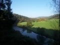
Discover three of the seven viewpoints in Dohan. Peace and quiet await you thanks to the unmarked trails.
Chassepierre – Arlon Official Campsite
47.67 mi
+1,962 ft
-1,634 ft
8 hrs
Difficult
Departure from Florenville (Province de Luxembourg)
Starting from Chassepierre, this route through the Gaume region allows time to visit remarkable cultural sites and another of the ‘most beautiful villages in Wallonia’. This involves a few detours, but fewer than those along the Semois, where the route cuts across several bends! The route description refers to the ‘nodes’ of the cycle network developed in Belgium. The route includes a loop through Arlon to the viewpoint at the top of Knippchen, which can be done in the evening or the following morning.
Scenic walk in Dohan
 4.80 mi
+597 ft
-597 ft
2h 45
Moderate
Departure from Bouillon (Belgique) (Province de Luxembourg)
4.80 mi
+597 ft
-597 ft
2h 45
Moderate
Departure from Bouillon (Belgique) (Province de Luxembourg)
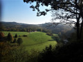
A scenic walk through the village of Dohan, between Bouillon and Florenville.
A route running almost entirely along forest paths.
Around Dohan
 7.73 mi
+1,417 ft
-1,394 ft
4h 45
Moderate
Departure from Bouillon (Belgique) (Province de Luxembourg)
7.73 mi
+1,417 ft
-1,394 ft
4h 45
Moderate
Departure from Bouillon (Belgique) (Province de Luxembourg)
This figure-of-eight hike takes you along pretty paths to five viewpoints and Roche Percée, a natural curiosity steeped in legend. Although classified as moderately difficult, this circuit requires a good level of fitness to tackle the steep gradients.
Schevauchée Walk
 4.06 mi
+299 ft
-299 ft
2h 05
Easy
Departure from Bouillon (Belgique) (Province de Luxembourg)
4.06 mi
+299 ft
-299 ft
2h 05
Easy
Departure from Bouillon (Belgique) (Province de Luxembourg)
A very easy walk through one of the Semois’ many meanders.
From Dohan to the heights of Les Hayons
 5.14 mi
+709 ft
-692 ft
3h 00
Easy
Departure from Bouillon (Belgique) (Province de Luxembourg)
5.14 mi
+709 ft
-692 ft
3h 00
Easy
Departure from Bouillon (Belgique) (Province de Luxembourg)
A walk through the Semois valley upstream from Bouillon. Lovely views of the Semois and the surrounding hills.
In the Semois valley near Corbion
 4.97 mi
+843 ft
-846 ft
3h 00
Moderate
Departure from Bouillon (Belgique) (Province de Luxembourg)
4.97 mi
+843 ft
-846 ft
3h 00
Moderate
Departure from Bouillon (Belgique) (Province de Luxembourg)
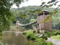
This short, mainly forest walk will take you close to the Semois river and offer beautiful views of its winding valley.
Le Rocher du Pendu and Les Augustins via the Passerelle de l'Épine footbridge
9.30 mi
+1,289 ft
-1,306 ft
5h 25
Moderate
Departure from Bouillon (Belgique) (Province de Luxembourg)
A loop between Corbion and Bouillon, on both banks of the Semois. A castle, an abbey, viewpoints and the crossing of the Semois on the magnificent Passerelle de l'Épine footbridge.
Walk through the Sainte-Cécile forest, between the rocks and the Semois
 4.90 mi
+686 ft
-682 ft
2h 50
Moderate
Departure from Florenville (Province de Luxembourg)
4.90 mi
+686 ft
-682 ft
2h 50
Moderate
Departure from Florenville (Province de Luxembourg)
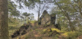
Discover the rocky outcrops of the Rocher du Saltire, and perhaps its heather depending on the season, as well as the view over the Semois from Le Castelain.
Poupehan, Rochehaut and the Frahan ridges
 9.27 mi
+1,972 ft
-1,962 ft
6h 00
Difficult
Departure from Bouillon (Belgique) (Province de Luxembourg)
9.27 mi
+1,972 ft
-1,962 ft
6h 00
Difficult
Departure from Bouillon (Belgique) (Province de Luxembourg)
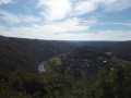
Three villages on the banks of or overlooking the Semois, where you can explore ridges, ladders and viewpoints.
Les Hayons, one of the villages in the Bouillon area
 8.28 mi
+1,391 ft
-1,391 ft
5h 00
Moderate
Departure from Bouillon (Belgique) (Province de Luxembourg)
8.28 mi
+1,391 ft
-1,391 ft
5h 00
Moderate
Departure from Bouillon (Belgique) (Province de Luxembourg)
Roche Levée, Saut des Sorcières, Mont Zatrou viewpoint, Roche Percée: these are just some of the places you will discover on this hike.
Tombeau du Chevalier circular in Herbeumont
 3.78 mi
+282 ft
-266 ft
2h 00
Easy
Departure from Herbeumont (Province de Luxembourg)
3.78 mi
+282 ft
-266 ft
2h 00
Easy
Departure from Herbeumont (Province de Luxembourg)
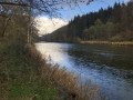
A lovely walk along the Semois on a wooded path with little elevation gain except for a short but steep climb at the end on a narrow path to return to the starting point.
From Château d’Herbeumont to the Libaipire viewpoint
 11.86 mi
+1,627 ft
-1,621 ft
6h 50
Difficult
Departure from Herbeumont (Province de Luxembourg)
11.86 mi
+1,627 ft
-1,621 ft
6h 50
Difficult
Departure from Herbeumont (Province de Luxembourg)
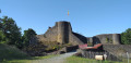
From Château d’Herbeumont, set off via the Herbeumont Viaduct into the Bois de Conques, home to the Grotte des Moines and the 17th-century Redoute des Mauleus. Follow the Semois river, discover the Castelain viewpoint, and return via the Bois de Sainte-Cécile and the Libaipire viewpoint overlooking the Tombeau du Chevalier and Herbeumont Castle.
La Châtelaine
3.44 mi
+1,207 ft
-1,207 ft
2h 40
Easy
Departure from Herbeumont (Province de Luxembourg)
The great classic in Herbeumont. Circular starting from Herbeumont Castle (easy parking). Several passages along the Semois
Circular of the great REX from Botassart
7.23 mi
+1,434 ft
-1,854 ft
4h 35
Moderate
Departure from Bouillon (Belgique) (Province de Luxembourg)
Circular passing by the resting place of the great L.D.
A route with elevation changes and beautiful scenery, but not too difficult. You can even avoid getting your feet wet. About 4½ hours of walking at a good pace.
Passing by the Cave of Saint Remacle de Cugnon
 6.86 mi
+1,017 ft
-997 ft
4h 00
Moderate
Departure from Bertrix (Province de Luxembourg)
6.86 mi
+1,017 ft
-997 ft
4h 00
Moderate
Departure from Bertrix (Province de Luxembourg)
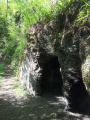
From Château Pierlot, you will visit the Grotte Saint Remacle via the Thibeauroche viewpoint and the bridge. With a little extra climbing, you will reach the Croix viewpoint overlooking the entire valley. The return journey will be along a short section of neglected paths, ending at the Prompt Secours Chapel and the Mergyre viewpoint.
Circular loop above Poupehan
5.18 mi
+748 ft
-768 ft
3h 00
Moderate
Departure from Vresse-sur-Semois (Province de Namur)
A family-friendly circular route along the left bank of the Semois, less touristy. A peaceful route following the Ruisseau des Surais. If the area has been cleared, there is a beautiful view of Poupehan and the Semois valley. Moderate elevation gain on forest tracks. The difficulty is therefore not excessive.
The Frahan ridges in all their glory
 3.88 mi
+492 ft
-499 ft
2h 15
Moderate
Departure from Bouillon (Belgique) (Province de Luxembourg)
3.88 mi
+492 ft
-499 ft
2h 15
Moderate
Departure from Bouillon (Belgique) (Province de Luxembourg)
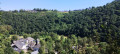
This route combines rural exploration, panoramic views, rocks and forest single trails, between the water's edge and rocky passages. Although the outward journey is not particularly difficult, please note that the ridge crossing is a demanding section that should not be underestimated!
From La Roche aux Corbeaux to the Saint-Bernard Hermitage
 7.30 mi
+1,063 ft
-1,056 ft
4h 15
Moderate
Departure from Bertrix (Province de Luxembourg)
7.30 mi
+1,063 ft
-1,056 ft
4h 15
Moderate
Departure from Bertrix (Province de Luxembourg)
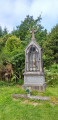
Passing by La Potale and the Chapel of Saint Barbara, patron saint of slate miners, set off to discover the remains of the Hermitage of Saint Bernard of Bertrix, starting from La Roche aux Corbeaux in Herbeumont. Along the way, look out for the various slate quarries known as La Côte de Champion, La Goutelle Husson and Linglé.
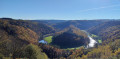
Le Tombeau du Géant, exceptional viewpoint over the Semois
 8.49 mi
+1,211 ft
-1,227 ft
4h 55
Moderate
Departure from Bouillon (Belgique) (Province de Luxembourg)
8.49 mi
+1,211 ft
-1,227 ft
4h 55
Moderate
Departure from Bouillon (Belgique) (Province de Luxembourg)
Set off to explore the Tombeau du Géant viewpoint in Botassart, passing by the ruins of Château le Duc, the Chapel of the Immaculate Conception in Botassart and returning via the Rocher des Gattes viewpoint, the Lyru viewpoint, the Gué des Invasions, also known as the Gué du Loquet, and the two small museums in Ucimont.
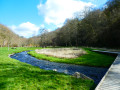
A walk towards the Arboretum and the Château des Fées
 10.80 mi
+1,762 ft
-1,752 ft
6h 30
Difficult
Departure from Bertrix (Province de Luxembourg)
10.80 mi
+1,762 ft
-1,752 ft
6h 30
Difficult
Departure from Bertrix (Province de Luxembourg)
Set off to explore the Château des Fées, a rocky outcrop secured by a few low stone walls, as well as the Bertrix Arboretum, where you can discover numerous specimens of trees from all corners of the world.This beautiful, exclusively woodland walk, which is very quiet, should be considered difficult not only because of its cumulative elevation gain but also due to a few sections on steeply sloping paths or paths that are virtually non-existent on the ground. It’s not the Alps or the Vosges... just Wallonia on the Semois side!
More walks in Pouru-Saint-Remy
Select a point of interest below: