Passing by the Cave of Saint Remacle de Cugnon

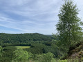
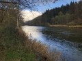
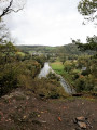
From Château Pierlot, you will visit the Grotte Saint Remacle via the Thibeauroche viewpoint and the bridge. With a little extra climbing, you will reach the Croix viewpoint overlooking the entire valley. The return journey will be along a short section of neglected paths, ending at the Prompt Secours Chapel and the Mergyre viewpoint.

Details

1126556
Creation:
Last update:
Last review:
  • Walking
    Activity: Walking
  • ↔
    Distance: 6.86 mi
  • ◔
    Average duration: 4h 00 
  • ▲
    Difficulty: Moderate

  • ⚐
    Back to start: Yes
  • ↗
    Ascent: + 1,017 ft
  • ↘
    Descent: - 997 ft

  • ▲
    Highest point: 1,234 ft
  • ▼
    Lowest point: 781 ft

Photos

Description of the walk

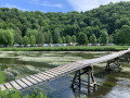
This hike, as initially described, can only be done in good weather following the installation of a temporary wooden bridge over the Semois. This bridge can be installed from May to the end of August, but I advise you to call the tourist office for confirmation (if it is not installed, see practical information).

Parking is available along the road in front of the village house, between the mill and Château Pierlot.

No signposts

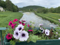
(S/E) With your back to the château, head towards the bridge over the Semois. From the bridge, you can see the mill with its water wheel. Head towards the N865. Turn right.

(1) Go straight up the road on your right, Rue de Thibeauroche. At the house, stay on the tarmac road. Pass the farm in the bend, ignore the farm track just after the farm and the next one at the entrance to the woods. Enter the forest, a little further on your right you will see railings, this is the Thibeauroche viewpoint. Then continue along the forest track until you reach a crossroads.

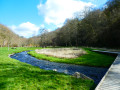
(2) Turn right and descend to the Semois. Cross the wooden bridge, and on the island, take the diagonal path on the right towards the fixed bridge. Cross the bridge and head left towards the campsite barrier.

Red rectangle markings

(3) Turn right before the campsite barrier and take the path along the fence. Follow this path uphill to the crossroads. Leave the markings behind for a circular route including the cave and the Croix de Saint-Remacle. Return via the path in front of you.

No Markings

(4) Turn left towards the cave.
At the fork, go left to explore the cave. Retrace your steps.
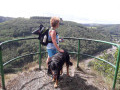
Once back, continue left towards the ascent to the Croix de Saint Remacle, to the left of the shelter. At the viewpoint of the cross, there is an information board and a bench. Return to the ridge path, follow this path into the forest and descend the slope to the edge of the path. As the path is not well marked at the end, you will need to jump over the embankment to get down to the forest path.

(5) Turn right for a few metres and then left at the hairpin bend.

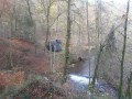
(6) At the end of this path, which is also poorly marked towards the end, do not jump over the embankment straight away, but walk along it to the right to pass a pile of tree trunks left in the middle of the forest path a little further on, and only then descend onto the path. Walk along the stream (not on OpenStreetMap). At the intersection, turn left and cross over the stream.

(7) Turn right onto the next forest path. Be careful, as this section is wilder and muddier because the path has been neglected and there are several tree trunks in the way. Stay on the main path, which further on turns sharply to the left and then climbs.

(8) At the T-junction, you will come to a better-maintained forest path. Turn right and return to the cave junction.

Red rectangle markings

(4) Turn left. Stay on the main path. Ignore a path joining you on your left and continue to the road. Cross and take the path almost opposite.

(9) At the fork, turn right and go downhill. Further down, the path turns sharply to the left until it reaches a T-junction.

(10) Turn right and descend to the road. Ignore the first forest path on your right. Leave the red rectangle markings.

GR® markings

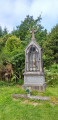
(11) Take the second path on your right, called Sentier Chauchet. At the fork, keep left. The path will be partially secured when you reach the Mergyre viewpoint. Continue up the path to the chapel. Leave theGR® markings.

No markings

Go around the chapel to take the path on its right. When you reach a wide path, continue downhill.

(12) At the bend, go straight ahead on the path opposite. Pass behind a campsite. At the fork, keep left and you will arrive at the corner of a lodge. Take the road leading to the house and return to the car park. (S/E)


Waypoints

  1. S/E : mi 0 - alt. 804 ft - Car park in front of Château Pierlot - Semoy (rivière)
  2. 1 : mi 0.24 - alt. 840 ft - Road on the right
  3. 2 : mi 1.07 - alt. 968 ft - Turn right towards the Semois.
  4. 3 : mi 1.69 - alt. 807 ft - Campsite barrier
  5. 4 : mi 2.4 - alt. 1,027 ft - Cave on the left
  6. 5 : mi 2.91 - alt. 974 ft - On the right
  7. 6 : mi 3.08 - alt. 873 ft - Turn right at the end of the trail.
  8. 7 : mi 3.32 - alt. 922 ft - On the right, forest path
  9. 8 : mi 3.87 - alt. 1,007 ft - On the right
  10. 9 : mi 4.91 - alt. 1,181 ft - Turn right at the fork.
  11. 10 : mi 5.61 - alt. 981 ft - Turn right.
  12. 11 : mi 5.78 - alt. 840 ft - On the right, 2nd path
  13. 12 : mi 6.59 - alt. 912 ft - Path straight ahead in the bend
  14. S/E : mi 6.86 - alt. 804 ft - Car park in front of Pierlot Castle.

Notes

Check with the Bertrix Tourist Office before starting this hike to find out whether the footbridge over the Semois has been installed. If it has not been installed, go directly to (3) via the N832 to the church and then via the Route de la Forteresse to the campsite barrier (3).

This hike cannot be done in the opposite direction because the trailheads at points (5) and (6) will not be visible at all as they are not marked on the embankment.

Worth a visit

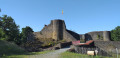
Pierlot Castle: where Hubert Pierlot, Prime Minister of Belgium from 1939 to 1945, lived.

The Mill: with its water wheel, one of the oldest buildings in the village. Built around 1695, it seems, however, that there is evidence of its existence, or of another mill in the locality, as early as 1562.

The "Thibeauroche" viewpoint: the monks of Orval established a barn nearby, which still bears the name of the Thibeauroche farm.

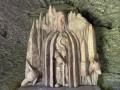
Caves of Saint Remacle: This is actually an oratory comprising three caves dug into the rock face overlooking the Semois. Everything is carved out of schist. The hermitage of Saint Remacle is said to bear witness to the evangelisation of our region in the 7th century. Saint Remacle was known as "the apostle of the Ardennes"...
It is said that Saint Remacle lived there with his donkey, subsisting on donations from neighbouring villages. Legend has it that Satan, having learned that Saint Remacle wanted to build an abbey on this site, transformed himself into a wolf to attack the donkey that served the Saint, but the latter overpowered him and the wolf became his servant!

The Cross of Saint Remacle: At this spot, an orientation table with lenticular images shows what the landscape looked like a century ago.

Chapel of Prompt Relief

Mergyre viewpoint: Halfway up the hillside, cross the rocky massif of the Tonfosse chasm via a staircase carved into the rock to reach the viewpoint. At the top of this rock, protected by a barrier, you can admire the circular loop of the Semois river that encircles the alluvial plain downstream from Linglé, where a slate quarry once cut through the landscape next to the mill and the bridge connecting Mortehan to Bertrix and Herbeumont.

Always be cautious and plan ahead when you're outdoors. Visorando and the author of this route cannot be held responsible for any accidents occurring on this route.

The GR® and PR® markings are the intellectual property of the Fédération Française de Randonnée Pédestre.

Reviews and comments

4.4 / 5
Based on 9 reviews

Reliability of the description
4.1 / 5
Ease of following the route
4.4 / 5
Route interest
4.8 / 5
User 20717695

Overall rating : 4 / 5

Date of your route : Sep 15, 2025
Reliability of the description : ★★★★☆ Good
Ease of following the route : ★★★★☆ Good
Route interest : ★★★★☆ Good
Very busy route : No

After dismantling the wooden bridge, we reached the cave via the chapel, then the viewpoint, and then continued along the road for about two kilometres and took the path on the left, indicated by a small sign.
We returned by the same route. It was a lovely walk, in any case. Given the rustic nature of the caves, you really had to have faith in your bones...
AS08

Machine-translated

lazzerini
lazzerini

Hello Olivier5100,
I'm sorry to hear that the footbridge wasn't up yet. Its installation always depends on the height of the Semois river and the weather. I'll make a note of the information about its installation in a different way.
As for doing the hike in the opposite direction, I would advise against it because the trailheads at (5) and (6) are not clearly marked in that direction. With the GPX track, it is still possible to find your way, but not all hikers use this guidance option.
In any case, I'm glad you enjoyed it despite this initial hiccup.

Best regards

Machine-translated

Olivier5100
Olivier5100

Overall rating : 4 / 5

Date of your route : May 26, 2023
Reliability of the description : ★★☆☆☆ Disappointing
Ease of following the route : ★★★★★ Very good
Route interest : ★★★★★ Very good
Very busy route : No

A very beautiful hike! Beautiful views. Not many people.
A little tip to compensate for the possible absence of the temporary wooden bridge: it's a good idea to do the hike in reverse, starting at point 12!
The description states that the temporary footbridge over the Semois (campsite) between points 2 and 3 is installed from the beginning of May. Unfortunately, this was not (yet) the case (hike done on 26/5)!!!! As a result, I had to turn back at point 2. However, if you do this hike in reverse, when you arrive at point 3 (i.e. towards the end of the hike), you can (as an alternative) simply continue along the GR and easily return to the starting point (if the footbridge has not been rebuilt)! Otherwise, everything was great!

Machine-translated

Rogersh
Rogersh

Overall rating : 5 / 5

Date of your route : Aug 15, 2022
Reliability of the description : ★★★★★ Very good
Ease of following the route : ★★★★★ Very good
Route interest : ★★★★★ Very good
Very busy route : No

A wonderful discovery, a shaded walk for hot days.

Machine-translated

ArinaTomberg
ArinaTomberg

Overall rating : 5 / 5

Date of your route : May 22, 2022
Reliability of the description : ★★★★★ Very good
Ease of following the route : ★★★★★ Very good
Route interest : ★★★★★ Very good
Very busy route : No

Thank you for this lovely walk! The views are magnificent. There are very few people, even on a beautiful Sunday like today. Along the way, there are a few benches: opposite the wicker bridge, at point 4 before turning towards the Grotto, at point 11 and near La Chapelle between points 11 and 12. We used the app, so we found the trail easily.

Machine-translated

avanbrabant
avanbrabant

Overall rating : 4.7 / 5

Date of your route : May 13, 2021
Reliability of the description : ★★★★★ Very good
Ease of following the route : ★★★★☆ Good
Route interest : ★★★★★ Very good
Very busy route : No

A very beautiful route with lovely views of the Semois.
The passage over the Semois footbridge is typical.
Definitely worth doing if you're not afraid of a few climbs.
We did the walk following the GPS route on our smartphone.

Machine-translated

lazzerini
lazzerini

Hello Capichette, and thank you for the information about the trail. I will correct it right away.

Machine-translated

Capichette
Capichette

Overall rating : 5 / 5

Date of your route : May 07, 2021
Reliability of the description : ★★★★★ Very good
Ease of following the route : ★★★★★ Very good
Route interest : ★★★★★ Very good
Very busy route : No

Thank you for the lovely tour.
A small correction from the tourist office: "If I may, you are not at the bottom of Chemin du Facteur but Chemin Chauchet or Chemin Warnichamme. The postman's path is the one at the crossroads in the woods, leaving the caves of St Remacle behind and climbing up towards Auby! It was along the St Remacle path, extended by the small path that people called the "postman's path", that the old postmen, on foot, would climb up to Auby to finish their Mortehan-Cugnon and Auby rounds 🙂"

Machine-translated

SabinePerard
SabinePerard

Overall rating : 4 / 5

Date of your route : Jul 20, 2019
Reliability of the description : ★★★☆☆ Average
Ease of following the route : ★★★★☆ Good
Route interest : ★★★★★ Very good

A very pleasant walk in a beautiful area! However, we did get lost and ended up in Auby... but the detour wasn't too bad, and I'm just starting out with hiking.
I have a few photos, I'll see how to post them.
Thank you in any case for this preparation, the next one will be circular to Dohan.

Machine-translated

henri57
henri57 ★

Hello,

Thank you for your comment.
You rated:

Reliability of the description: Average
Reliability of the map route: Average

Did the description and route cause any problems? If so, how can we remedy this?

We got lost.

When hiking, you need to have several strings to your bow:

1. The description
2. The map-description/terrain relationship with the Visorando map (IGN 1:25,000).
3. Checking your position with the Visorando GPS app or your GPS.

https://www.visorando.com/article-mode-d-...

See you soon!

Machine-translated

myrmyr
myrmyr

Overall rating : 3.3 / 5

Date of your route : Sep 28, 2018
Reliability of the description : ★★★☆☆ Average
Ease of following the route : ★★★☆☆ Average
Route interest : ★★★★☆ Good

As mentioned, the route is not signposted and we got lost. Nevertheless, it was a lovely, varied walk in an area that encourages exploration. Thank you.

Machine-translated

lazzerini
lazzerini

Hello guyarmand,
Thank you for inaugurating this hike.
I did indeed forget to mention the GR trail markings.
I will correct it immediately and it will be changed as soon as it is approved by a moderator.

Thank you again for your vigilance.

Machine-translated

guyarmand
guyarmand

Overall rating : 5 / 5

Date of your route : Jun 03, 2018
Reliability of the description : ★★★★★ Very good
Ease of following the route : ★★★★★ Very good
Route interest : ★★★★★ Very good

One small reservation in the description. At point 11, as soon as you go around the chapel, you leave the GR trail!

Machine-translated

Other walks in the area

For more walks, use our search engine .

The GPS track and description are the property of this route's author. Please do not copy them without permission.