Country:

 City:
City:


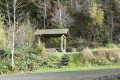
Start from the car park at the end of Rue de l’Abbé Muller, at a place known as Moulin d’en Haut (or Moulin Brûlé).
(S/E) From the bridge over the stream, head up the street towards the village of Sugny for 450 m and turn right onto the path climbing diagonally up the hillside (ignore the path on the right at the Fork in the road). Just before the top, the path curves to the left. Keep close to the left shortly afterwards to exit the woods.
(1) On leaving the woods, continue straight on along the tarmac road, following it to the end (700 m), then take the path on the right (marked by two fir trees at the junction).
(2) At the end of the tarmac road (a row of larch trees runs perpendicular to the road on the right), turn onto the grassy track on the left. Ignore the first track on the right and keep to the right at the first Fork in the road, then turn left at the second Fork in the road (stay on the current track).
This path runs parallel to the contour lines and then climbs slightly. Follow it for approximately 1,400 metres.
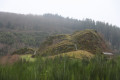
(3) When the path begins to curve leftwards uphill (with a view of the Château de la Roche rock), take the steep little footpath that descends back to the Sugny–Membre road. Please note: this footpath is several metres past the Blue Rectangle walking sign – do not attempt to go down at this point!
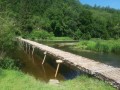
(4) At the bottom, take the small footbridge, then cross the road and join the forest track that climbs opposite. Turn onto the first track on the right at the edge of the woodland, running parallel to the contour lines. (View of the castle ruins)
(5) After 700 m, as the path completes a wide bend to the right, head down at a right angle onto the lower path, which also follows a contour line, and take it to the left until the first junction where the deciduous trees are less dense.
(6) Head down to the right onto the path which leads into a coniferous woodland.
(7) At the second junction, turn left onto the grassy path which heads back downwards. After about a hundred metres, turn left onto the wide firebreak which climbs steeply through the coniferous trees.
Turn right before the stand of deciduous trees. This forest track initially follows the contour line before gradually descending to join the Sugny–Membre road (N935).
(8) Walk up the road for a few metres and turn left towards the village of Laforêt. Immediately after the bridge, turn right onto the path running alongside the stream.
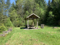
(9) After 300 m, before the fir forest, head left up the steep track which leads into a deciduous woodland. At the first junction, just before the summit, turn right onto the track running parallel to the contour lines. Follow it until you reach a gravel track (marked by a wooden tepee).
(10) Turn right onto this track (known as the Chemin de Sedan) and follow it for about 3 km.
(11) At a place called Grand Chemin de Laforêt, at a large crossroads, continue straight on towards the south (shortcut – see Practical Information).
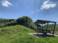
(12) At a place called Mont Franc, by a small teepee-shaped hut, leave the Chemin de Sedan by turning right onto the path running through the woods to begin the descent towards the Membre stream shortly afterwards.
(13) Just before the bottom of the slope, keep to the right at the Fork in the road to take a grassy path running alongside fir trees, which will lead you fairly quickly to the path running along the right bank of the stream. Continue to the Moulin d’en Haut car park (S/E).


 Visorando Member
 Difficult
  Easy
Easy