From Les Glaynées to Woaygnie

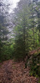
A short, leisurely walk through woodland with varied terrain.

Details

3326746
Creation:
Last update:
Last review:
  • Walking
    Activity: Walking
  • ↔
    Distance: 4.79 mi
  • ◔
    Average duration: 2h 30 
  • ▲
    Difficulty: Easy

  • ⚐
    Back to start: Yes
  • ↗
    Ascent: + 371 ft
  • ↘
    Descent: - 374 ft

  • ▲
    Highest point: 1,053 ft
  • ▼
    Lowest point: 709 ft

Photos

Description of the walk

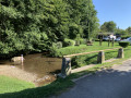
Park in the car park in the village of Olly.

(S/E) Take the Route Forestière du Lazareth opposite. You’ll very quickly reach a crossroads with several paths.

(1) Take the path furthest to the left, which quickly leads to the left bank of the Ruisseau de la Givonne. Follow this bank. Continue along a wide circular path to the right to rejoin the Route Forestière du Lazareth.

(2) Turn left onto it; further on, this track makes a 180° turn to the right. You’ll very quickly reach the junction marked by a sign: ‘No horse riding’.

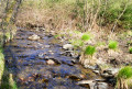
(3) Turn right onto this path; you’ll reach a reforested area and then turn right. You’ll reach the Ruisseau des Franchis. Follow its left bank, veering slightly away from it before rejoining the bank further on by turning right. Turn left again to follow this bank. You’ll reach the junction where you can cross the stream.

(4) Continue along the path on the right bank and, following a circular route, you’ll reach the point where the stream joins the Ruisseau de la Givonne.

(5) You then walk along the left bank of the Givonne and come to a gate after the houses at Châtaimont.

(6) Go through the barrier, go up the hill and you’ll then come back to the junction you passed at the start.

(1) Turn left and follow the same route as on the way there to return to the Olly car park (S/E).


Waypoints

  1. S/E : mi 0 - alt. 755 ft - Olly car park
  2. 1 : mi 0.07 - alt. 751 ft - Crossroads at the end of the circular route. Follow the - Givonne (rivière)
  3. 2 : mi 1.2 - alt. 1,050 ft - Lazareth Forest Road
  4. 3 : mi 2.11 - alt. 1,043 ft - Sign: No horse riding
  5. 4 : mi 3.33 - alt. 781 ft - Crossing the stream
  6. 5 : mi 3.83 - alt. 709 ft - Confluence of the streams
  7. 6 : mi 4.31 - alt. 732 ft - Barrier
  8. S/E : mi 4.79 - alt. 755 ft - Olly car park

Reviews and comments

3.8 / 5
Based on 4 reviews

Reliability of the description
3.8 / 5
Ease of following the route
3.8 / 5
Route interest
4 / 5
ouvre pascale
ouvre pascale

Overall rating : 3.3 / 5

Date of your route : Jun 29, 2026
Reliability of the description : ★★★☆☆ Average
Ease of following the route : ★★★★☆ Good
Route interest : ★★★☆☆ Average
Very busy route : Yes

Many of the paths are impassable, having been badly damaged by foresters and poorly maintained; there is a lot of undergrowth, so you have to use the main paths

Machine-translated

Carabaffe
Carabaffe

Overall rating : 4.3 / 5

Date of your route : Apr 05, 2026
Reliability of the description : ★★★★☆ Good
Ease of following the route : ★★★★☆ Good
Route interest : ★★★★★ Very good
Very busy route : No

Enjoy your walk in the woods. Please note that some sections can be quite muddy depending on the season.
A small error on the route: to cross to the other side at point 4, you need to carry on a little further to find the bridges.

Machine-translated

tioneb
tioneb

Overall rating : 4 / 5

Date of your route : Feb 27, 2022
Reliability of the description : ★★★★☆ Good
Ease of following the route : ★★★★☆ Good
Route interest : ★★★★☆ Good
Very busy route : No

A lovely walk this Sunday. A few muddy patches (to be expected after the rainy spell) but easy to get round.
Don’t hesitate to go a little further to find the right spot to cross the stream towards point 4.

Machine-translated

coulonval08
coulonval08

Overall rating : 3.7 / 5

Date of your route : May 02, 2021
Reliability of the description : ★★★★☆ Good
Ease of following the route : ★★★☆☆ Average
Route interest : ★★★★☆ Good
Very busy route : No

A minor issue with map reading:
- For the start of the route (the description is rather vague)
- Access to point 4, particularly when crossing the stream

Otherwise, a pleasant route

Lots of people in the woods, but not there to do the route

Machine-translated

Other walks in the area

For more walks, use our search engine .

The GPS track and description are the property of this route's author. Please do not copy them without permission.