Country:

 City:
City:


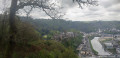
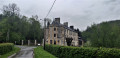
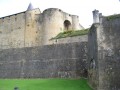
Douves car park at the foot of Sedan Castle.
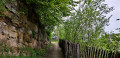
(S) The entrance gate to the ramparts is on your left; take the path leading uphill on your right. When you reach the road, cross with care and take Rue du Vieux Camp opposite.
GR® signposting
(1) At the top, first turn right then left onto Rue du Tournant Simonet. Further on, take the dead-end road closed to lorries. The road becomes a dirt track. You’ll come to a road which you should cross with care. Continue straight on until you reach the crossroads at the hamlet of Garenne.
(2) Take the second path on the left. Walk uphill to a crossroads and turn right. At the next junction, keep to the right on the wide forest track. Walk alongside a cultivated field on your left and, at the next crossroads, turn right. End ofthe GR®
Yellow line markings
(3) Follow the signs for La marche du Général Margueritte. At the road, take the first turn left then right and stay on the dirt track furthest to the right. At the three-way junction, stay on the right-hand track then head down the sunken path.
(4) Continue along the meadow and follow the path straight ahead under the trees. Markings end.
No signposting
Ignore the next path on your right. At the T-junction, turn right and continue to the next junction at a place called La Linette.
(5) Turn left towards Givonne. Walk down the stony path and enter Givonne. Turn left onto Rue de la Côte and walk down to the war memorial. Continue straight on along the main road and keep following it as it bends to the left. Walk past the town hall.
(6) Carry on and ignore the road branching off to your right. Just before you leave the village, continue along the road to the left towards the leisure centre. After crossing over the river, ignore the road on the right and walk to the next one, which has a welcome sign for the Bannet Leisure Centre at its entrance.
(7) Take this road. At the car park, continue into the woods along the path between the two information boards. Keep to your left at the next signpost. At the junction, keep to your left and head down towards the steps. Continue along the path opposite, overlooking the river, until you reach the Fork in the road marked by the Jacquemotte signpost.
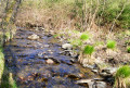
(8) Continue along the forest track as it bends to the right and, a little further on, look out for a small path on your left. Take this path and cross the two small footbridges to cross the Ruisseau des Fraichis. Walk back up to the wide track and continue along it to the left. Follow this forest track for 800 m, ignoring the paths branching off on either side. At the sign indicating hunting days, head down to the left and you’ll come out onto the road.
(9) Turn right towards the house. Walk past it and go through the gate. Take the path leading straight ahead up the slope. At the top, keep to your left and, when you reach the road, turn left. Continue along the road, cross the river and, at the car park, turn right towards Château d’Olly.
(10) Walk past Château d’Olly and take the path leading under the trees on your right. At the top, continue to the right. Pass the Ruins of the Glaynées Wheat Mill on your right. Then ignore the path on the right leading to a private pond, and also ignore the next junction; at the T-junction, take the path on the right.
(11) Ford the leat and then the Ruisseau des Dix Frères, a tributary of the Givonne. At the next junction, keep to the right. Follow the path to the road.
(12) Continue to the left and, further on, pass an old quarry. At the signpost for La Bonne Fontaine, continue along the road for 200 m. Then turn right at Canton du Douaire. Cross the river and turn left immediately. Walk for just under 1 km.
(13) At the fork in the road with a signpost, turn right (path not shown on IGN maps). At the next signpost, after the sharp bend, turn left towards La Belle Église. Walk for just over 1.3 km and you’ll reach the hamlet of La Belle Église. You are now at the border with Belgium.
(14) Turn right and walk to the road, following the ditch that marks the border. Turn right and walk carefully along the road for 450 m. Continue along the dirt track ahead of you. You’ll come to a road; follow it downhill until you reach another road, which you’ll follow to the right. Follow this road carefully until you reach the green ‘Point Nœud Vélo 5’ sign.
(15) Walk past it and take the forest track with the ‘No Vehicles’ sign at the entrance, a little further up on your left. Walk along this track until you reach the mast.
(16) Turn left and head towards the woods, ignoring the farm track on your right. Follow the main path, ignoring any other paths branching off, until you enter the woods. Turn right onto thefirst path opposite the tree marked S13.
(17) Walk down through the broom. You’ll come out onto a wide path; turn right. You’ll arrive at the Bouillon Arboretum. Follow theGR® path branching off to the left. Ignore the path directly to your left and stay on the level path. Pass the hamlet known as Arboretum Botanique and stay on this path until you reach the road. Follow the path near the concrete electricity pole on your left. Return to the road and head downhill to the white house on your right.
(18) Take the hairpin bend to the left, towards Ramonette. Continue along the path running alongside house no. 5. Follow the path to the viewpoint, from where you’ll have a magnificent view of Bouillon Castle. Continue along the path to the left of the viewpoint. Walk down the path until you reach the road. Turn right, carry on straight ahead, passing the tunnel on your right, and walk to the Pont de Cordemoy at the foot of Bouillon Castle (E).

 Visorando Member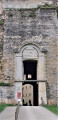

 Easy
Easy