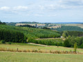
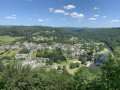
Le Tombeau du Géant, exceptional viewpoint over the Semois

Set off to explore the Tombeau du Géant viewpoint in Botassart, passing by the ruins of Château le Duc, the Chapel of the Immaculate Conception in Botassart and returning via the Rocher des Gattes viewpoint, the Lyru viewpoint, the Gué des Invasions, also known as the Gué du Loquet, and the two small museums in Ucimont.

Details

29033712
Creation:
Last update:
Last review:
  • Walking
    Activity: Walking
  • ↔
    Distance: 8.49 mi
  • ◔
    Average duration: 4h 55 
  • ▲
    Difficulty: Moderate

  • ⚐
    Back to start: Yes
  • ↗
    Ascent: + 1,211 ft
  • ↘
    Descent: - 1,227 ft

  • ▲
    Highest point: 1,270 ft
  • ▼
    Lowest point: 673 ft

Photos

Description of the walk

Parking at the village hall "Les Ondines" Rue du Château le Duc in Ucimont.

No markings

(S/E) With your back to the hall, turn right. At the crossroads, turn left into Rue du Champs du Tu. At the intersection, continue to the right. Pass the last house. Walk alongside the Christmas tree plantation. After a lone deciduous tree on your right, take the path through the pine plantation.

(1) Follow this path to the foot of the large conifers opposite you once you are in the plot, cross them and continue downhill. Follow the path that turns sharply to the right. Further on, pass the stream and climb up to a crossroads.

(2) Turn right and then immediately right again at the fork towards Château le Duc. Explore the ruins. Climb the embankment and cross through the middle of the ruins. Look for the barriers framing the old well on your right. Return to the path and continue along it, crossing through the ferns. Go downhill, keep to your left and return to the entrance to the ruins. Take the path you came on and, at the intersection before the crossroads, turn right. Go down the path. At Grand Ruisseau, stay on the main path until you reach the road.

(3) Cross carefully and continue along the stony path opposite. At the T-junction, with Bovomoulin on your left (read during the hike), continue to the right. Climb up to the road. Look for the Marian stele under the fir trees on your right. Continue to the left, walking carefully along the road. Enter the village of Ucimont, pass house no. 68 and turn left onto the farm track just after it.

(4) Walk downhill for 500 m and, at the intersection, continue along the path going uphill to the right. Walk for 700 m along this path, which becomes a forest track, until you reach the multiple crossroads at a place called "Le Mairy"

(5) Turn right and you will arrive near a villa. Turn right and walk to the road. Continue to the left. Pass in front of the Chapel of the Immaculate Conception of Botassart. Follow the road until you reach the car park at the Giant's Tomb viewpoint. Cross it and discover the Giant's Tomb viewpoint.

(6) Take the stairs down to the road, cross it and continue along the path opposite.

Red Rectangle Marking 4

Go down the path and ignore the one on your left (red rectangle 5), stay on the wider path which descends more gently. At the bottom, continue along the less marked path opposite. Follow the markings and pass the Rocher des Gattes viewpoint. With your back to it, continue to the left. Before the clearing, turn left and discover the Lyru viewpoint. Continue to follow the markings, cross a ravine and you will come to a forest path. Leave the markings.

No markings

(7) Ignore the path leading opposite the Chateaumont viewpoint, as it is not worth the effort, and turn left onto the forest track. Walk for 1.1 km until you reach a wide path descending on your left.

(8) Descend. Cross the forest path and continue straight ahead.

Red cycle route signposting

Walk along this path for 400 m until you come to a path on your left. Walk along this path and back to discover the Invasions stele, not far from the Gué du Loquet, which was often used during successive wars. Retrace your steps and continue to the left. In the bend, look for a path descending to your left with a tree marked with a red bicycle sign at its entrance.

(9) Take the path and descend carefully. Fork the stream and follow the path until you reach another path. Go up to the right on a path that returns to your right. At the intersection, turn left onto the path with a tree at the entrance bearing the number 35 in fluorescent red framed in green and stay on the main forest path. Abandon the markings.

No markings

(10) Go up this forest path. It turns sharply, and a path comes back on your left (not visible on maps). Immediately after, look for the path on your left at the corner of a young fir tree plantation.

(11) Descend this path. Further on, cross the ford and turn right at the intersection. Follow theGR® markings as you climb this path, which becomes a track, until you reach a stony path. Turn left and then immediately right at the football goals. Walk along the pitch towards the far corner. Look for a campfire area and, immediately afterwards, the forest path starting under the trees. Take this path; another path will appear on your right (not visible on maps). Walk until you reach a path on your left.

(12) Turn onto this path and you will come to a bend in a forest track. Continue to the left and follow the grassy bend. Look for a tree with the number 29 in fluorescent red surrounded by fluorescent green on your right.

(13) Turn right onto this path. Go downhill, cross the stream and return to a wider path. Turn right and walk uphill until you reach Ucimont. At the road, turn left and go around the small park in front of you on the left. Walk past the Musée des Lavandières.

(14) Walk up Rue de la Fontinelle, which runs alongside this park. At the intersection with Rue du Château le Duc, look for the Musée des Métiers (Museum of Trades) near the drinking trough, then turn right. At the crossroads, continue straight ahead and return to the Salle les Ondines and your car park. (S/E)

Waypoints

  1. S/E : mi 0 - alt. 1,198 ft - Les Ondines hall
  2. 1 : mi 0.44 - alt. 1,263 ft - Path crossing a Christmas tree plantation.
  3. 2 : mi 1.04 - alt. 1,263 ft - Crossroads near Château le Duc
  4. 3 : mi 1.95 - alt. 1,112 ft - Road
  5. 4 : mi 2.46 - alt. 1,175 ft - Farm track after No. 68.
  6. 5 : mi 3.22 - alt. 1,152 ft - The Mairy
  7. 6 : mi 3.96 - alt. 1,129 ft - Viewpoint over the - Tombeau du Géant (Botassart - Belgique)
  8. 7 : mi 4.73 - alt. 942 ft - Forest path. Overlooking the - Semoy (rivière)
  9. 8 : mi 5.44 - alt. 840 ft - Downhill path
  10. 9 : mi 5.94 - alt. 778 ft - Downhill trail
  11. 10 : mi 6.61 - alt. 955 ft - Tree with 35 in fluorescent red framed in green.
  12. 11 : mi 6.86 - alt. 1,033 ft - Trail through the fir forest
  13. 12 : mi 7.55 - alt. 1,135 ft - Path on the left
  14. 13 : mi 7.76 - alt. 1,125 ft - Tree with 29 in fluorescent red framed in green.
  15. 14 : mi 8.26 - alt. 1,142 ft - Musée des Lavandières (Washerwomen's Museum)
  16. S/E : mi 8.49 - alt. 1,198 ft - Les Ondines hall

Notes

Food and drink available at the Géant viewpoint during the summer.

From October to December, bear in mind the hunting season.

During periods of high water, check for information as between (9) and (10) you will be passing very close to the Semois.

Studded shoes are recommended as the undergrowth is very leafy in autumn.

Benches at Château le Duc, at (6): Géant viewpoint, at the Rocher des Gattes viewpoint between (6) and (7), Lyru viewpoint between (6) and (7), at the football pitch after (11).

Drinking water at the watering hole in Ucimont.

Worth a visit

During
Château le Duc: Château le Duc and its owners, the Counts of Ardenne-Verdun family, ancestors of Godfrey of Bouillon. Built around the 9th century. The western part was used as a quarry. In the northern part of the courtyard, a cistern was found during excavations in 1975. A text recalls that in 1574 the château was still beautiful and grand.

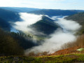
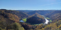
Tombeau du Géant (Giant's Tomb): classified as "exceptional heritage of Wallonia" and "natural heritage of landscape interest". It is undoubtedly one of the best known and most photographed sites in Belgium, with its superb circular loop of the wild Semois river. According to legend, a Treveri giant is buried there who, refusing to be taken prisoner by the Romans after the Battle of the Sambre, preferred to throw himself into the void at the "Rcher des Gattes" rather than die in the arenas of the Colosseum. It is also a historic site crossed by a path once used by the Germanic tribes. It was still used in 1914 and 1940 by Prussian and German troops.

At the T-junction after the (3), you can see the reconstruction of the Bovomoulin water wheel. The road passing in front of the lodge is communal. Round trip 100 m.

Viewpoint at Rocher des Gattes.
Lyru viewpoint.
Locquet ford or Invasions ford, also known as Gernonwez ford.

Always be cautious and plan ahead when you're outdoors. Visorando and the author of this route cannot be held responsible for any accidents occurring on this route.

The GR® and PR® markings are the intellectual property of the Fédération Française de Randonnée Pédestre.

Reviews and comments

4.6 / 5
Based on 6 reviews

Reliability of the description
4.6 / 5
Ease of following the route
4.4 / 5
Route interest
4.8 / 5
User 26648267

Overall rating : 4.7 / 5

Date of your route : Jan 12, 2026
Reliability of the description : ★★★★★ Very good
Ease of following the route : ★★★★☆ Good
Route interest : ★★★★★ Very good
Very busy route : No

Very beautiful course

Machine-translated

EG67
EG67

Overall rating : 5 / 5

Date of your route : Aug 26, 2024
Reliability of the description : ★★★★★ Very good
Ease of following the route : ★★★★★ Very good
Route interest : ★★★★★ Very good
Very busy route : No

Hello

A very beautiful hike in the Ardennes forest, very pleasant to do, not very busy, with good directions for the route to follow in the printable guide or using the Visiorando app.

There is a beautiful view of the Giant's Tomb, which is a pleasure to discover on foot thanks to this hike.

Thank you for this suggested route in the beautiful Belgian Ardennes region.

Eric (Strasbourg, Alsace, France)

Machine-translated

Bpeu
Bpeu

Overall rating : 4 / 5

Date of your route : Aug 13, 2023
Reliability of the description : ★★★★☆ Good
Ease of following the route : ★★★★☆ Good
Route interest : ★★★★☆ Good
Very busy route : No

A pleasant hike, you can choose between 1 to 4 hours from the start of the hike. In this case, the hike takes about 3 hours of walking.

Machine-translated

lazzerini
lazzerini

With pleasure, Jacques
Château-le-duc must have been beautiful with the heather in bloom.
During my reconnaissance, I came across a fox cub near the well, napping in the grass.
Bovomoulin is a lodge, and there were people outside when I passed by. Although the path in front of it is public, I felt like an intruder.
However, I will take up your suggestion in the information section.

All the best, and say hello to "mamyness" for me.

Machine-translated

jacques.nys
jacques.nys

Overall rating : 5 / 5

Date of your route : Aug 10, 2023
Reliability of the description : Not used / Not applicable
Ease of following the route : Not used / Not applicable
Route interest : ★★★★★ Very good
Very busy route : No

Once again, many thanks, Carla, for this suggestion
As usual, we adapted the route to suit our style, extending it to 19 kilometres and covering a little more countryside on the Sensenruth and Curfoz side.
The heather was already in bloom at the Château le Duc site...
The BOVOMOULIN waterwheel is a splendid reconstruction that is well worth a detour (100 m there and back).
We met a total of five people along the route.
Also worth discovering in seasons other than summer :-)

Machine-translated

MSkyfall
MSkyfall

Yes, absolutely. I plan to go back and do it again as soon as possible because I really think the places you pass through are worth seeing ;-)

Machine-translated

lazzerini
lazzerini

Thank you for all your explanations. I will add a few details about the fir tree cultivation because there are still quite a few people who take the paper explanation and sometimes it is not obvious (to explain the route and interpret what is written). As for the trail to the Giant's Tomb, the red rectangle 5 and 4 start at the same place. Number 5 starts a little lower down on the left and is very steep, while number 4 stays on the wider path with a gentler slope. From there, you arrive at the less marked path, which is also signposted. Number 5 leads further down and ends near the Semois with unmarked paths.
Thank you for your help. I hope this is only a temporary setback, as the hike is enjoyable and not very busy (except at the viewpoint).

Machine-translated

MSkyfall
MSkyfall

Hello,
I just compared the map linked to this hike (on the Visorando website) with the route recorded by my watch.
We took the right-hand path through the farmland because it says that when you reach the deciduous trees, you have to cross the pine forest... We took the description literally and headed to the right. However, I can see on the hike map that we should have gone to the conifers in front of us...
In fact, if we had done that, we would have come across the ruins... Mea culpa.

Machine-translated

MSkyfall
MSkyfall

Hello,
I will try to clarify the elements that I am taking directly from the description.

(S/E) With your back to the hall, turn right. At the crossroads, turn left into Rue du Champs du Tu. At the intersection, continue to the right. Pass the last house. Walk alongside the Christmas tree plantation. After a lone deciduous tree on your right, take the path, still on your right, and cross the Christmas tree plantation.
=> PERFECT SO FAR

"(1) Follow this path to the foot of the tall conifers, cross through them and continue downhill." => We did this, but couldn't find the famous descent.

"Follow the path that turns sharply to the right. Further on, cross the stream and climb up to a crossroads."

=>As we couldn't find the descent or the path that turns sharply to the right, everything else was complicated. We still managed to end up on a road, which we climbed to the... starting point of the walk... from where we walked along the road to the giant's tomb. We thought that from there it would be easy to get back on the right track.

But once we arrived at the Giant's Tomb, we took the path that descends on the other side of the road after going down the stairs. But this is the red rectangle 5 and not 4 (which we didn't see). So, once again, we had to improvise... we ended up at the edge of the Semois and climbed back up the other side.

It was strange because this is not the first time, far from it, that we have used Visorando walks (which we print out on paper). We really tried to follow the description as closely as possible, but it was difficult to find our way. It's a shame, because I think the walk is really worthwhile. But yes, we will use the app next time...

===> In fact, at the isolated deciduous tree in paragraph (S/E), we turned right and crossed the field to the conifers. I wonder if we should have gone towards the conifers opposite us rather than those on the right at the end of the fenced field...

Machine-translated

lazzerini
lazzerini

Hello MSkyfall,
I'm sorry to hear that you weren't able to complete this hike.

I must admit that I'm a little confused by your explanation
You mention a descent that you couldn't find, then the giant's tomb, then ruins...

Could you give me some details: which descent are you talking about? Because the first descent is after you cross the fir tree plantation and is not hidden by vegetation at all. Did you cross the fir tree plantation?
Because from there, you first arrive at the castle ruins and much later you arrive at the viewpoint of the giant's tomb... and not the other way around.

For future reference, I recommend downloading the Visorando app, which is free and uses Open Street Map as its base map.
Without signposts to follow, which is often the case on my hikes, there can always be some doubt.
And if I can improve thanks to your more precise feedback, I will be sure to do so.

Best regards

Machine-translated

MSkyfall
MSkyfall
• Edited:

Overall rating : 4 / 5

Date of your route : May 29, 2023
Reliability of the description : ★★★★☆ Good
Ease of following the route : ★★★★☆ Good
Route interest : Not used / Not applicable
Very busy route : No

Finding the starting point was easy. The beginning of the walk was very well described. But we couldn't find the descent (hidden by vegetation?). So we decided to improvise.
Then, to reach the giant's tomb via the footpath, either the signs had disappeared or they were incorrect.
We never made it to the ruins and improvised for the rest of the walk.
We were disappointed because we had high expectations for this discovery in the Ardennes.
The setting was superb, however.

Machine-translated

lucvertongen
lucvertongen

Overall rating : 5 / 5

Date of your route : May 08, 2023
Reliability of the description : ★★★★★ Very good
Ease of following the route : ★★★★★ Very good
Route interest : ★★★★★ Very good
Very busy route : No

A very beautiful hike that passes through tourist attractions (the Giant's Tomb) but always along pretty, secluded paths. Very few people encountered along the way.

Machine-translated

Other walks in the area

For more walks, use our search engine .

The GPS track and description are the property of this route's author. Please do not copy them without permission.