


 Country:

 City:
City:



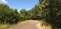
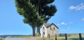
A few parking spaces on the Route du Sati, not far from Dohan Church.
(S/E) Head towards Dohan-Haut church. Go past the church and head towards the monument. Go round it on the left.
Red Rectangle 17 signpost
(1) Take the steps carved into the rock, just behind the monument, alongside the fence. Climb up towards the statue of the Virgin Mary. Continue uphill and pass the hamlet of Pasay d’Auby. Ignore the path on the right (not shown on the OSM map) and carry on uphill. At the top, discover the Viaumont viewpoint.
(2) Follow the path. Ignore the path on your left between the property and a fir forest. Carry on straight ahead. The path turns left. At the T-junction, continue to the right. The path turns left and then left again a little further on. You’ll come to a fork on your right leading to the Rivage de Marion viewpoint, which is of no interest (a detour not worth making).
(3) Ignore the path to the viewpoint and carry on straight ahead. Head downhill until you reach a forest track. Change of signposting.
Red Rectangle 21 signpost
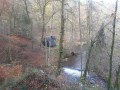
(4) Continue along the path to the left. Cross over the Ruisseau des Gorges, which is channelled beneath the path. Follow it from a distance. Cross the stream again – still channelled beneath the path – and now follow it on your right. Climb up tothe first hairpin bend on your left. Change of signposting.
GR® signposting
(5) Turn left. At the Fork in the road, keep to the left. Cross the dry stream (as at late July 2022). Climb up and walk out into the open, with a view over the valley. You’ll come to another path at the top, at a place called Germone.
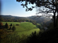
(6) Head right. At the road, enjoy a panoramic view of Dohan and the valley, then head right. Turn ontothe first path on the left. Walk downhill to the slightly offset crossroads.
(7) Turn right. Follow this contour path, cross a stream and, at the forest track, continue to the left. Head downhill. At the Fork in the road, keep to your left. Walk to the grassy crossroads.
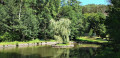
(8) Turn left. Then let the faintly marked path continue straight ahead and follow the clearly marked path turning to the right. Walk downhill to the road. Cross carefully and continue along the path opposite. View of the Moulin Hideux pond. Follow the wide path, leaving a path on your left, until you reach the three-way junction.
(9) Take the middle path and begin a steep climb. Pass through the hamlet of Hounaimont. At the crossroads (only visible on the IGN map), carry on straight ahead.
(10) Join a forest track and continue to the right until you reach the road. Turn right to discover the Chapel of Buhan and a panoramic view over the Bouillon countryside. Retrace your steps. Go past the path you came from. Walk along the road for just over 350 m, passing the hamlet of Hasay de Ha, and look out for the footpath immediately afterwards, on your left.
(11) Take the path and head downhill. A stream runs alongside the path. Continue downhill until you reach the road. Turn left towards the barbecue area at the hamlet known as Les Enclaves.
No signposting
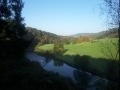
(12) Follow the road as it bends to the left. Walk alongside the Moulin Hideux stream. At the ‘Give Way’ sign, turn right and take the disused road. Walk for 2 km. At the end of the disused road, go round the gate and continue along the road. Another road joins from your right. Walk to the dirt track just past the statue of Mary.
(13) Take the dirt track on your right. At the road, continue to the right and, at thefirst road on the left, turn off to return to your car park (S/E).


 Visorando Member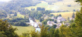

 Easy
Easy 
 Very difficult
