Country:

 City:
City:


Parking in the bend of the N 884 leading from Mortehan to Herbeumont, as close as possible to the Semois.
(S/E) Heading towards Herbeumont, cross the road carefully to reach the car park on the opposite side. Look for the path climbing up to your left.
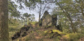
(1) Climb up and follow the path to the Roche aux Corbeaux viewpoint.
(2) Continue until you reach a wide forest path.
(3) Turn right and look for the path starting on the right. Follow it uphill until you reach a wider forest track. Continue along it to the left, passing the antenna, and walk to the crossroads.
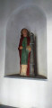
(4) Head straight ahead towards the picnic tables. On your right, you will see the Potale Sainte Barbe. After this, take the grassy path on the right and, further on, keep to the left. The path becomes a track and turns sharply to the right. You will come to a multiple junction.
(5) Take the second path on the left, which slopes slightly. Return to a wider forest path and continue until you reach a path on your left, marked with a tree with the inscription BU 5 to 7 bis Yellow on a red background on the trunk.
(6) Turn and cross over the stream. Continue along the path that turns left and descends for 700 m. Join another path and continue to the right. Climb back up and pass a white rock on the ground. Continue along the forest track.
(7) Continue along the path opposite and begin to descend. Return to a path and turn left.
(8) Take the path on the right. The stream splits in two; follow the one on the right.
(9) The path passes over the other stream. Continue and turn right at the hairpin bend when you reach another path. Follow the path passing near the Ardoisière de la Goutelle Husson and walk to a fork.
(10) Turn left and continue until you reach a wide forest path.
GR®® markings
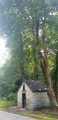
Turn left and continue to the road (N884). Take this road to the right and walk carefully to the Sainte Barbe Chapel. Turn around and go through the tunnel. Then look for the path on your right.
(11) Climb this path to reach the old railway line, which you follow to the right. Walk for about 750 m until you see a path on your right, which you take.
(12) Keep to the right at the picnic table and descend to the wide forest path. Turn right and climb up to a path on your left.
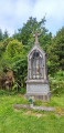
(13) Walk up another 50 metres to see the ruins of the hermitage on your left. Retrace your steps and walk up the forest path, now on your right. You will come to a wide forest path.
(14) Turn left and walk for 1 km until you reach a fenced meadow on your left.
(15) Go past the gates closing off the meadow and take the path running alongside the fence. Go down the path and continue downhill for 800 m until you reach the bottom. You are now not far from the Linglé slate quarry.
(16) Turn left and walk to the road. Turn right and carefully follow the road. Cross over and take the dirt track going up to the left of the house. Walk uphill, passing the Côte de Champion slate quarry, for 600 m until you reach the path you took on the way there, on your right.
(3) Turn right and follow the same route you took on the way there to return to the N884 car park. (S/E)
 Visorando Member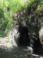

 Difficult
 Easy
Easy