


Refine your search for walks in Église Saint-Rémi (Pouru-Saint-Remy)
Église Saint-Rémi (Pouru-Saint-Remy) walks


 From Douzy (Camping du Lac) to Chassepierre
 Visorando Member
 14.70 mi
 +958 ft
 -551 ft
 2.5 hrs
 Moderate
 Departure from Douzy (Ardennes)
From Lac de Douzy, after passing through the Forges de Brévilly industrial site – which was very active in the 19th century – we reach the nearby Belgian border (10 km) via a small road that turns into a track suitable for vehicles. From there, simply follow numbers 30, then 11, then 13 on the cycle network’s ‘points-nœuds’ system to reach the village of Chassepierre and the campsite on the banks of the Semois. Halfway along the route, after Muno, a short walk takes you to a remarkable geological feature.
Lorraine, Gaume and Guttland Route (Metz – Chassepierre – Luxembourg)
248.55 mi
+8,120 ft
-8,127 ft
5 days
 Difficult
Departure from Lorry-lès-Metz (Moselle)
Difficult
Departure from Lorry-lès-Metz (Moselle)
Two borders, three countries, several castles, a river and winding streams punctuate this short cycle trip. The route often follows valleys, so the elevation gain is not very significant. It almost always follows dedicated routes, including smooth cycle paths, footpaths or shared roads with very little motor traffic. If all the cultural attractions appeal to you, you’ll need to allow an extra day or two – which is possible, for example, by camping in Inor (Meuse) and Hesperange (Luxembourg).
Walks near Église Saint-Rémi (Pouru-Saint-Remy)
 Bouillon – Florenville
 16.41 mi
+1,529 ft
-1,470 ft
8h 55
16.41 mi
+1,529 ft
-1,470 ft
8h 55
 Very difficult
Departure from Bouillon (Belgique) (Province de Luxembourg)
Very difficult
Departure from Bouillon (Belgique) (Province de Luxembourg)
Leaving Bouillon and its castle to reach Florenville means linking the two ends of the Semois by crossing the plateau and its forests rather than following the river’s course and meanders; it is therefore a long climb followed by a gradual descent; it also means leaving a town on tarmac, travelling along stony paths and dirt tracks, crossing two fords, and returning to tarmac to reach the town again. And it’s a long walk of over 26 kilometres. The accommodation I’ve chosen in Florenville is the campsite.
From Bouillon Castle to Sedan Castle
14.14 mi
+1,385 ft
-1,601 ft
7h 40
Difficult
Departure from Bouillon (Belgique) (Province de Luxembourg)
This fully signposted cross-border trail links Bouillon Castle in Belgium to Sedan Castle in France.
This is one of the possible return routes for the hike from one castle to another across the border, hike no. 36479520
After following the Semois river, you will climb up to Corbion, a small village perched high in the municipality of Bouillon. Then, after crossing the border stream near the "Maison Verlaine", you will join the old Bouillonnais road, which will take you gently to the Sedan region.
From Chassepierre to Pétange (Luxembourg) along the Semois
46.66 mi
+1,430 ft
-1,398 ft
6 hrs
Difficult
Departure from Florenville (Province de Luxembourg)
For most of the route, this third stage follows roads suitable for cycling, smooth paths and cycle lanes. The Semois meanders so much that it is impossible to ‘follow’ it along its entire length, but this route crosses it numerous times and heads all the way up to its source in Arlon!The ride takes you through the Gaume and the Arlon region, away from the main roads with heavy motor traffic.
Chassepierre – Arlon Official Campsite
47.67 mi
+1,962 ft
-1,634 ft
8 hrs
Difficult
Departure from Florenville (Province de Luxembourg)
Starting from Chassepierre, this route through the Gaume region allows time to visit remarkable cultural sites and another of the ‘most beautiful villages in Wallonia’. This involves a few detours, but fewer than those along the Semois, where the route cuts across several bends! The route description refers to the ‘nodes’ of the cycle network developed in Belgium. The route includes a loop through Arlon to the viewpoint at the top of Knippchen, which can be done in the evening or the following morning.
Chassepierre – Longuyon
36.76 mi
+2,024 ft
-2,254 ft
7 hrs
Difficult
Departure from Florenville (Province de Luxembourg)
For a return trip to Metz in a single day, this route takes you to Longuyon station. Provided you set off early enough, you’ll be able to visit Orval Abbey, then the citadel of Montmédy, stop for lunch by the Étang de Charency-Vezin and reach Longuyon by mid-afternoon.
Circular of the great REX from Botassart
7.23 mi
+1,434 ft
-1,854 ft
4h 35
Moderate
Departure from Bouillon (Belgique) (Province de Luxembourg)
Circular passing by the resting place of the great L.D.
A route with elevation changes and beautiful scenery, but not too difficult. You can even avoid getting your feet wet. About 4½ hours of walking at a good pace.
Florenville – Meix-devant-Virton
12.75 mi
+719 ft
-896 ft
6h 30
Difficult
Departure from Florenville (Province de Luxembourg)
From Florenville to Meix-devant-Virton, our path will take us along a succession of forest tracks and paths and gravel roads. It also means leaving the gentle riverbank behind to venture deep into the steeply wooded massif on the southern slope of the Semois.
Rochehaut – Bouillon
 7.89 mi
+1,168 ft
-1,270 ft
4h 40
Moderate
Departure from Bouillon (Belgique) (Province de Luxembourg)
7.89 mi
+1,168 ft
-1,270 ft
4h 40
Moderate
Departure from Bouillon (Belgique) (Province de Luxembourg)
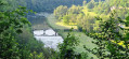
The starting point, the Rochehaut viewpoint, is one of the region’s most beautiful spots, offering a bird’s-eye view of a circular bend in the River Semois and the little village of Frahant. As for the finishing point, it is one of the most popular tourist attractions, with its superb fortified castle perched above the town. In between, along the way, there are forests, steep ascents and descents, and magnificent scenery. Accommodation at the Youth Hostel.