Country:

 City:
City:


Car park in front of the Fond de Givonne football ground, next to the dog club’s training ground
(S/E) Walk up the hill to the crossroads and take the track reserved for farm vehicles leading down to the right.
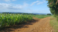
(1) Continue straight on up the Côte des Triples Levrettes to enjoy the panoramic view over the market gardeners’ fields at Fond de Givonne and the hills of Sedan.
Head down the zigzagging track towards the bottom of Remilly. When you reach the crossroads at the bottom, continue along the grassy track opposite, with a market gardener’s field on your right and a pasture on your left.
Stay on this path until you come to a track leading up into the woods on the right.
Climb until you come to a path running at right angles. Turn right and continue uphill to the edge of the woods.
(2) At the crossroads of tracks at the edge of the woods, turn left to enter the Gibou woods. Cross the woods, staying on this main track. On emerging from the woods, you’ll arrive at the Haut de Bazeilles.
As you continue, you’ll see the village of Illy below on your left.
After a 90° left-hand bend, you’ll reach a crossroads of tracks. Join theGR® 14 here and continue straight on towards Illy.
When you reach the tarmac road, turn left and stay on theGR® 14. Walk up the hill.
(3) Illy wayside cross. Panoramic view over the Val d’Illy with a map marker, a table and a bench for a picnic or simply a moment’s rest.
Leave the tarmac road and stay on theGR®14(path opposite the Calvary). Head for the small copse opposite, then stay on theGR®14by turning right onto the track.
Continue along this path until you reach a steep ‘S’-shaped climb. Once at the top, you’ll find a clearing on your left with a bin where you can dispose of any rubbish.
(4) At the crossroads, take the track on the right towards the Croix Margueritte (1.2 km, as indicated on the signpost). Follow the Fond du Loup (GR® 14). As you reach the Terme, enjoy the view of Sedan below and the woods of La Marfée in the distance on the horizon.
You’ll come to a three-way junction (with a small cottage on the right). Turn left onto the Chemin de l’Hôtel de la Patrie towards Floing.
(5) Weimar Stele: a memorial to the 94th Bavarian Infantry Regiment, which was decimated during the battle that took place on the Terme on 1 September 1970 (Battle of Sedan).
100 metres further on, on the left, is the Croix Margueritte, erected in memory of General Jean-Auguste Margueritte, who was fatally wounded in the head on 1 September 1870 nearby.
Continue straight on towards Floing. At the next junction, take the first track leading down to the left towards the grave of Camille Varaigne.
(6) The grave of Commander de Varaigne, an officer in the 3rd Regiment of African Chasseurs, who died in action on 1 September 1870 and was buried here.
Retrace your steps to rejoin theGR® 14. Turn left again towards Floing.
(7) Memorial erected in honour of the officers and soldiers of the 12th Regiment of African Chasseurs who died for France during the Battle of Sedan (1 September 1870).
Head down theGR® 14 to the left towards Floing. Walk past the Floing military cemetery on your right (2,000 victims of the Second World War) and continue down towards the village.
(8) To the left of the road lies the military cemetery where, in 1950, the remains of the soldiers who died for France during the Battle of Sedan on1 September 1870 were gathered.
Continue down Rue des Braves Gens, then turn left and walk behind the church to head down towards the town hall square.
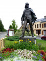
(9) Statue of General Margueritte. Turn left and follow Rue Charles de Gaulle towards Sedan.
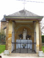
(10) Chapel of Notre-Dame de la Consolation (commonly known as the Virgin of Floing).
Turn left and walk up Allée de la Division Margueritte, then continue along Allée des Épinettes.
At the top of the hill, turn left and walk through the “Épinettes” housing estate. To do this, follow Allée des Pervenches; then, when you reach Allée des Violettes, turn right and head back down.
At the next junction, head left up Avenue André Payer. The tarmac ends at the former care home on the right-hand side of the road. Continue up the track to the top of the steep slope.
At the junction at the top of the track, you’ll be at the entrance to the Bois de la Garenne.
(11) Head down to the right. 200 to 300 metres further on, you’ll come to a three-way junction. Take the left-hand path down towards the Garenne housing estate.
At the bottom of the descent, turn left.
At the next junction, follow the tarmac road going uphill opposite towards Route de la Garenne.
At the next junction, turn right to reach the football ground (S/E).


 Visorando Member

 Easy
Easy