


A new car park is available at the starting point
🧭 Full details of this walk: here you’ll find a detailed description, advice based on site reconnaissance, points of interest, the IGN map and any updates to the route.


This 12.5 km circular route starting from Sainte-Cécile takes you to explore the new Himalayan-style footbridge overlooking the Semois, before heading into the magnificent forests of the Épioux estate.
Three superb viewpoints line the route: the Castelain, the Vanne des Moines and the spectacular Rocher du Chat.
The return journey follows a lovely moss-covered path before passing under the footbridge and then crossing it a second time. A very varied walk that alternates between forests, panoramic views, rocky outcrops and the river.


 Country:
Belgium
Country:
Belgium

 City:
Florenville
City:
Florenville 


A new car park is available at the starting point
🧭 Full details of this walk: here you’ll find a detailed description, advice based on site reconnaissance, points of interest, the IGN map and any updates to the route.

Overall rating : 5 / 5
Date of your route : Sep 18, 2026
Ease of following the route : ★★★★★ Very good
Route interest : ★★★★★ Very good
Very busy route : No
A really lovely walk. Varied and enjoyable. Partly along the River Semois, partly through the woods. The elevation gain is quite significant, with several lovely descents – and consequently some steep climbs – but it remains physically manageable for someone in good shape. There are some stunning views of the Semois at various points.
You might spot some Corsican mouflons (I was lucky enough to see a herd of six), as well as the local flora and fauna.
Thank you for sharing.
Machine-translated
Himalayan footbridge and Rocher du Chat in Sainte-Cécile  4.88 mi
+928 ft
-935 ft
3h 05
Moderate
4.88 mi
+928 ft
-935 ft
3h 05
Moderate
 Departure from Florenville (Province de Luxembourg)
The Himalayan-style footbridge over the Semois
Departure from Florenville (Province de Luxembourg)
The Himalayan-style footbridge over the Semois  11.59 mi
+1,243 ft
-1,217 ft
6h 25
11.59 mi
+1,243 ft
-1,217 ft
6h 25
 Difficult
Departure from Florenville (Province de Luxembourg)
Walk through the Sainte-Cécile forest, between the rocks and the Semois
Difficult
Departure from Florenville (Province de Luxembourg)
Walk through the Sainte-Cécile forest, between the rocks and the Semois 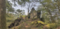 4.90 mi
+686 ft
-682 ft
2h 50
Moderate
Departure from Florenville (Province de Luxembourg)
A short stretch of the Semois via the GR®16
4.90 mi
+686 ft
-682 ft
2h 50
Moderate
Departure from Florenville (Province de Luxembourg)
A short stretch of the Semois via the GR®16  4.91 mi
+371 ft
-367 ft
2h 35
Moderate
Departure from Florenville (Province de Luxembourg)
The Roche du Chat viewpoint and the Vanne des Moines
4.91 mi
+371 ft
-367 ft
2h 35
Moderate
Departure from Florenville (Province de Luxembourg)
The Roche du Chat viewpoint and the Vanne des Moines  5.85 mi
+781 ft
-791 ft
3h 20
Moderate
Departure from Florenville (Province de Luxembourg)
A walk through the woods of the Semois, a leisurely stroll.
5.85 mi
+781 ft
-791 ft
3h 20
Moderate
Departure from Florenville (Province de Luxembourg)
A walk through the woods of the Semois, a leisurely stroll.  14.54 mi
+1,880 ft
-1,860 ft
8h 20
Difficult
Departure from Florenville (Province de Luxembourg)
Between the Semois, streams and forest via the circular route of the Épioux 13.45 mi
+1,683 ft
-1,686 ft
7h 40
Moderate
Departure from Florenville (Province de Luxembourg)
In the forest between Herbeumont and Chiny, starting from Les Épioux
14.54 mi
+1,880 ft
-1,860 ft
8h 20
Difficult
Departure from Florenville (Province de Luxembourg)
Between the Semois, streams and forest via the circular route of the Épioux 13.45 mi
+1,683 ft
-1,686 ft
7h 40
Moderate
Departure from Florenville (Province de Luxembourg)
In the forest between Herbeumont and Chiny, starting from Les Épioux  12.80 mi
+1,358 ft
-1,375 ft
7h 05
Difficult
Departure from Florenville (Province de Luxembourg)
12.80 mi
+1,358 ft
-1,375 ft
7h 05
Difficult
Departure from Florenville (Province de Luxembourg)
For more walks, use our search engine .
The GPS track and description are the property of this route's author. Please do not copy them without permission.
Scan this QR code with your smartphone's camera.
To open this route on your smartphone, you must have the Visorando app installed. If not, got to the Apple Store (iPhone) or Google Play Store (Android) to download the app.
 Visorando Member
