Country:

 City:


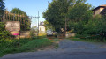
(S) Car park in front of the Fond de Givonne football ground, near the dog club’s training ground.
Walk down Rue de la Garenne towards Fond de Givonne. As you walk down, you’ll see market gardens stretching out to the left of the road; on the right is the Fond de Givonne Catholic cemetery and, a little further on to the left, the Protestant cemetery.
(1) At the junction with the Faubourg du Fond de Givonne, turn left onto Rue de la Linette (a small road running parallel to the D997 leading to Givonne).
Head up Rue de la Linette, passing the ‘Bosserelle’ greengrocer’s and the La Linette village hall on your left (a modern blue building). Continue uphill, keeping slightly to the right (the road runs parallel to the departmental road).
(2) Junction leading onto the D997. Carry on straight up the hill. At the next right-angled bend, the tarmac ends. Continue along the track towards the mobile phone masts visible on the right-hand side of the track.
Turn left at the second junction and continue uphill.
At the next junction, leave the path leading back down towards La Linette on your left and continue uphill, heading north towards the woods.
At the edge of the woods, leave the path leading down to Givonne on your right and carry on straight ahead towards the next junction.
(3) At the junction, turn left, heading due west, onto the path running between the Bois de la Linette and the Bois Gibou. Stay on this path, which climbs up through a narrow pass towards Rue de la Garenne (Sedan/Illy).
(4) You’ll reach this street opposite a mobile phone mast. On the left is the Garenne farm.
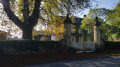
Turn left, walk past the farm and head down Rue de la Garenne. On the right-hand side as you go downhill is the Château de la Garenne.
At the bottom of the hill, ignore the Chemin de la Garenne which heads down to the right and carry on towards the Fond de Givonne football ground.
(E) Car park at the Fond de Givonne football ground.

 Visorando Member
 Moderate