


Refine your search for walks in Landrévarzec
Landrévarzec walks


 Countryside and heritage in Landrévarzec
 Visorando Member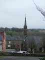
 4.99 mi
 +259 ft
 -246 ft
 2h 30
2h 30
 Easy
Easy
 Departure from Landrévarzec (Finistère)
A discovery route through authentic countryside, enhanced by the village of Quilinen with its chapel, calvary and fountain, listed as historic monuments since 1990.
The interior of the chapel and the calvary have recently been restored.
Two other fountains are also of interest.
Chapels of Briec and the Ménez-Roc'h-Meur site
 6.55 mi
+561 ft
-558 ft
3h 30
6.55 mi
+561 ft
-558 ft
3h 30
 Moderate
Departure from Landrévarzec (Finistère)
Moderate
Departure from Landrévarzec (Finistère)
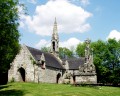
A countryside route exploring three chapels, all situated in remarkable locations.The chapel at Saint-Venec is particularly well known for its calvary and its majestic fountain.The route also takes you to Ménez-Roc’h-Meur, from where the view stretches across the whole of Douarnenez Bay.
Ménez Roc’h Meur walk starting from the Notre-Dame d’Illijour Chapel
 4.96 mi
+518 ft
-518 ft
2h 50
Easy
Departure from Briec (Finistère)
4.96 mi
+518 ft
-518 ft
2h 50
Easy
Departure from Briec (Finistère)
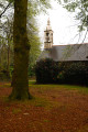
From the Chapel of Notre-Dame d’Illijour, come and discover some wonderful panoramic views as you walk around Ménez Roc’h Meur, Briec’s highest point at an altitude of 230 m. Weather permitting, you’ll be able to see the sea and the cliffs of the Crozon Peninsula. And if you feel like it, two extension routes will take you to the foot of the Chapel of Garnilis (a further 1 km) and the listed Chapel of Saint-Venec (a further 2 km).
Hent Glaz (the Briec tower)
 6.32 mi
+331 ft
-322 ft
3h 10
Moderate
Departure from Briec (Finistère)
6.32 mi
+331 ft
-322 ft
3h 10
Moderate
Departure from Briec (Finistère)
The Hent Glaz route (the Briec tour) showcases the surrounding countryside and the wetlands and wooded areas of Briec through streams and warrens. You will discover panoramic views towards Landudal and Edern, a passage close to the Manoir de la Boissière, Anita Conti Park, the heights of Briec de l'Odet, then the future urban forest of 7,000 newly planted trees and beautiful meadows and wetlands that will remind you of a bayou. Don't be surprised if you come across a deer or see a buzzard hovering above you in the unspoilt, natural vegetation, which is rich in biodiversity.
Urban route and green spaces in Briec
 3.46 mi
+187 ft
-190 ft
1h 45
Easy
Departure from Briec (Finistère)
3.46 mi
+187 ft
-190 ft
1h 45
Easy
Departure from Briec (Finistère)
Urban route in Briec and discovery of several green spaces: Anita Conti Park with its fitness and orienteering trail, the future 8.7-hectare urban forest where 7,500 trees have been planted since 2024. The route offers several benches for resting and areas with children's games and picnic tables.
Circulars between Briec and Le Merdy
 6.13 mi
+522 ft
-518 ft
3h 15
Moderate
Departure from Briec (Finistère)
6.13 mi
+522 ft
-518 ft
3h 15
Moderate
Departure from Briec (Finistère)
South of Briec, come and discover the Merdy countryside. Walk along the Langelin River where you may find a few trout fishermen. Finally, walk along the grounds of Manoir de la Boissière and cross its woods.
In the Stéïr valley, starting from Pont Quéau
 7.42 mi
+732 ft
-728 ft
4h 05
Moderate
Departure from Quimper (Finistère)
7.42 mi
+732 ft
-728 ft
4h 05
Moderate
Departure from Quimper (Finistère)
A hilly route through the countryside where the Stéïr, a tributary of the Odet, flows.
Menfouest Chapel Route
 4.29 mi
+341 ft
-381 ft
2h 15
Easy
Departure from Quimper (Finistère)
4.29 mi
+341 ft
-381 ft
2h 15
Easy
Departure from Quimper (Finistère)
Starting from the Menfouest Chapel and its bucolic setting, this route will first take you along small country lanes through countryside dominated by cattle farming.
The banks of the Steïr and woodland from Menfouest Chapel
 3.66 mi
+397 ft
-384 ft
2h 00
Easy
Departure from Quimper (Finistère)
3.66 mi
+397 ft
-384 ft
2h 00
Easy
Departure from Quimper (Finistère)
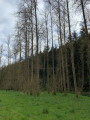
A return walk through unspoilt countryside along the Steïr, a tributary of the Odet, and then through the woods of this valley.The route may take you across two bridges used by the TER train linking Quimper to Landerneau.Along the route, you’ll pass the Menfouest Chapel and Kergadou Manor.
In the countryside between Saint-Albin and Quéménéven
 6.98 mi
+571 ft
-561 ft
3h 40
Moderate
Departure from Plogonnec (Finistère)
6.98 mi
+571 ft
-561 ft
3h 40
Moderate
Departure from Plogonnec (Finistère)
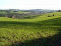
A route through the countryside with rolling hills offering wide open views. The route mainly follows quiet country lanes. Discover picturesque views, including Ménez Hom (330m), which marks the western end of the Montagnes Noires range.
Route de Saint-Albin en Plogonnec
 6.93 mi
+463 ft
-446 ft
3h 35
Moderate
Departure from Plogonnec (Finistère)
6.93 mi
+463 ft
-446 ft
3h 35
Moderate
Departure from Plogonnec (Finistère)
A route through undulating countryside, offering vast expanses of farmland surrounding a few hamlets.
The route mainly follows quiet country lanes.
Discover picturesque views from the hilltops, with the Montagne du Prieuré de Locronan towering above it all.
Countryside south of Edern and west of Briec.
 4.63 mi
+269 ft
-259 ft
2h 20
Easy
Departure from Edern (Finistère)
4.63 mi
+269 ft
-259 ft
2h 20
Easy
Departure from Edern (Finistère)
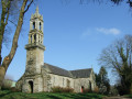
A semi-rural route south of Edern via the Chapel of Notre-Dame de Lannien, one of six chapels in the commune and the only one in the south, then near Château de la Boissière, which had its heyday during the lifetime of Jean Edern Hallier.The route then takes in the western side of Briec, where the sports and cultural facilities and schools are concentrated.
Note: This route mainly follows small country roads and streets in the urbanised area.
Campagne et patrimoine à Edern
 6.86 mi
+466 ft
-459 ft
3h 35
Moderate
Departure from Edern (Finistère)
6.86 mi
+466 ft
-459 ft
3h 35
Moderate
Departure from Edern (Finistère)
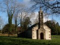
The route takes you along small country roads and a few paths, allowing you to discover the local heritage: a chapel, a cross, the remains of an ancient abbey and a monumental fountain saved from oblivion in 2023 by the Edern Histoire et Patrimoine association.
On the heights of Ménez Hellen
 4.35 mi
+427 ft
-404 ft
2h 20
Easy
Departure from Edern (Finistère)
4.35 mi
+427 ft
-404 ft
2h 20
Easy
Departure from Edern (Finistère)
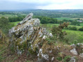
Starting in the Edern countryside, this hilly route leads through woods to one of the ridges of the Montagnes Noires and one of the highest points, offering extensive views over the west of the Châteaulin Basin to the sea.
The route takes you through the "Jardin Picart", a botanical garden on the side of a rocky moor, the result of a long-term project by an enthusiast.
Discover the heritage of two chapels, a fountain, a wash house and an old wicker-making workshop.
Countryside and panoramic views near Edern
 6.35 mi
+351 ft
-328 ft
3h 15
Easy
Departure from Edern (Finistère)
6.35 mi
+351 ft
-328 ft
3h 15
Easy
Departure from Edern (Finistère)
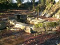
A route mainly along small country roads offering lovely views of the Montagnes Noires.
Landudal countryside via the Trolez Chapel
 6.14 mi
+390 ft
-417 ft
3h 10
Easy
Departure from Landudal (Finistère)
6.14 mi
+390 ft
-417 ft
3h 10
Easy
Departure from Landudal (Finistère)
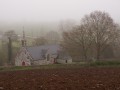
A countryside route along sunken paths and small roads, passing by the Chapel of Trolez (16th century).
Along the sunken paths of Landudal
 5.15 mi
+466 ft
-459 ft
2h 45
Easy
Departure from Landudal (Finistère)
5.15 mi
+466 ft
-459 ft
2h 45
Easy
Departure from Landudal (Finistère)
From the small village of Landudal, a route heading south through the commune, taking in many sunken paths and wooded sections.
Circuit de Trémarec
 7.91 mi
+620 ft
-620 ft
4h 10
Moderate
Departure from Landudal (Finistère)
7.91 mi
+620 ft
-620 ft
4h 10
Moderate
Departure from Landudal (Finistère)
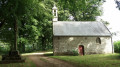
Discover the village of Landudal with its two churches, located about 100 metres apart, which bear witness to its history.Walk along the sunken paths of the bocage countryside, which has been spared from land consolidation. Follow in the footsteps of Admiral Yves de Kerguelen, who discovered the southern islands in 1772, which still bear his name.A wonderful programme of discoveries!
Along the Odet at Stangala
 3.42 mi
+279 ft
-279 ft
1h 50
Easy
Departure from Ergué-Gabéric (Finistère)
3.42 mi
+279 ft
-279 ft
1h 50
Easy
Departure from Ergué-Gabéric (Finistère)
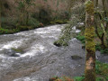
Between Quimper and the commune of Ergué-Gabéric, the 80-hectare Stangala communal property features deep gorges carved out over time by the Odet, which sometimes resembles a mountain torrent, leaping over rocky outcrops. This route allows you to follow part of the river's course, from calm areas to more turbulent ones. The end of the route crosses a wild wooded area.
In the Steïr valley
 5.74 mi
+545 ft
-538 ft
3h 05
Easy
Departure from Plogonnec (Finistère)
5.74 mi
+545 ft
-538 ft
3h 05
Easy
Departure from Plogonnec (Finistère)
This route, very close to Quimper, alternates between small country lanes and sections through woodland. It also takes you along the right bank of the River Steïr, allowing you to explore the valley floor and the infrastructure for the Quimper-Brest railway line. At the start, the small Seznec chapel, dating from 1673, with its calvary in the enclosure.
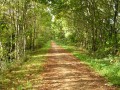
Passing by the Saint-Alouarn Mill
 7.10 mi
+636 ft
-653 ft
3h 50
Moderate
Departure from Plogonnec (Finistère)
7.10 mi
+636 ft
-653 ft
3h 50
Moderate
Departure from Plogonnec (Finistère)
Following small country lanes, wooded paths and the old railway line converted into a greenway, let’s go and see the old feudal mill at Saint-Alouarn.
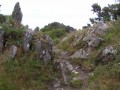
Passing by La Roche du Feu
 6.03 mi
+673 ft
-659 ft
3h 20
Moderate
Departure from Gouézec (Finistère)
6.03 mi
+673 ft
-659 ft
3h 20
Moderate
Departure from Gouézec (Finistère)
The route passes by the Roche du Feu (Karreg an Tan), the highest point of the Montagnes Noires (281m).
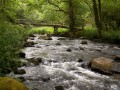
Around the Odet at Stangala
 3.93 mi
+430 ft
-430 ft
2h 10
Easy
Departure from Ergué-Gabéric (Finistère)
3.93 mi
+430 ft
-430 ft
2h 10
Easy
Departure from Ergué-Gabéric (Finistère)
This short walk allows you to explore a part of the Stangala site that is relatively steep and to follow the River Odet.
Returning via a small road allows you to complete a circular route, avoiding the more difficult sections.
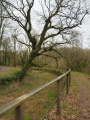
Route pédagogique along the Odet Canal
 1.93 mi
+26 ft
-26 ft
0h 55
Easy
Departure from Briec (Finistère)
1.93 mi
+26 ft
-26 ft
0h 55
Easy
Departure from Briec (Finistère)
This canal was built between 1852 and 1858. It carried water from the Odet to the mill, where its power was used to drive the machinery and was essential for the production of paper pulp.
The paper mill closed in 1983, rendering the canal obsolete.
A educational route, marked by 9 information panels, has been created by the departmental council, which owns a large part of the site, the municipality of Ergué-Gabéric and the O.N.F.
Come and explore it.
Canal and Stang Luzigou route
 6.39 mi
+397 ft
-400 ft
3h 15
Easy
Departure from Ergué-Gabéric (Finistère)
6.39 mi
+397 ft
-400 ft
3h 15
Easy
Departure from Ergué-Gabéric (Finistère)
After following the Odet and the leat of the old paper mills, a beautiful circular route takes us through the wooded area of Stang Luzigou. On the way back, we pass through the Kerho Arboretum.Discover the Saint-Corentin Chapel in the hamlet of Kreïker.
The Stangala trail starting from Saint-Guénolé Chapel
 4.74 mi
+633 ft
-620 ft
2h 45
Moderate
Departure from Ergué-Gabéric (Finistère)
4.74 mi
+633 ft
-620 ft
2h 45
Moderate
Departure from Ergué-Gabéric (Finistère)
After exploring Saint-Guénolé Chapel, let’s approach the Stangala site from the side opposite Quimper.
Let’s head down to the Odet as it winds its way through here and climb a little higher to get a panoramic view.
 Route of chapels starting from Quimper and passing through Plogonnec
 20.61 mi
+1,467 ft
-1,467 ft
3 hrs
Moderate
Departure from Quimper (Finistère)
20.61 mi
+1,467 ft
-1,467 ft
3 hrs
Moderate
Departure from Quimper (Finistère)
Discover part of the religious heritage of the area around Quimper via a hilly route mainly following small country lanes.
The Odet at the Stangala Gorges
 7.21 mi
+728 ft
-705 ft
3h 55
Moderate
Departure from Quimper (Finistère)
7.21 mi
+728 ft
-705 ft
3h 55
Moderate
Departure from Quimper (Finistère)
The Odet River first rolls its cool waves through gently rolling hills, wooded countryside and long meadows.Then, suddenly, upstream from Quimper, it carves out a narrow, deep gorge and describes a surprising "hairpin bend" around the Griffonès cliff, creating a wild, winding ravine framed by woods, rocks and moors.It is this discovery that I invite you to explore.
From Kerlic to the old Kerrous quarry
 2.44 mi
+102 ft
-105 ft
1h 15
Easy
Departure from Quimper (Finistère)
2.44 mi
+102 ft
-105 ft
1h 15
Easy
Departure from Quimper (Finistère)
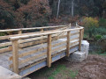
From the Kerlic health centre, theGR®38 takes us through part of the Stangala woods to the banks of the Odet, where a new footbridge has been installed.
This provides access to the site of the former Kerrous aggregate quarry, which has been redeveloped as a walking area with deciduous trees. A small viewing point overlooks the extraction pit, which has been converted into a drinking water reservoir.
A short walk on the outskirts of Quimper.
The Kergoat route via Locronan
 6.90 mi
+430 ft
-417 ft
3h 35
Moderate
Departure from Quéménéven (Finistère)
6.90 mi
+430 ft
-417 ft
3h 35
Moderate
Departure from Quéménéven (Finistère)
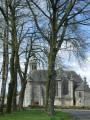
Countryside route along sunken paths connecting Kergoat Chapel to the town of Locronan and back along the Forêt du Duc.
Route of the Three Chapels in Edern
 6.22 mi
+617 ft
-630 ft
3h 25
Moderate
Departure from Edern (Finistère)
6.22 mi
+617 ft
-630 ft
3h 25
Moderate
Departure from Edern (Finistère)
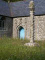
The route mainly follows small country roads and beautiful trails, allowing you to discover three chapels.Vast panoramic views of the Montagnes Noires.
The former Kerrous quarry and the banks of the Odet at Stangala
 5.61 mi
+417 ft
-404 ft
2h 55
Moderate
Departure from Ergué-Gabéric (Finistère)
5.61 mi
+417 ft
-404 ft
2h 55
Moderate
Departure from Ergué-Gabéric (Finistère)
From the former aggregate quarry, which was converted into a walking area and water reservoir in late 2020, cross the Odet via a new footbridge installed in late 2021 to follow the river upstream. After another footbridge, head up into the upper Stangala valley. The return journey follows a small road passing through the hamlet of Squividan and its electricity substation, then the rapidly developing Kervouvois 2 industrial estate.
Through the Kerfeunteun neighbourhoods north of Quimper
 3.87 mi
+243 ft
-269 ft
2h 00
Easy
Departure from Quimper (Finistère)
3.87 mi
+243 ft
-269 ft
2h 00
Easy
Departure from Quimper (Finistère)
A short peri-urban route to explore this rapidly changing area in the north.
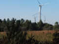
In the woods of Saint-Gildas between the chapel and the wind turbines.
 6.57 mi
+725 ft
-728 ft
3h 40
Moderate
Departure from Cast (Finistère)
6.57 mi
+725 ft
-728 ft
3h 40
Moderate
Departure from Cast (Finistère)
From the clearing surrounded by beech, chestnut and cypress trees, discover the long Saint-Gildas Chapel and, a little further down, its associated fountain, then venture into the Saint-Gildas woods overlooking the Châteaulin valley. Continue through this area where there are numerous wind turbines.The long climb up the old Châteaulin-Quimper Roman road may leave you panting before you reach the bare heights of Ménez Quelc'h.
Currently being revised
Hike around the St. Alouarn mill
 5.91 mi
+482 ft
-453 ft
3h 10
Easy
Departure from Guengat (Finistère)
5.91 mi
+482 ft
-453 ft
3h 10
Easy
Departure from Guengat (Finistère)
Discover the remains of the Manor of Saint-Alouarn and the mill, via the Quimper-Douarnenez bike route and country roads.
A walk through the Kerfeunteun neighbourhoods of Quimper
 5.15 mi
+344 ft
-322 ft
2h 40
Moderate
Departure from Quimper (Finistère)
5.15 mi
+344 ft
-322 ft
2h 40
Moderate
Departure from Quimper (Finistère)
A short, unpretentious stroll through housing estates, back roads, woods and a valley to explore part of the Kerfeunteun neighbourhood: the countryside within the city.Currently being revised!
Short route around Cuzon
 3.94 mi
+262 ft
-289 ft
2h 05
Easy
Departure from Quimper (Finistère)
3.94 mi
+262 ft
-289 ft
2h 05
Easy
Departure from Quimper (Finistère)
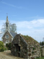
A short route through the Cuzon neighbourhood, which was an independent parish from Kerfeunteun until the Revolution. The two neighbourhoods are separated by the Frout valley, a tributary of the Odet.The retention basin is used to regulate the river’s flow to prevent flooding in Quimper.The Cuzon neighbourhood, situated a little apart, has developed a relatively recent craft and trade area.Around the Manoir de Kermahonnet lies one of the last remaining market-gardening areas in this north-western part of Quimper.
Fountains, gardens and footbridges in the heart of Quimper
 3.69 mi
+236 ft
-217 ft
1h 55
Easy
Departure from Quimper (Finistère)
3.69 mi
+236 ft
-217 ft
1h 55
Easy
Departure from Quimper (Finistère)
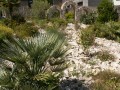
Starting from Kerfeunteun, in the northern district of Quimper, head down into the heart of the city to discover some of its beautiful gardens, stroll along the River Odet, crossed by numerous flower-covered footbridges, and through the small cobbled streets.
Along the way, you will see Saint-Corentin Cathedral, the former bishop's palace and the Max Jacob Theatre, three of the city's most iconic monuments.
Route along the Aulne towpath via Vieux-Bourg
 7.03 mi
+312 ft
-331 ft
3h 30
Moderate
Departure from Lothey (Finistère)
7.03 mi
+312 ft
-331 ft
3h 30
Moderate
Departure from Lothey (Finistère)
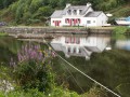
Stroll peacefully along the banks of the Aulne, following the towpath.Views of the lock-keeper’s cottages on the opposite bank.Pass through Vieux-Bourg and its Saint-They Church, the cradle of the parish of Lothey until 1846.
Via the towpath and the highest point at Lothey
 5.34 mi
+495 ft
-518 ft
2h 55
Moderate
Departure from Lothey (Finistère)
5.34 mi
+495 ft
-518 ft
2h 55
Moderate
Departure from Lothey (Finistère)
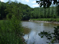
This little-used route descends towards the towpath of the channelled Aulne and follows the river, lined with beautiful ash trees.After the somewhat noisy stretch under the N165 bridge, the route continues along quiet country lanes and several grassy paths to reach the highest point in the commune of Lothey (166 m), offering a sweeping panorama of the Châteaulin basin which separates the Monts d’Arrée from the Montagnes Noires.Finish with a return trip to the wash house and the Saint-Fiacre fountain.
Le Juch - Douarnenez circular via the Greenway
 24.29 mi
+640 ft
-636 ft
3 hrs
Moderate
Departure from Guengat (Finistère)
24.29 mi
+640 ft
-636 ft
3 hrs
Moderate
Departure from Guengat (Finistère)
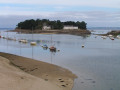
This route follows the route of the old Quimper - Douarnenez railway line.Along the way, take a short detour to pass through the village of Le Juch and cross Douarnenez along the seafront.
Around the Moulin Vert, in the north-west of Quimper
 3.93 mi
+230 ft
-203 ft
2h 00
Easy
Departure from Quimper (Finistère)
3.93 mi
+230 ft
-203 ft
2h 00
Easy
Departure from Quimper (Finistère)
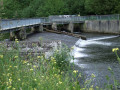
The Moulin Vert residential area to the north-west is well known for its family walks along the banks of the River Stéîr, a tributary of the Odet.This route takes its inspiration from this area but also explores less well-known paths on the built-up hills of Kermabeuzen.It is also an opportunity to rediscover the beautiful beech-lined avenue at Kerayen, which was cut in two during the construction of the North-West Bypass (CNO), opened in 2008.
Through the Kermabeuzen Wood
 3.63 mi
+230 ft
-203 ft
1h 50
Easy
Departure from Quimper (Finistère)
3.63 mi
+230 ft
-203 ft
1h 50
Easy
Departure from Quimper (Finistère)
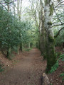
From the green space near the Steïr, this route leads to the Bois de Kermabeuzen, where well-marked paths through unspoilt countryside take you to the foot of the viaduct on Quimper’s north-western bypass. After a lovely climb through the same woodland, the return journey takes you along a beautiful avenue of majestic beech trees.
There are two footbridges to cross over the river to complete the circular route.
Kermabeuzen Valley Route
 6.56 mi
+636 ft
-617 ft
3h 35
Moderate
Departure from Quimper (Finistère)
6.56 mi
+636 ft
-617 ft
3h 35
Moderate
Departure from Quimper (Finistère)
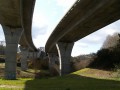
The route crosses the wild Kermabeuzen valley, passing under the new viaduct to reach Toulgoat Manor.
Kermabeuzen Valley via Saint-Conogan Chapel
 6.03 mi
+476 ft
-456 ft
3h 10
Moderate
Departure from Quimper (Finistère)
6.03 mi
+476 ft
-456 ft
3h 10
Moderate
Departure from Quimper (Finistère)
Very close to Quimper, this route takes you through the Kermabeuzen valley, which has retained its wild character and is dominated by the viaduct of the North-West bypass.
On the way back, you’ll pass through a quiet woodland.
Discover Quimper and its two rivers
 6.19 mi
+194 ft
-194 ft
3h 00
Easy
Departure from Quimper (Finistère)
6.19 mi
+194 ft
-194 ft
3h 00
Easy
Departure from Quimper (Finistère)
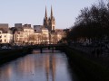
Follow the Stéïr, then take the small streets to walk through the city centre and reach the Locmaria district and its Romanesque church. Walk along the Odet, the main river that crosses Quimper, following the old towpath and the quays.
On the north-western outskirts of Quimper towards the Chapel of Ty Mamm Doué
 6.58 mi
+571 ft
-574 ft
3h 30
Moderate
Departure from Quimper (Finistère)
6.58 mi
+571 ft
-574 ft
3h 30
Moderate
Departure from Quimper (Finistère)
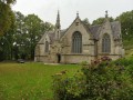
Semi-urban circuit towards the imposing Ty Mamm Doué Chapel. Alternating between streets, wooded areas and riverside paths.
Karreg an Tan (Roche au Feu) and the countryside around Gouézec
 6.27 mi
+814 ft
-837 ft
3h 35
Moderate
Departure from Gouézec (Finistère)
6.27 mi
+814 ft
-837 ft
3h 35
Moderate
Departure from Gouézec (Finistère)
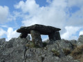
Two loops in Gouézec: at an altitude of 279 m, one of the highest points in the Montagnes Noires, the Karreg an Tan summit offers a beautiful 360° panorama of the Aulne valley, the Monts d'Arrée and the Bay of Douarnenez.Its name comes from the fact that, during the Norman invasions in the 9th century, a lookout would light a fire there to warn the population, which could be seen from across the Châteaulin basin. Back at the car park, a second loop leads through the countryside in the lower part of Gouézec.
Vallon de Kermabeuzen et Bois de Saint-Conogan
4.73 mi
+443 ft
-433 ft
2h 35
Easy
Departure from Quimper (Finistère)
Après un cheminement sur les rives du Steïr, une belle allée de hêtres conduit sur les hauteurs du Bois de Saint-Conogan. Une descente par le vallon de Kermabeuzen avec un passage toujours aussi impressionnant sous le viaduc de la rocade permet de retrouver les ruelles et les passages piétonniers du Moulin Vert.
Walk along the Steïr to Moulin Vert
 3.75 mi
+49 ft
-49 ft
1h 45
Easy
Departure from Quimper (Finistère)
3.75 mi
+49 ft
-49 ft
1h 45
Easy
Departure from Quimper (Finistère)
A short route along the Steïr, one of the tributaries of the Odet which flows through Quimper.
Heritage walk in Quimper
 2.66 mi
+89 ft
-89 ft
1h 20
Easy
Departure from Quimper (Finistère)
2.66 mi
+89 ft
-89 ft
1h 20
Easy
Departure from Quimper (Finistère)
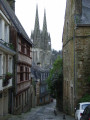
This walk through Quimper will take you back in time and allow you to discover part of this city of art and history.
Kerdévot route
 5.91 mi
+335 ft
-315 ft
3h 00
Easy
Departure from Ergué-Gabéric (Finistère)
5.91 mi
+335 ft
-315 ft
3h 00
Easy
Departure from Ergué-Gabéric (Finistère)
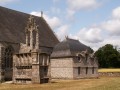
Country route starting from the hamlet of Kerdévot, famous for its chapel and enclosure. The route alternates between sunken paths, quiet roads and hamlets.
Currently being revised
Around the former Gourmelen Hospital and Quimper’s small gardens
 3.25 mi
+144 ft
-141 ft
1h 35
Easy
Departure from Quimper (Finistère)
3.25 mi
+144 ft
-141 ft
1h 35
Easy
Departure from Quimper (Finistère)
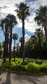
An urban stroll slightly off the beaten track: around the former Gourmelen Hospital (early 19th century), with its magnificent old trees and palm trees, returning via the Jardin de la Retraite, the cathedral and then the old theatre and its garden.
Please note a message left by a user on 25 June 2024:
1 - It is no longer possible to enter through the gate of the former Gourmelen Hospital; all entrances are closed as major works are due to take place. Therefore, there is no longer any access to the park.
2 - Access to the Max Jacob Theatre and its gardens is also closed due to works, until January 2025.
Route de Cuzon and the banks of the Odet
 6.38 mi
+367 ft
-348 ft
3h 15
Moderate
Departure from Quimper (Finistère)
6.38 mi
+367 ft
-348 ft
3h 15
Moderate
Departure from Quimper (Finistère)
Discovering the former parish of Cuzon, which became a commune in 1791.
Situated to the east and beyond the Ruisseau du Frout de Quimper, this neighbourhood remains, for the most part, a rural outlying area of Quimper.
This route runs alongside the Odet, which is partly wild and partly channelled as it enters the town.
Saint-Laurent Chapel and Aulne Canal from Saint-Coulitz
 5.83 mi
+449 ft
-479 ft
3h 05
Easy
Departure from Saint-Coulitz (Finistère)
5.83 mi
+449 ft
-479 ft
3h 05
Easy
Departure from Saint-Coulitz (Finistère)
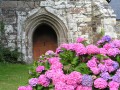
Hike along small roads, paths and towpaths to discover Saint-Coulitz, its religious heritage and the beauty of the surrounding nature.
Kermabeuzen valley and stream, approached from the south
 2.65 mi
+344 ft
-354 ft
1h 30
Easy
Departure from Quimper (Finistère)
2.65 mi
+344 ft
-354 ft
1h 30
Easy
Departure from Quimper (Finistère)
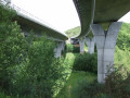
A peaceful walk through the valley where the Kermabeuzen stream flows. After passing under the magnificent double viaduct of Quimper’s north-western ring road, you head deep into the woodland, where the sound of traffic from the ring road quickly fades away. Only the murmur of the stream you’re following and the birdsong break the silence: peace and a change of scenery guaranteed just a stone’s throw from the town. The route passes close to the imposing Toulgoat Manor.
Gouézec route starting from Pont-Coblant
 7.22 mi
+344 ft
-331 ft
3h 35
Moderate
Departure from Gouézec (Finistère)
7.22 mi
+344 ft
-331 ft
3h 35
Moderate
Departure from Gouézec (Finistère)
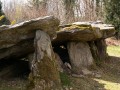
The towpath of the canalised Aulne and its two locks, small roads leading to the rural village of Gouézec offering views of the Monts d’Arrée, and a return to Pont-Coblant via paths through the countryside.Along the route, discover a beautiful covered walkway.
The hillsides of Penhars
 5.12 mi
+361 ft
-351 ft
2h 40
Easy
Departure from Quimper (Finistère)
5.12 mi
+361 ft
-351 ft
2h 40
Easy
Departure from Quimper (Finistère)
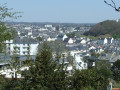
Explore the hillsides of Penhars via the Bois du Séminaire and the Bois d'Amour, cross the ZUP and its allotments, discover the Manoir de Kermoysan tucked away amongst the buildings, and follow the Odet along the towpath: a varied itinerary on the outskirts of Quimper.
More walks in Landrévarzec
Select a point of interest below: