Hent Glaz (the Briec tower)

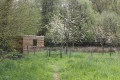
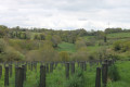
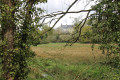
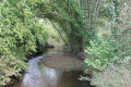
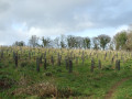
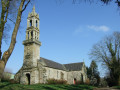
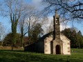
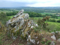
The Hent Glaz route (the Briec tour) showcases the surrounding countryside and the wetlands and wooded areas of Briec through streams and warrens. You will discover panoramic views towards Landudal and Edern, a passage close to the Manoir de la Boissière, Anita Conti Park, the heights of Briec de l'Odet, then the future urban forest of 7,000 newly planted trees and beautiful meadows and wetlands that will remind you of a bayou. Don't be surprised if you come across a deer or see a buzzard hovering above you in the unspoilt, natural vegetation, which is rich in biodiversity.

Details

n°72849899
Creation:
Last update:
Last review:
  • Walking
    Activity: Walking
  • ↔
    Distance: 6.32 mi
  • ◔
    Average duration: 3h 10 
  • ▲
    Difficulty: Moderate

  • ⚐
    Back to start: Yes
  • ↗
    Ascent: + 331 ft
  • ↘
    Descent: - 322 ft

  • ▲
    Highest point: 551 ft
  • ▼
    Lowest point: 331 ft
  • ⚐ Country: France
  • ⚐ City: Briec (29510)
  • ⚑
    Start/End: N 48.095944° / W 4.001404°
  • ❏
    IGN map(s): Ref. 0618OT
  • Hour-by-hour weather

Photos

Description of the walk

Start at the municipal stadium car park opposite the Ty Eugène funeral parlour.

(S/E) Walk alongside the D785 towards Quimper, turn left after No. 15, then cross a road. Take Impasse du Roi Gradlon and head down the field on the right. Cross a stream and you’ll reach a road.

(1) Turn left onto Route de Runigen, then, at the roundabout, turn right onto Rue de Pennarun.

(2) At No. 6, turn right into the cul-de-sac, then go straight on along the path between Nos. 7 and 8. Turn left at the storm water retention basin and follow the lane behind the housing estate until you reach Route de Landudal.

(3) Head up the road to the left, then cross it carefully at the 50 km/h sign to enter the woods, and turn right immediately. Continue alongside the road until you reach the edge of the woods.

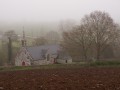
(4) Turn left onto the road, then turn left again and enter the grounds of the Château de la Boissière via the small path on the left. Walk round the back of the property.

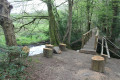
(5) Turn left (do not follow the farm track), cross the footbridges over the Langevin stream, then turn right up the small embankment and head towards the sewage treatment plant.

(6) Go up the embankment near the sewage treatment plant and enter the factory grounds, then walk up through the car park to the D72. Cross the road at the pedestrian crossing, turn right, then follow the cycle path downhill to the roundabout. Turn left towards Briec centre via Rue de la Résistance.

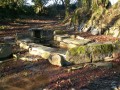
(7) Turn right at No. 41, follow the path down past the house and garden, then go past the embankment on the left to enter Anita Conti Park. Walk alongside the sheep enclosure. At the sheep shed, head up the path on the left to the top and leave the park.

(8) Turn right onto Chemin de Quénéac’h Du, then turn left to enter the meadow. At the entrance to the plantation, take the path on the left to enter the woods. Continue until you reach the junction with a lane.

(9) Turn left onto Allée de Quénéarch Du, then turn right onto Route de Pont Ar Guen.

(10) Take the Croas Ver hare trail on the left and turn left again to join Chemin de Croas Ver.

(11) Turn right and follow the road as it bends to the left.

(12) At the yellow signpost,turn left into the field and walk round it, cross the D785 with care and take the path behind the gate. You’ll come to a road; follow it to the right.

(13) Turn right onto Rue Yeun Pargamou, veer right, cross a road and head into the meadow opposite. Continue for about 200 m, then enter the woods and carry on until you come out at the roundabout by the Intermarché supermarket.

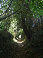
(14) Turn left and take thefirst right onto Rue de Lannechuen, continuing until you reach a warren on the left.

(15) Cross it and, at the other end, carry on straight ahead then turn right onto Rue de Kervalay. Follow the path, go through the tunnel under the D61 and turn left. Walk past the funeral parlour, turn right onto the D785, continue to the traffic lights (Rue de Gurvale) and cross carefully to reach the car park (S/E).

Waypoints

  1. S/E : mi 0 - alt. 463 ft - Municipal stadium car park
  2. 1 : mi 0.44 - alt. 381 ft - Route de Runigen
  3. 2 : mi 0.59 - alt. 407 ft - Rue de Pennarun
  4. 3 : mi 0.99 - alt. 404 ft - Route de Landudal
  5. 4 : mi 1.26 - alt. 351 ft - Exit from the woods
  6. 5 : mi 1.63 - alt. 351 ft - Footbridge - Langelin (cours d'eau) - Affluent de l'Odet
  7. 6 : mi 2.01 - alt. 384 ft - Wastewater treatment plant
  8. 7 : mi 2.82 - alt. 436 ft - 41 Rue de la Résistance
  9. 8 : mi 3.11 - alt. 528 ft - Quénéac’h Du Path
  10. 9 : mi 3.36 - alt. 499 ft - Allée de Quénéac’h Du
  11. 10 : mi 3.93 - alt. 456 ft - Junction towards La Garenne
  12. 11 : mi 4.22 - alt. 486 ft - Kroas Ver Path
  13. 12 : mi 4.4 - alt. 495 ft - Yellow marker
  14. 13 : mi 5.03 - alt. 499 ft - Yeun Pargamou Estate
  15. 14 : mi 5.49 - alt. 535 ft - Intermarché roundabout
  16. 15 : mi 5.77 - alt. 505 ft - Garenne Hent Glas
  17. S/E : mi 6.32 - alt. 463 ft - Municipal stadium car park

Notes

Yellow markings.

Worth a visit

Reviews and comments

4.5 / 5
Based on 4 reviews

Reliability of the description
4.5 / 5
Ease of following the route
4.3 / 5
Route interest
4.8 / 5
FLOCH
FLOCH ★

Overall rating : 4.3 / 5

Date of your route : Oct 01, 2026
Reliability of the description : ★★★★☆ Good
Ease of following the route : ★★★★☆ Good
Route interest : ★★★★★ Very good
Very busy route : No

I did this walk again with my walking group (15 people), who were experiencing the route for the first time.
At point 9, we turned right to walk all the way round the planted area, adding about 500 metres to the route.
In the built-up area, there are lots of changes of direction: perhaps some additional details would be helpful.
The yellow markings are still a good guide, though.
Thank you for this route.

Machine-translated

FLOCH
FLOCH ★

Overall rating : 5 / 5

Date of your route : Dec 19, 2025
Reliability of the description : ★★★★★ Very good
Ease of following the route : ★★★★★ Very good
Route interest : ★★★★★ Very good
Very busy route : No

A beautiful route alternating between wild and more urban areas.
Well marked.
A wonderful opportunity to discover the extensive plantations and woods around the Château de la Boissière, which is regaining its former glory.

Machine-translated

jlucquimper
jlucquimper

Overall rating : 4.7 / 5

Date of your route : Jul 28, 2025
Reliability of the description : ★★★★★ Very good
Ease of following the route : ★★★★☆ Good
Route interest : ★★★★★ Very good
Very busy route : No

Very beautiful, well-marked hike; lovely views and a beautiful manor house that you walk around.

Machine-translated

GERMAINE
GERMAINE

Overall rating : 4 / 5

Date of your route : Jun 13, 2025
Reliability of the description : ★★★★☆ Good
Ease of following the route : ★★★★☆ Good
Route interest : ★★★★☆ Good
Very busy route : Yes

Very beautiful route. Well signposted.

Machine-translated

Other walks in the area

For more walks, use our search engine .

The GPS track and description are the property of this route's author. Please do not copy them without permission.