Country:
 City:
City:


Access:
- From Plogonnec, head towards Landrévarzec, then, after about 3.5 km, turn right towards Saint-Albin (road sign).
- From Quimper, take the D39. At the Ty Pont Kerroué roundabout, head straight on along the Roman road for about 3.5 km and turn left, following signs for Pont Quéau – Saint-Albin (road sign).
Park in the car park at the front of the bar-tobacconist’s
(S/E). Leave the car park on the right (sign for Ouest Auto Démolition) and follow this road.
GR®38signposting: White and Red
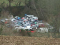
(1) At a place called Leurnéven (end of the 30 km/h zone), turn right towards Keryacob Bihan. This tarmac road overlooks a large car scrapyard. In the hamlet, at the gable end of a well-restored barn, turn right onto the stony path that climbs through a small wood and continue until you reach a road, which you follow to the left for about 100 metres.
(2) At the crossroads, turn left towards Keryacob Bras, leave the hamlet on your left and carry on following the GR®. Cross the Staven stream, pass the hamlet of Penhoat and continue to the large crossroads at Pen ar Vouez.
No signposting
(3) Leave theGR® to continue straight ahead; turn right heading north-west and follow this small, ascending road until you reach a main road (Stop sign), which you follow to the left for about 100 m (a shortcut is possible – see Practical Information).
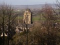
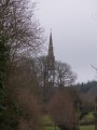
(4) Turn right and follow this road straight on, ignoring the turnings to the farms. Directly ahead, you’ll see the Montagne du Prieuré de Locronan, with a pylon standing out against it. As you continue, you’ll be able to spot, on the left, the openwork bell tower of the Saint-Thélau Chapel.
(5) Turn right, heading east then north-east, following the small road that passes through the hamlet of Kergueven Nevet and then Kermalaby. Pass this farm and continue to a crossroads.
(6) Turn right towards the large Pennaprat Nevet livestock farm, which you can recognise by its wind turbine. Keep the farm on your right and, at the next three-way junction, turn left to rejoin the small road you left earlier.
(7) Turn right and head south-east until you reach Saint-Albin. Cross the main road you’ve already crossed and carry on straight ahead, ignoring the turnings to the two farms on your right. You’ll arrive at the entrance to Saint-Albin, marked by the ‘entrance to built-up area’ sign. At the junction, move slightly to the right and cross at the pedestrian crossing.
(8) Take the gravel path opposite, which runs behind the houses.
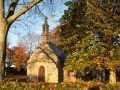
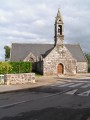
(9) At the first street, turn left into the Garenne housing estate and walk through it. Turn right onto the main road and continue to the chapel on the left, a few metres from the car park, then retrace your steps back to the car park (S/E).


 Visorando Member

 Easy
Easy