Country:
 City:
City:


Jean Jaouen car park. Coming from the town centre, at the roundabout on Avenue de la France Libre in the Kerfeunten neighbourhood, turn left into Rue du Chanoine Kerbrat (right if approaching from the north of Quimper). The car park is situated below this street.
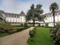
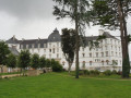
(S/E) From the car park, go up the stairs and head left towards the roundabout. Cross carefully at the pedestrian crossing. Note the mission cross dating from 1848 and take the path (with the town hall annexe on your left) leading to the steps that enter the inner courtyard of the former seminary, now converted into flats. Cross the hall and enter the inner garden, laid out in the French style (access permitted, closed on Sundays and public holidays). Exit, turn left and walk round the entire complex of buildings, following the pavement on Rue Marie-Rose le Bloch. Turn right towards the small roundabout.
(1) Cross at the pedestrian crossing and follow the street to the left towards a ‘no entry’ sign, then turn right into the first street, Rue Jean le Brusq. At the end, turn right and walk down Rue Charles Chassé. At the bottom, at the crossroads, turn left for a few dozen metres, then take a grassy path on the right which winds downwards, skirting a retention basin partly hidden by shrubs.
(2) At the bottom, opposite an area planted with ten oak trees, turn left then right and follow a path that climbs to the left between two hedges (GR® markings). Continue straight on up Rue Pierre Allier, cross Rue Louis Tiercelin and, at the end, turn right towards the Kermoguer municipal stadium. Walk along the left-hand side of the stadium (sign for Square Louis Cuzon), then turn right before the children’s playground.
(3) Cross an embankment, turn right and head downhill to walk all the way round the stadium along a former athletics track (views of the eastern slope of Kerfeunteun and the southern side of Quimper).
Leave the stadium by crossing the embankment again, head uphill to the left and turn right onto the path leading to Rue du Professeur Alain. Follow this street, ignoring the two dead-end streets on the right. At a block of flats, turn right into a one-way street and continue straight ahead.
(4) Turn right into the residents-only lane signposted Rue Charles Barrois. At the end, you’ll come out onto Chemin des Égalntines, which you follow. Note on your left the imposing Manoir du Loc’h, now tucked away in a commercial area.
(5) Turn right onto Rue de L’Aubépine, go round a grassy verge with a transformer, then turn left and continue along a path that runs behind the houses. Start up a short, steep slope on a concrete path, then turn left to take a small flight of steps.
(6) Carry on straight ahead along the street, ignoring the streets to the right and left. At the bottom of the descent, take a flight of steps on the left to go down into a former children’s playground. Follow this path through some shrubbery and rejoin the street. Turn into the first street on the left (against the flow of traffic) and you’ll come to a flight of steps.
(7) Go down these steps; at the bottom, head diagonally left, then turn right and follow this path, which may be wet in winter. Where the path joins Rue Pierre Patérour, turn left towards a roundabout and follow Rue Jean Savina to the left. At the end of the road, continue into the woods and follow this wide path which crosses the woods and ends at a wire fence. Take a steep path alongside the fence, which overlooks a car park.
(8) At the top, turn left onto the tarmac path that runs behind the houses. Go round a retention basin that is partly overgrown. Continue along this path, which passes to the left of a housing estate and runs alongside a low wall that has partly collapsed. Ignore the first path on the right (barrier) and go down a small flight of steps. Go round a patch of greenery with two trees on your left. At a street lamp and a fire hydrant, turn left into the passageway that ends in a metal gate. On your left, you’ll see a stone porch marking the entrance to the Manoir de Tréquefellec.
(9) Retrace your steps, walk back up Allée Ernest de l’Écluse and, at nos. 14–14bis, take the path that leads to the car park of the Jacques Prévert School Complex. Cross the car park, then take the first road on the left to go round a grassy area. Enter the public garden (children’s playground), exit opposite and continue along Rue Joseph Loth.
(10) Take a passageway between the houses to reach Rue Jean-François Le Gonidec and head up it to the right. Enter the housing estate (dead-end sign, 30 km/h zone), Rue Joseph Loth. Turn right into the first street (barrier) and continue straight on. At the end, take the passageway near house No. 57 and emerge near the retention basin you passed earlier.
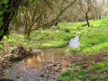
Turn left and follow a path overlooking the woods, then turn left to rejoin the main road. Follow it to the right; at the end, take the path overlooking the valley you crossed earlier and you’ll reach a flight of steps. Go down the fifty or so steps.
(11) Turn left towards the roundabout and turn right onto the start of Rue Pierre Patérour (dead-end sign, 30 km/h zone). Cross the road and take the grassy path on the left (GR® markings) on an electricity pole. Follow this path as it climbs to the right; note a small spring on the left and continue through the passage between two houses lined with hedges. Carry on straight ahead up Rue Pierre Allier, then turn left into Rue Louis Tiercelin, which continues as a footpath with a wooden gate at each end.
(12) Turn right onto the street leading to Rue Ponthier de Chamaillard; follow this to the right along the pavement on the left-hand side. Turn left between the two car parks and pass between the two blocks of flats (under the archway) to follow a footpath on the left, the Allée Simone Morand. At the bottom, turn right, cross Rue Charles Chassé, and continue along a section with alternating traffic. Turn right, walk up Rue Pierre De Beaumarchais and arrive at the roundabout you passed on the way there.
(1) Enter the grounds of the former seminary (information sign) and veer right to cross the car park, with the disused chapel on your left. Continue along the boundary wall (the town hall annexe is on your left), pass by a book box, then turn right to follow the route taken on the way there back to the Jean Jaouen car park (S/E).





 Visorando Member
 Easy
Easy